Turnersburg near Harmony in Iredell County, North Carolina — The American South (South Atlantic)
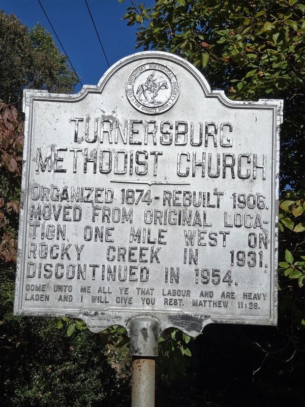
Turnersburg Methodist Church
Photographed by Mark Parker, October 12, 2024
1. Turnersburg Methodist Church Marker
Come unto me all ye that labour and are heavy laden and I will give you rest. Matthew 11:28.
Erected by The Methodist Historical Society.
Topics. This historical marker is listed in this topic list: Religion & Religious Structures. A significant historical year for this entry is 1874.
Location. 35° 54.73′ N, 80° 48.078′ W. Marker is near Harmony, North Carolina, in Iredell County. It is in Turnersburg. It can be reached from Turnersburg Highway (U.S. 21) 0.1 miles south of Noel Road, on the right when traveling south. Touch for map. Marker is at or near this postal address: 2421 Turnersburg Hwy, Harmony NC 28634, United States of America. Touch for directions.

Regionally, this marker is in North Carolina’s Piedmont. It is also in the American South and specifically in the Upper South. Globally, it is in North America, the Western Hemisphere, the Western World, and the Anglosphere. Historically, it finds itself in what was once the territory of the Mississippian Culture, one of the
this page online
Other nearby markers. At least 8 other markers are within 9 miles of this marker, measured as the crow flies: Harmony Hill Camp Meeting (approx. 3.8 miles away); James Hall (approx. 4.2 miles away); Ebenezer Academy (approx. 4.3 miles away); Fort Dobbs (approx. 7.3 miles away); Site of Fort Dobbs (approx. 8.2 miles away); Preserving the Past (approx. 8.2 miles away); Anglo-Cherokee War (1759 - 1761) (approx. 8.3 miles away); The Natural Landscape of Fort Dobbs (approx. 8.3 miles away).
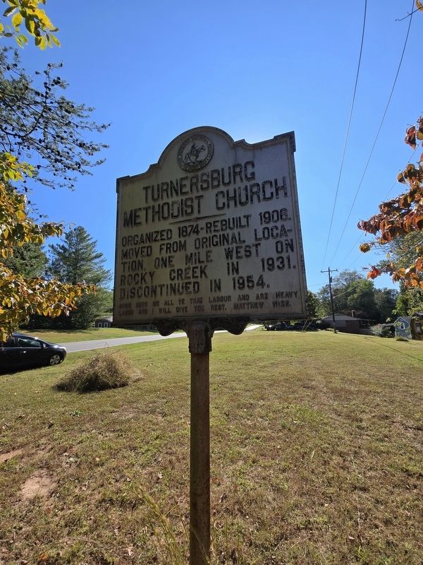
More about this marker. The marker is bordered by a line of trees to the north. It is easier to see traveling north on US 21. Location is about 50 feet west of the road.

Photographed by Mark Parker, October 12, 2024
2. Turnersburg Methodist Church Marker
Looking north near Turnersburg Hwy (US 21).
Photographed by Mark Parker, October 12, 2024
3. Turnersburg Methodist Church Marker
Looking south along Turnersburg Hwy (US 21).
Credits. This page was last revised on October 21, 2024. It was originally submitted on October 19, 2024, by Mark Parker of Hickory, North Carolina. This page has been viewed 151 times since then and 20 times this year. Photos: 1, 2, 3. submitted on October 19, 2024, by Mark Parker of Hickory, North Carolina. • Bernard Fisher was the editor who published this page.
