Arnold near Lexington in Davidson County, North Carolina — The American South (South Atlantic)
Philip Sauer (Sowers)

Photographed by Mark Parker, October 10, 2024
1. Philip Sauer (Sowers) Marker
Principal founder Sauer's Church-Meeting House on this site in 1788.
Now 1968 Beulah United Church of Christ
This marker erected in memory of our distinguished pioneer ancestor by Philip Sauer (Sowers) Family Ass'n Edward W. Sowers, Pres., 1968 • Oscar Sowers, Sec'y, 1968 • J. Lewis Sowers, I.P.P. • Ruth Sowers Owen, Historian
Erected 1968 by Philip Saue (Sowers) Family Association.
Topics. This historical marker is listed in these topic lists: Religion & Religious Structures • Settlements & Settlers. A significant historical year for this entry is 1788.
Location. 35° 53.307′ N, 80° 16.734′ W. Marker is near Lexington, North Carolina, in Davidson County. It is in Arnold. It can be reached from Arnold Road (State Road 1457) south of Winchester Drive, on the left when traveling south. The closest access to the marker from the parking lot at Beulah United Church of Christ. The marker is just past the stone archway into the cemetery on the left. Touch for map. Marker is at or near this postal address: 2828 Arnold Rd, Lexington NC 27295, United States of America. Touch for directions.

Regionally,
this page online
Other nearby markers. At least 8 other markers are within 5 miles of this marker, measured as the crow flies: Bicentennial Tribute (within shouting distance of this marker); Pilgrim Cemetery Revolutionary War Memorial (approx. 4.2 miles away); First Site of Pilgrim Reformed Church (approx. 4.2 miles away); George Washington Boulder (approx. 4.4 miles away); Pilgrim Church (approx. 4.6 miles away); Daniel Boone and Gen. Nathanael Greene (approx. 4.7 miles away); Captain Benjamin Merrill (approx. 4.7 miles away); Lexington in the Civil War (approx. 4.7 miles away). Touch for a list and map of all markers in Lexington.

Photographed by Mark Parker, October 10, 2024
2. Stone archway entrance of Beulah Cemetery. The Sauer marker is to the left past the entrance
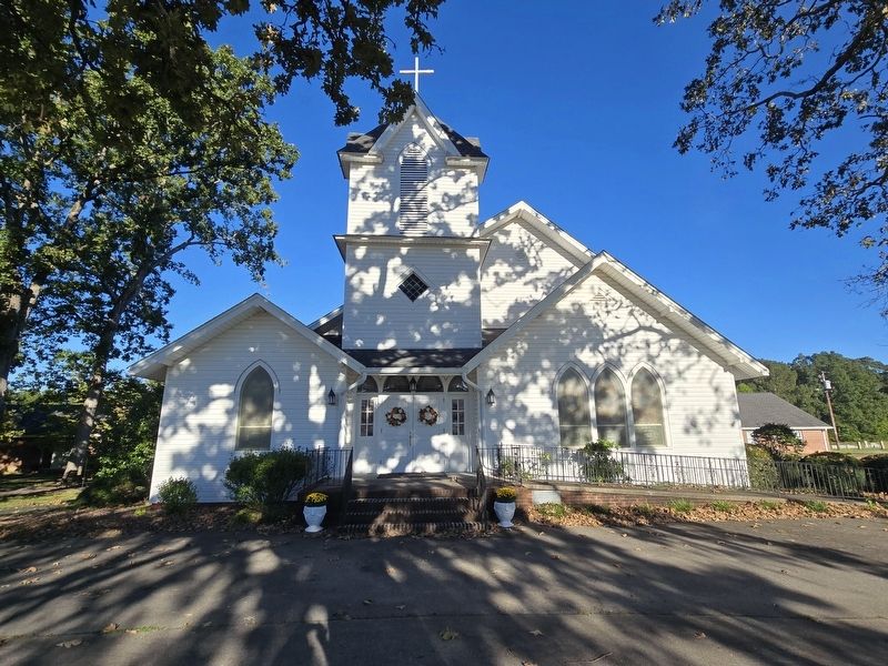
Photographed by Mark Parker, October 10, 2024
3. Beulah United Church of Christ, church founded by Philip Sauer
Credits. This page was last revised on October 28, 2024. It was originally submitted on October 19, 2024, by Mark Parker of Hickory, North Carolina. This page has been viewed 401 times since then and 109 times this year. Photos: 1, 2, 3. submitted on October 19, 2024, by Mark Parker of Hickory, North Carolina. • Bill Pfingsten was the editor who published this page.
