Thomaston in Knox County, Maine — The American Northeast (New England)
A Town Landmark
Thomaston, Maine
| — | The Museum in the Streets | — |
Photographed by Darren Jefferson Clay, October 15, 2024
1. A Town Landmark Marker
A Town Landmark
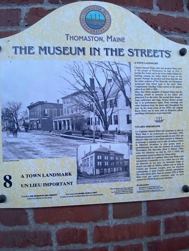
Captain Samuel Watts built and donated Watts Hall to the people of Thomaston. In June of 1915, a terrible fire broke out in the livery stable behind the building causing the entire block to burn to the ground. Perhaps the greatest loss from that fire wan the entire archives of The Recorder, the Thomaston newspaper that dated back to the early 1800 Congressman Jonathan Cilley served as the paper's editor from 1825 to 1828.
Mary Jane Watts, daughter of Samuel Watts, had the building rebuilt in memory of her father and presented it to the town. The second floor houses a large auditorium and stage. Several theater groups use it as performance space. Town meetings and other functions keep the space used throughout the year. In the street scene of the 1870's, the original Knox Hotel can be seen with its distinctive pillars and Watts Hall had not as yet been built. Un Lieu Important
Le Capitaine Samuel Watts fait construire et offre le Watts Hall à ses concitoyens en novembre 1890. Malheureusement, le grand incendie de juin 1915. qui démarre dans une écurie située derrière le bâtiment, se propage et anéantit
this page online
Erected by The Museum in the Streets. (Marker Number 8.)
Topics. This historical marker is listed in this topic list: Notable Buildings.
Location. 44° 4.728′ N, 69° 10.973′ W. Marker is in Thomaston, Maine, in Knox County. It is at the intersection of Main Street (U.S. 1) and Knox Street, on the right when traveling east on Main Street. Touch for map. Marker is at or near this

Photographed by Darren Jefferson Clay, October 15, 2024
2. A Town Landmark Marker

Regionally, this marker is in Midcoast Maine and on Penobscot Bay. It is also in the American Northeast, in New England, and on the Eastern Seaboard. Globally, it is in the North Atlantic Region, North America, the Western Hemisphere, the Western World, and the Anglosphere.
Other nearby markers. At least 8 other markers are within walking distance of this marker: A Case of Modern Technology (here, next to this marker); The Builders, the Captains and the Seamen of Thomaston Ships (a few steps from this marker); Thomaston, Maine (within shouting distance of this marker); June 7, 1915 (within shouting distance of this marker); Thomaston's Business Block (within shouting distance of this marker); Thomaston Historical Timeline (within shouting distance of this marker); Two Historic Churches and Good Neighbors (within shouting distance of this marker); Once a Tavern / Une Ancienne Taverne (about 700 feet away, measured in a direct line). Touch for a list and map of all markers in Thomaston.
Photographed by Darren Jefferson Clay, October 15, 2024
3. A Town Landmark Marker
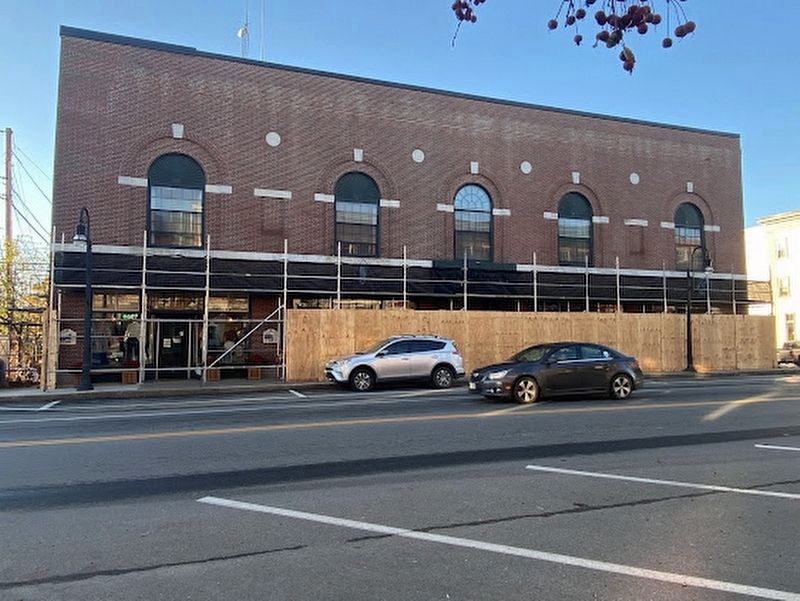
The marker is just to the left of the temporary wooden wall.
Credits. This page was last revised on November 1, 2024. It was originally submitted on October 26, 2024, by Darren Jefferson Clay of Duluth, Georgia. This page has been viewed 192 times since then and 32 times this year. Photos: 1, 2, 3. submitted on October 26, 2024, by Darren Jefferson Clay of Duluth, Georgia. • Michael Herrick was the editor who published this page.
