Prince Frederick in Calvert County, Maryland — The American Northeast (Mid-Atlantic)
Joseph & James Wilkinson
Two revolutionary leaders who grew up on farm south of Hunting Creek
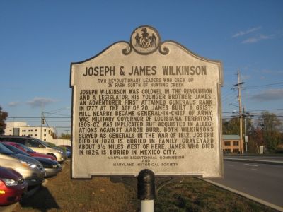
Photographed by F. Robby, November 6, 2007
1. Joseph & James Wilkinson Marker
Erected by Maryland Bicentennial Commission, Maryland Historical Society.
Topics and series. This historical marker is listed in these topic lists: Patriots & Patriotism • War of 1812 • War, US Revolutionary. In addition, it is included in the Maryland Historical Trust series list. A significant historical year for this entry is 1777.
Location. Marker is missing. It was located near 38° 33.496′ N, 76° 35.95′ W. Marker was in Prince Frederick, Maryland, in Calvert County. It could be reached from Stoakley Road east of Solomons Island Road (Maryland Route 2/4), on the right when traveling
this page online

Regionally, this marker was in Southern Maryland. It was also in the American South, specifically in the Upper South, in the Mid-Atlantic, in the Tidewater, in the Chesapeake Bay Region, and on the Eastern Seaboard. Globally, it was in the North Atlantic Region, North America, the Western Hemisphere, the Western World, and the Anglosphere. Historically, it found itself in what was once one of the original Thirteen Colonies and also the Antebellum South.
Other nearby markers. At least 8 other markers are within 2 miles of this location, measured as the crow flies: Arthur Storer Planetarium (approx. one mile away); W. S. Brooks High School (approx. 1½ miles away); World War Memorial (approx. 1.6 miles away); Veterans Green (approx. 1.6 miles away); Michael J. Moore (approx. 1.6 miles away); War in the Chesapeake (approx. 1.6 miles away); "O! say can you see…" (approx. 1.6 miles away); Panic in Prince Frederick (approx. 1.7 miles away). Touch for a list and map of all markers in Prince
Library of Congress
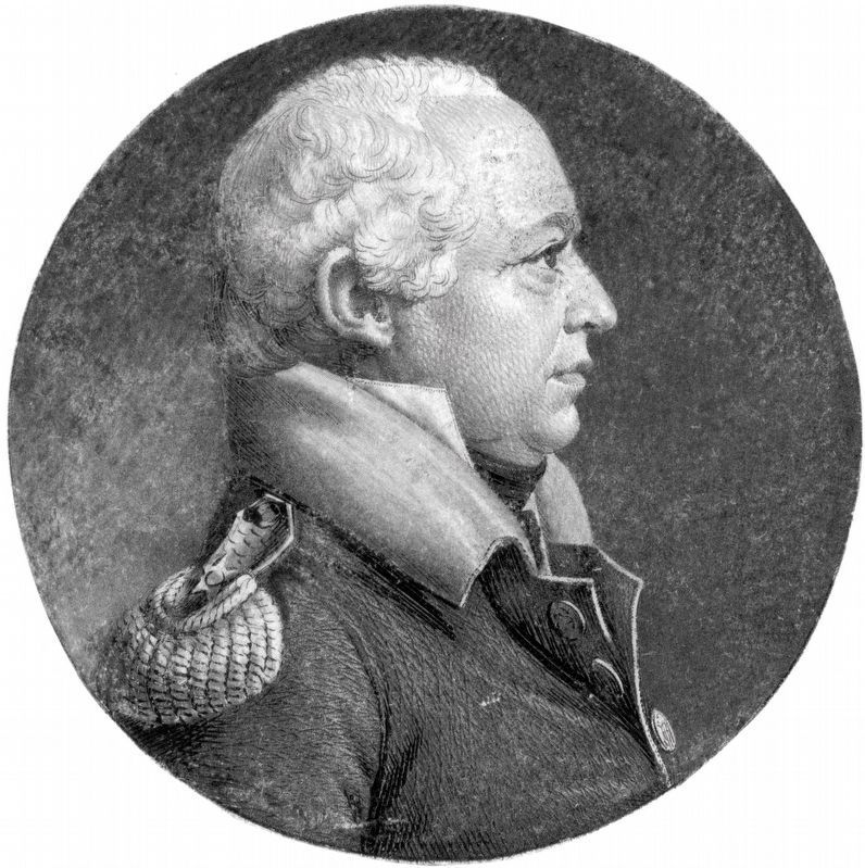
2. James Wilkinson
Soldier, Statesman and Spy
Soldier, Statesman and Spy
1808 engraving of James Wilkinson by Charles Balthazar Julien Fevret de Saint-Mémin.
More about this marker. The marker is no longer there. Apparently, it was taken out during construction of a bank at the location. (May 8, 2021)
Additional commentary.
1. Wilkinson is my great grandfather
I was reading all the information on General James Wilkinson, he is my mother's grandfather, my great grandfather. My mother's family was from Louisana, where Wilkinson was governor at one time. I would like to contact any of his family.
— Submitted September 11, 2008, by Debbie Collins of Daphne, Alabama.
2. I too am related to Wilkinson.
My mother's father is from Louisiana, the Lake Charles region, and is related directly to James Wilkinson (although I'm not exactly sure what generation he is to me..or what generation he is to my grandfather). It's amazing to be able to track your roots back to the American Revolution! I've been trying to fill in all the gaps in family history between them all.
— Submitted September 23, 2008, by Christi Elizabeth Hooten of Clayton, North Carolina.
Credits. This page was last revised on May 7, 2026. It was originally submitted on November 11, 2007, by F. Robby of Baltimore, Maryland. This page has been viewed 6,310 times since then and 79 times this year. Last updated on October 31, 2024, by Rico Ramirez of Prince Frederick, Maryland. Photos: 1. submitted on November 11, 2007, by F. Robby of Baltimore, Maryland. 2. submitted on July 16, 2019, by Allen C. Browne of Silver Spring, Maryland. • Devry Becker Jones was the editor who published this page.
