Thurmont in Frederick County, Maryland — The American Northeast (Mid-Atlantic)
From Mules to Motors
Catoctin Furnace Iron Trail
Photographed by Allen C. Browne, October 30, 2024
1. From Mules to Motors Marker
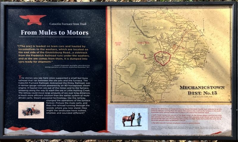
“[The Ore] is loaded on tram cars and hauled by locomotives to the washers, which are located on the east side of the Emmitsburg Road…a sidetrack from the Frederick Railroad runs under the washers, and as the ore comes from them, it is dumped. into cars ready for shipment.”
– Joseph Singewald, geologist, describing the mining operation at Catoctin, published December 1911.
The stones you see here once supported a small but busy railroad that ran between the Ore pits and the furnace. The Catoctin Furnace Railroad, nicknamed the Dinky Railroad, was a narrow-gauge railroad powered by an 80-horsepower steam engine. It hauled iron ore out of the mines and to the furnace, stopping along the way to wash the ore in Little Hunting Creek. The railway could move large amounts of ore over long distances, a much more efficient solution than the earlier. system of mule-driven carts. Steam-powered technology, like the railway, changed the operations of the furnace forever. Picture the mule carts, and then the railroad running through the woods where you now stand. How might the landscape have looked, smelled, and sounded different?
[Captions:]
(Above) An 1873 atlas of Frederick County shows the Dinky tracks, here referred to as the Catoctin railroad, running from the Upper Mine bank in the north to the furnace in the south. A possibly Dinky railroad trestle was located to tthe west of the Deborah stack.
« (Left) Mules hauled iron ore out of the deep mines. As the furnace grew, a second ore mine was opened south of the stacks. Workers lined up their ore carts under the pit walls so that the ore could fall right into the awaiting carts as they worked. Mules then pulled the carts along the small railroad tracks embedded in the pit.
« (Far left) Catoctin Furnace employed miners to extract the ore.
Erected by Catoctin
this page online
Topics and series. This historical marker is listed in these topic lists: Industry & Commerce • Railroads & Streetcars. In addition, it is included in the William G. Pomeroy Foundation series list. A significant historical month for this entry is December 1911.
Location. 39° 34.919′ N, 77° 26.079′ W. Marker is in Thurmont, Maryland, in Frederick County. It is on Catoctin Furnace Road. Touch for map. Marker is at or near this postal address: 12700 Catoctin Furnace Rd, Thurmont MD 21788, United States of America. Touch for directions.

Regionally, this marker is in the Washington Metropolitan Area and in Central Maryland. It is also in the American Mid-Atlantic. Globally, it is in North America, the Western Hemisphere, the Western World, and the Anglosphere. Historically, it finds itself in what was once one of the original Thirteen Colonies and also the Antebellum South.
Other nearby markers. At least 8 other markers are within walking distance of this marker: Hidden Labor (a few steps from this marker); Ironmaster's Mansion
Photographed by Allen C. Browne, October 30, 2024
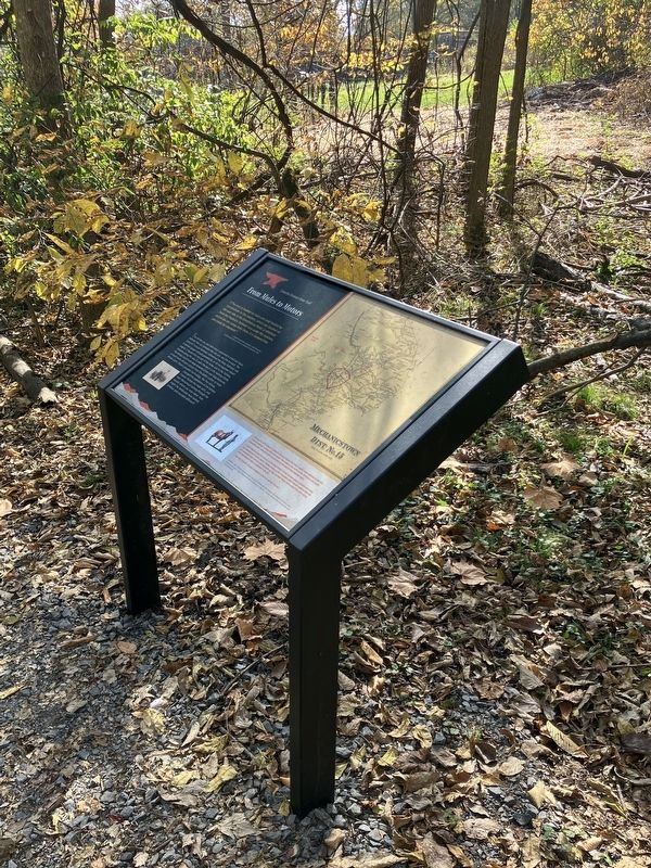
2. From Mules to Motors Marker
Other markers no longer nearby. Ruins of the Ironmaster’s House (was within shouting distance of this marker but has been replaced with another marker now near it); Prosperity and Power (was within shouting distance of this marker but has been replaced with another marker now near it); Bowstring Arch Bridge (was within shouting distance of this marker but has been replaced with another marker now near it).
Also see . . . Joseph T. Singewald, The Iron Ores of Maryland, 1911, page 198. Source of the quotation above. (Submitted on November 2, 2024, by Allen C. Browne of Silver Spring, Maryland.)
Credits. This page was last revised on May 18, 2026. It was originally submitted on November 2, 2024, by Allen C. Browne of Silver Spring, Maryland. This page has been viewed 227 times since then and 38 times this year. Photos: 1, 2. submitted on November 2, 2024, by Allen C. Browne of Silver Spring, Maryland.
