Near Brunson in Hampton County, South Carolina — The American South (South Atlantic)
Cherry Grove Christian Church
Photographed by Mike Stroud, 2009
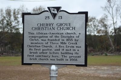
1. Cherry Grove Christian Church Marker
This African-American church, a congregation of the Disciples of Christ, was founded in 1855 by members of Three Mile Creek Christian Church. A Rev. Ervin was its first pastor, and it met in a brush arbor before building its first sanctuary here. The present brick church was built in 2002.
Erected 2009 by South Carolina Department of Archives and History; sponsored by the Congregation. (Marker Number 25-13.)
Topics. This historical marker is listed in these topic lists: African Americans • Religion & Religious Structures. A significant historical year for this entry is 1855.
Location. 33° 0.104′ N, 81° 4.63′ W. Marker is near Brunson, South Carolina, in Hampton County. It is on Cherry Grove Road (State Highway 25-621) 0.2 miles west of Harold Lane, on the right when traveling south. Touch for map. Marker is at or near this postal address: 1895 Cherry Grove Road, Ehrhardt SC 29081, United States of America. Touch for directions.

Regionally, this marker is in the Lowcountry, in the Ashepoo and Combahee and Edisto Basin. It is also in the American South, specifically in the Deep South, and on the Eastern
this page online
Other nearby markers. At least 10 other markers are within 4 miles of this marker, measured as the crow flies: Hickory Grove Baptist Church and Cemetery (approx. 2½ miles away); John Jacob Heyer (approx. 2.7 miles away); Battle At Rivers Bridge / Rivers Bridge Memorials (approx. 3.2 miles away); St. Nicholas Church (approx. 3½ miles away); Battle of Rivers' Bridge (approx. 3.7 miles away); a different marker also named Battle of Rivers' Bridge (approx. 3.7 miles away); a different marker also named Battle of Rivers' Bridge (approx. 3.8 miles away); a different marker also named Battle of Rivers' Bridge (approx. 3.8 miles away); a different marker also named Battle of Rivers' Bridge (approx. 3.8 miles away); a different marker also named Battle of Rivers' Bridge (approx. 3.8 miles away).
Photographed by Mike Stroud, December 15, 2009
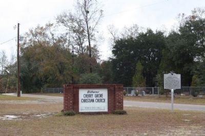
2. Cherry Grove Christian Church Marker looking north along Cherry Grove Road
Photographed by Mike Stroud, December 15, 2009
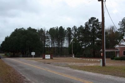
3. Cherry Grove Christian Church and Marker looking southward
Photographed by Mike Stroud, December 15, 2009
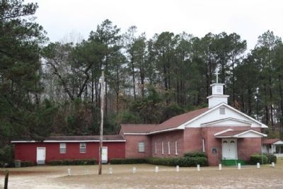
4. Cherry Grove Christian Church
Credits. This page was last revised on May 31, 2026. It was originally submitted on December 30, 2009, by Mike Stroud of Bluffton, South Carolina. This page has been viewed 1,841 times since then and 56 times this year. Photos: 1, 2, 3, 4. submitted on December 30, 2009, by Mike Stroud of Bluffton, South Carolina. • Kevin W. was the editor who published this page.
