Downtown in Anchorage, Alaska — Northwest (North America)
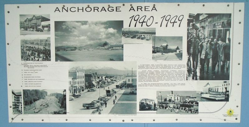
Anchorage Area 1940-1949
Photographed by William Fischer, Jr., August 12, 2024
1. Anchorage Area 1940-1949 Marker
In September 1940, Elmendorf Army Airfield was completed. Soldiers lived in tents while the remainder of the airbase and temporary facilities at Fort Richardson were built. The military build-up played a major role in the development of Anchorage.
After Pearl Harbor, Anchorage appeared especially vulnerable to attaqck [sic]. Rumors were frequent; a rigid black out schedule was imposed; troops took up positions in anti-aircraft pillboxes on the bluffs near Anchorage. Overnight Anchorage was transformed into a city living under military rule. By late 1942, 3500 military construction workers, 20,000 soldiers and airmen and hundreds of government workers had transformed the city. The housing and office space shortage was extreme! Civilians lived in tents and garages; some businesses posted sentries at night to prevent office space poaching.
In 1942 the Alaska-Canadian Highway, the only land route from the contiguous 48 states to Alaska, was completed in a record 8 months and 11 days. It opened to civilian use in 1947.
[Photo captions, clockwise from bottom left, read]
A. Construction of the Alaskan [sic] Canadian [H]ighway.
this page online
B. [Highway] construction camp
C. 1942. City Hall lawn
D. 4th Avenue
E. Elmendorf Army Air Base
F. 1945. Recreation on Elmendorf
G. 1946. USO 5th and G [S]treet
H. 1945. [V]ictory celebration
I. 1946. 4th of July parade
Erected by 4th Avenue Market Place.
Topics. This historical marker is listed in these topic lists: Air & Space • Patriots & Patriotism • Settlements & Settlers • War, World II. A significant historical month for this entry is September 1940.
Location. 61° 13.122′ N, 149° 53.315′ W. Marker is in Anchorage, Alaska. It is in Downtown. It is on 4th Avenue, on the right when traveling west. Marker is under the covered 4th Avenue Market Place colonnade between C and D Streets. Touch for map. Marker is at or near this postal address: 333 West 4th Avenue, Anchorage AK 99501, United States of America. Touch for directions.

Regionally, this marker is in the Alaska Railroad Corridor, in the Athabascan Region, in the Prince William Sound, and in Southcentral Alaska. It is also on the American Pacific Coast. Globally, it is in North America,
Photographed by William Fischer, Jr., August 12, 2024
2. Anchorage Area 1940-1949 Marker
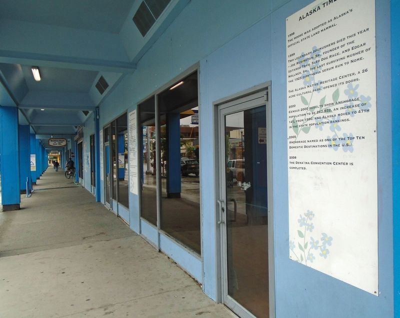
Other nearby markers. At least 8 other markers are within walking distance of this marker: Anchorage Area Time Line (here, next to this marker); a different marker also named Anchorage Area 1940-1949 (here, next to this marker); Anchorage Area 1950-1963 (a few steps from this marker); Bear Totem (a few steps from this marker); Anchorage Area All-American City (within shouting distance of this marker); Anchorage Area 1930-1939 (within shouting distance of this marker); Iditarod Sled Dog Race History (within shouting distance of this marker); Anchorage Area 1916-1920 (within shouting distance of this marker). Touch for a list and map of all markers in Anchorage.
Credits. This page was last revised on November 5, 2024. It was originally submitted on November 5, 2024, by William Fischer, Jr. of Reynoldsburg, Ohio. This page has been viewed 268 times since then and 61 times this year. Photos: 1, 2. submitted on November 5, 2024, by William Fischer, Jr. of Reynoldsburg, Ohio.
