Sarasota in Sarasota County, Florida — The American South (South Atlantic)
Franklin Field

Photographed by Brandon D Cross
1. Franklin Field Marker(Front)
(Front)
The U.S. Army Air Service had two bases near Arcadia, once the United States had entered the war in 1917, community leaders approached local congressmen and War Department representatives about establishing an auxiliary field in the tract of land 1000 x 3000 feet without stumps or roots, a building to store oil, water for radiators, and a pole for flag and tell tale (wind sock). To identify the landing field from the air, a sandy area in the shape of a large cross would be cleared of vegetation.
The selected site was north of Fruitville Road and east of Tuttle Avenue. Mayor George W. Franklin called a community service day for citizens to help prepare a field that would serve as a landing site for the Arcadia army pilots.
this page online
(Rear)
Army pilots-in-training began flying from Arcadia to the new Franklin Field in May 1918. During the summer, the local press carried numerous articles about the soldiers who flew into Sarasota not only for training purposes, but also for recreation. Baseball teams from Arcadia fields flew into Franklin Field for games in Sarasota and Bradenton.
After the war ended on November 11, 1918, the Army had less use for Franklin Field. In 1922 Matthew Dixon purchased an Army surplus “Jenny” and on July 29 John B. Browning flew it from Arcadia to Franklin Field. The newly formed Dixon ~ Browning Company planned to offer sightseeing and passenger service from that landing strip.
Within two years, Franklin Field ceased to exist. In 1924 the landing strip became part of the new Avionics subdivision. Eager to keep Sarasota on the list of available sites for occasional Army flight training. Mayor E.J. Bacon offered the beaches of Siesta key as “ideal landing places.” Not until 1929 did Sarasota build a more permanent municipal airport, located

Photographed by Brandon D Cross
2. Franklin Field Marker(Rear)
Erected 2000 by Sarasota County Historical Commission.
Topics. This historical marker is listed in these topic lists: Air & Space • War, World I. A significant historical month for this entry is April 1914.
Location. 27° 20.263′ N, 82° 30.653′ W. Marker is in Sarasota, Florida, in Sarasota County. It is at the intersection of North Rhodes Avenue and Fruitville Road, on the left when traveling south on North Rhodes Avenue. Touch for map. Marker is at or near this postal address: 100 North Rhodes Avenue, Sarasota FL 34237, United States of America. Touch for directions.

Regionally, this marker is on the Gulf Coast. It is also in the American South and on the Gulf Coast. Globally, it is in the North Atlantic Region, North America, a Gulf of Mexico state, the Western Hemisphere, the Western World, and the Anglosphere. Historically, it finds itself in what was once New Spain, the territory of the Mississippian Culture, one of the Confederate States of America, and the Antebellum South.
Other nearby markers. At least 8 other markers are within 2 miles
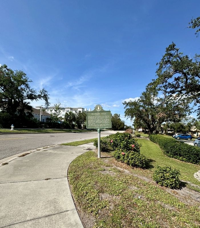
Photographed by Brandon D Cross
3. Franklin Field Marker
Another marker is no longer nearby. First Municipal Airport Lowe Field (was approx. 1.1 miles away but has been confirmed missing).
Also see . . . Vintage Sarasota: Local Aviation Interest Took Off in Early 1900s. (Submitted on November 11, 2024, by Brandon D Cross of Flagler Beach, Florida.)
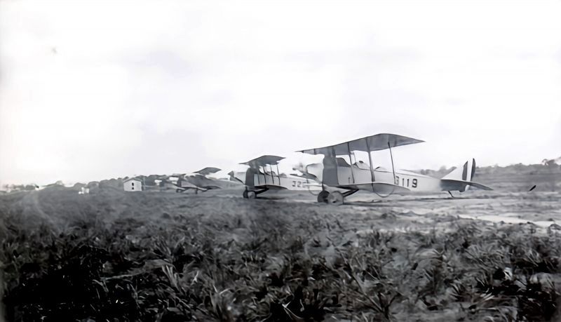
courtesy Florida Majority
4. Army “Jenny” planes parked at Franklin Field in Sarasota

courtesy Florida Memory
5. Men inspecting an Army “Jenny” at Franklin Field

courtesy Wikimedia Commons
6. Army “Jenny” planes and observers at Franklin Field in Sarasota
Credits. This page was last revised on November 11, 2024. It was originally submitted on November 11, 2024, by Brandon D Cross of Flagler Beach, Florida. This page has been viewed 196 times since then and 35 times this year. Photos: 1, 2, 3, 4, 5, 6. submitted on November 11, 2024, by Brandon D Cross of Flagler Beach, Florida. • Andrew Ruppenstein was the editor who published this page.
