Near Trona in Inyo County, California — The American West (Pacific Coastal)
Reilly Townsite & Anthony Mill
1882 - 1884

Photographed by Craig Baker
1. Reilly Townsite & Anthony Mill Marker
The town of Reilly was established on a mining claim purchased by Edward Reilly of New York in September 1882. By October, Reilly had ordered a 10 stamp mill and began to organize his mining district. This rapidly growing "company town" soon supported a boarding house, general store, and a blacksmith shop. and in January of 1883 the Reilly Post Office began mail service. Over 32 buildings have been recorded at this site and it is estimated that over 60 people probably worked and lived in Reilly during its peak.
To supply water to operate the mill and support the town, a pipeline was constructed from Water Canyon over 5 miles away. In September of 1883 the stamp mill to process the ore finally arrived, was fired up and promptly broke down when a water pump failed. At this point the population at Reilly had shrunk to 16 workers, and the Post Office closed that following October. Investors poured over $200,000 into Reilly and produced only $21,500 in silver bullion during the mill's 18 months of operation. In March of 1885 the mill was closed and sold.
The mill is named after Charles Anthony, who later filed claims in Pleasant Canyon in the Panamint Mountains. Anthony may have overseen the construction and operation of the stamp mill that bears his name.
The Reilly townsite provides a window into the life of a typical California desert "boom and bust" mining town. The site was first recorded in 1978 by Larry Vredenburgh, a BLM geologist. Research at Reilly continues. Archaeologists hope to answer questions such as: What was life like for the mill workers? How was it different for the mill supervisor or for Edward Reilly, the owner? Were Chinese laborers employed by Reilly? Was Charles Anthony actually the man who built the mill and ran it for Edward Reilly?
this page online
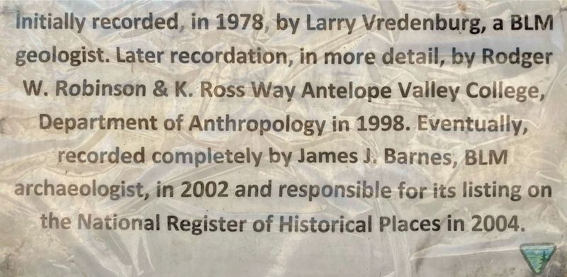
Initially recorded in 1978 by Larry Vredenburg, a BLM geologist. Later recordation, in more detail, by Rodger W. Robinson & K. Ross Way, Antelope Valley College, Department of Anthropology in 1998. Eventually, recorded completely by James J. Barnes, BLM archaeologist, in 2002 and responsible for its listing on the National Register of Historical Places in 2004.
Erected by Bureau of Land Management.
Topics and series. This historical marker is listed in these topic lists: Industry & Commerce • Natural Resources • Settlements & Settlers. In addition, it is included in the National Register of Historic Places (NRHP) series list. A significant historical year for this entry is 1882.
Location. 36° 0.474′ N, 117° 22.192′ W. Marker is near Trona, California, in Inyo County. It can be reached from
Photographed by Craig Baker
2. Reilly Townsite & Anthony Mill Marker

Regionally, this marker is in the Sierra Nevada. It is also in the American Mountain West. Globally, it is in North America, on the Ring of Fire, on the Pacific Rim, in the Western Hemisphere, in the Western World, and in the Anglosphere. Historically, it finds itself in what was once New Spain and also Mexico’s Alta California.
Other nearby markers. At least 6 other markers are within 13 miles of this marker, measured as the crow flies: Panamint City (approx. 5.2 miles away); Ballarat (approx. 5.2 miles away); a different marker also named Ballarat (approx. 5.2 miles away); a different marker also named Ballarat (approx. 8½ miles away); Fish Canyon (approx. 10½ miles away); Valley Wells (approx. 12½ miles away).
Regarding Reilly Townsite & Anthony Mill.
Take Care ...
Exercise caution when exploring this site. The stone walls and chimneys are easily damaged, so do not climb or otherwise disturb these historic

Photographed by Craig Baker
3. Take Care ...
There are many abandoned mine shafts, adits and tunnels in the mountains and canyons around Reilly. Do not attempt to enter any of these old workings they are extremely dangerous!
Stay well away from any open mine shafts. It is dangerous to attempt to even peer down into
these deep shafts.
At least three species of rattlesnake make the Argus Mountains around Reilly their home. Watch where you put your hands and feet at all times.
The Reilly Townsite, as well as all cultural resource sites on the public lands are protected by law. Severe civil and criminal penalties can be brought against individuals who damage or destroy cultural resources.
If you discover any illegal activity, please notify your local BLM office or phone (760) 384-5400.

Photographed by Craig Baker
4. Reilly Townsite & Anthony Mill Marker

Photographed by Craig Baker, November 8, 2024
5. Reilly Townsite & Anthony Mill Marker

Photographed by Craig Baker, November 8, 2024
6. Sign at Trailhead
Photographed by Craig Baker, November 8, 2024
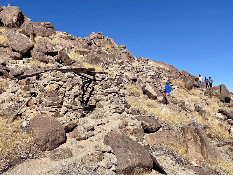
7. Remains of Cabins

Photographed by Craig Baker, November 8, 2024
8. Anthony Mill Ruins

Photographed by Craig Baker, November 8, 2024
9. Reilly Townsite & Anthony Mill Ruins
Credits. This page was last revised on November 12, 2024. It was originally submitted on November 11, 2024, by Craig Baker of Sylmar, California. This page has been viewed 282 times since then and 64 times this year. Photos: 1, 2, 3, 4, 5, 6, 7, 8, 9. submitted on November 11, 2024, by Craig Baker of Sylmar, California.
