Peterborough in Peterborough County, Ontario — Central Canada (North America)
The Post Office
Photographed by Cosmos Mariner, June 1, 2024
1. The Post Office Marker
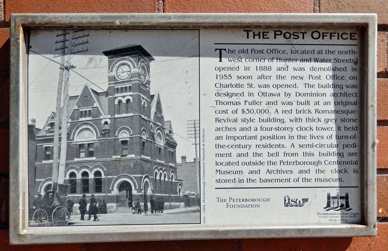
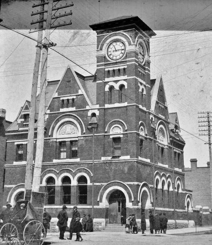
The old Post Office, located at the north-west corner of Hunter and Water Streets, opened in 1888 and was demolished in 1955 soon after the new Post Office on Charlotte St. was opened. The building was designed in Ottawa by Dominion architect Thomas Fuller and was built at an original cost of $30,000. A red brick Romanesque-Revival style building, with thick grey stone arches and a four-storey clock tower, it held an important position in the lives of turn-of the-century residents. A semi-circular pediment and the bell from this building are located outside the Peterborough Centennial Museum and Archives and the clock is stored in the basement of the museum.
Erected by The Peterborough Foundation.
Topics and series. This historical marker is listed in these topic lists: Architecture • Communications. In addition, it is included in the Postal Mail and Philately series list. A significant historical year for this entry is 1888.
Location. 44° 18.363′ N, 78° 19.155′ W. Marker is in Peterborough, Ontario, in Peterborough County. It is on Hunter Street West just west of Water Street, on the right when traveling west.
this page online

Regionally, this marker is in the Kawarthas Northumberland Area and in Eastern Ontario. It is also in Central Canada. Globally, it is in North America, the Western Hemisphere, the Western World, and the Anglosphere. Historically, it finds itself in what was once a British colony, the Viceroyalty of New France, the Haudenosaunee (Iroquois) Confederacy, and Rupert’s Land.
Other nearby markers. At least 8 other markers are within walking distance of this marker: The Peterborough Club (about 150 meters away, measured in a direct line); Government House Site (about 150 meters away); The Brock Street Burial (about 210 meters away); The Robinson Settlement (about 210 meters away); Civic Park (approx. 0.3 kilometers away); Military (approx. 0.3 kilometers away); The Citizens' War Memorial (approx. 0.3 kilometers away); The Peterborough Armoury / Le manège militaire de Peterborough
Peterborough Centennial Museum & Archives, 1904
2. Marker detail: Post Office Photo
1888 Romanesque Post Office Building at the corner of Hunter Street & Water Street.
Photographed by Cosmos Mariner, June 1, 2024
3. The Post Office Marker
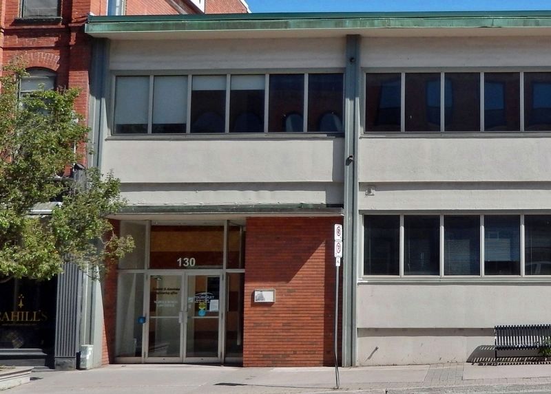
Looking north across Hunter Street; the marker is mounted on the right side of the building entrance at this location today.
Photographed by Cosmos Mariner, June 1, 2024
4. Hunter Street West & Water Street
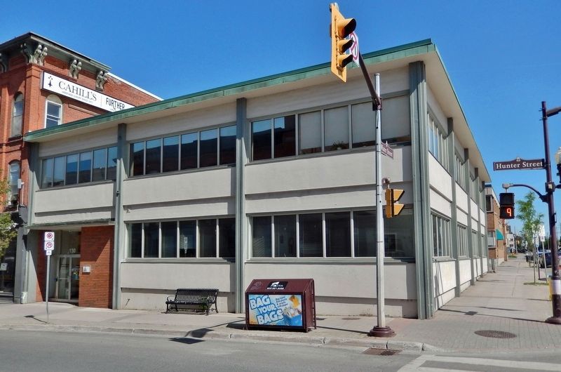
Northwest corner of the intersection today; former site of the 1888 Peterborough Post Office.
Photographed by Cosmos Mariner, June 1, 2024
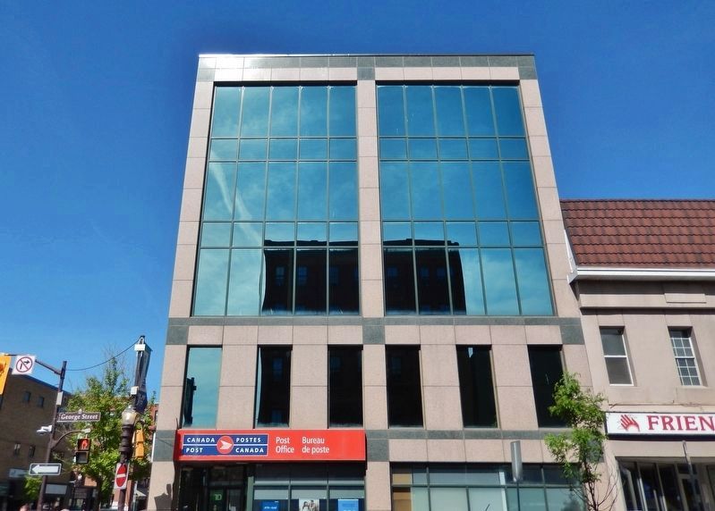
5. Contemporary Peterborough Post Office
Three blocks south of the 1888 Post Office site, at the intersection of George Street & King Street.
Credits. This page was last revised on November 14, 2024. It was originally submitted on November 13, 2024, by Cosmos Mariner of Cape Canaveral, Florida. This page has been viewed 283 times since then and 63 times this year. Photos: 1, 2, 3, 4, 5. submitted on November 14, 2024, by Cosmos Mariner of Cape Canaveral, Florida.
