Schuylkill Haven in Schuylkill County, Pennsylvania — The American Northeast (Mid-Atlantic)
Irish Flat
Schuylkill Haven Heritage Trail
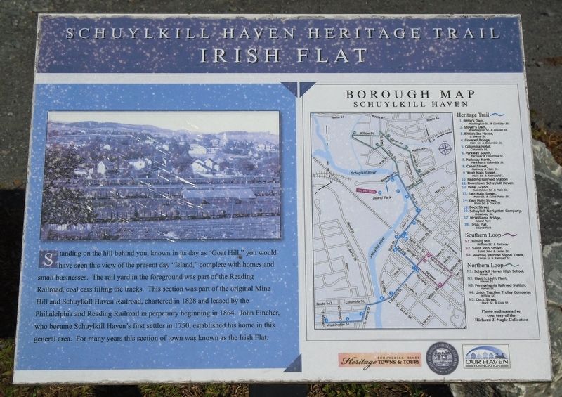
Photographed by William Fischer, Jr., November 12, 2024
1. Irish Flat Marker
Standing on the hill behind you, known in its day as "Goat Hill," you would have seen this view of the present day "Island," complete with homes and small businesses. The rail yard in the foreground was part of the Reading Railroad, coal cars filling the tracks. This section was part of the original Mine Hill and Schuylkill Haven Railroad, chartered in 1828 and leased by the Philadelphia and Reading Railroad in perpetuity beginning in 1864. John Fincher, who became Schuylkill Haven's first settler in 1750, established his home in this general area. For many years this section of town was known as the Irish Flat.
Borough Map [and] Heritage Trail [key]
Erected by Schuylkill River Heritage Towns & Tours, Schuylkill Haven Borough, and Our Haven Foundation. (Marker Number 18.)
Topics and series. This historical marker is listed in this topic list: Settlements & Settlers. In addition, it is included in the Pennsylvania, Schuylkill Haven Heritage Trail series list. A significant historical year for this entry is 1828.
Location. 40° 37.905′ N, 76° 10.49′ W. Marker is in Schuylkill Haven, Pennsylvania, in Schuylkill County.
this page online

Regionally, this marker is in Pennsylvania’s Anthracite Coal Region. It is also in the American Northeast, in the Mid-Atlantic, in Appalachia, and specifically in Northern Appalachia. Globally, it is in North America, the Western Hemisphere, the Western World, and the Anglosphere. Historically, it finds itself in what was once the Haudenosaunee (Iroquois) Confederacy and also one of the original Thirteen Colonies.
Other nearby markers. At least 8 other markers are within walking distance of this marker: McWilliams Bridge (within shouting distance of this marker); Schuylkill Navigation Company (about 500 feet away, measured in a direct line); Dock Street (about 700 feet away); East Main Street (approx. 0.2 miles away); a different marker also named East Main Street (approx. 0.2 miles away); The First National Bank and Trust Company of Schuylkill Haven (approx. 0.2 miles away); Jerusalem Evangelical Lutheran Church Labyrinth (approx. 0.2 miles away); Hotel Grand (approx. 0.2 miles away). Touch for a list and map of all markers in Schuylkill Haven.
Credits. This page was last revised on July 22, 2025. It was originally submitted on November 14, 2024, by William Fischer, Jr. of Reynoldsburg, Ohio. This page has been viewed 225 times since then and 48 times this year. Photo 1. submitted on November 14, 2024, by William Fischer, Jr. of Reynoldsburg, Ohio.
Editor’s want-list for this marker. Distance photo of marker and surroundings. • Can you help?
