Marker Logo
THE HISTORICAL
MARKER DATABASE
“Bite-Size Bits of Local, National, and Global History”
Pleasant Grove in Utah County, Utah — The American Mountains (Southwest)
 

"Soft-Rock"
 
 
"Soft-Rock" Marker image. Click for full size.
Photographed by Tom Bosse, July 28, 2024
1. "Soft-Rock" Marker
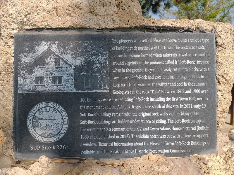
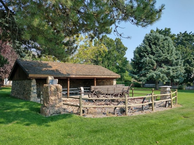
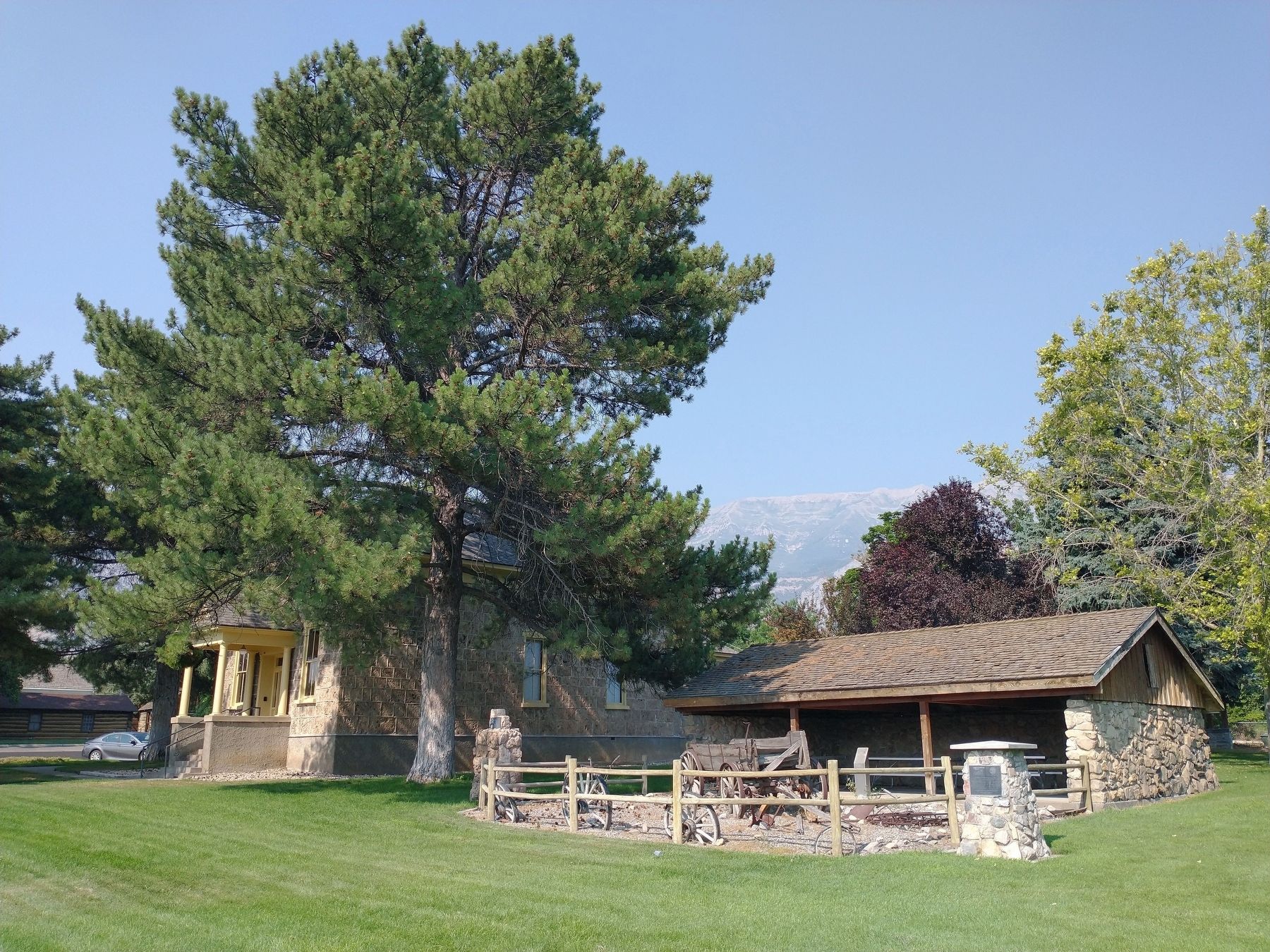
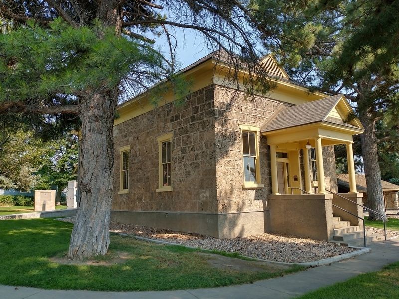
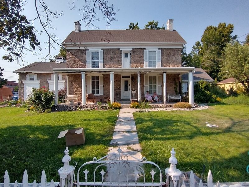
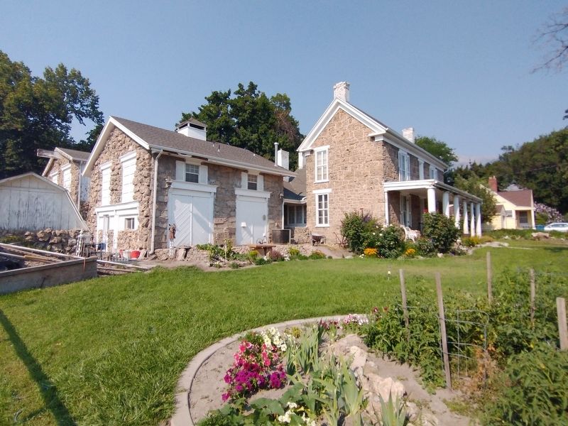
Inscription. The pioneers who settled Pleasant Grove found a unique type of building rock northeast of the town. The rock was a soft, porous limestone formed when minerals in water accumulate around vegetation. The pioneers called it "Soft-Rock" because when in the ground, they could easily cut it into blocks with a saw or axe. Soft-Rock had excellent insulating qualities to keep structures warm in the winter and cool in the summer. Geologists call the rock "Tufa". Between 1865 and 1900 over 100 buildings were erected using Soft-Rock including the first Town Hall, next to the monument and the Ashton/Driggs house south of this site. In 2021, only 19 Soft-Rock buildings remain with the original rock walls visible. Many other Soft-Rock buildings are hidden under stucco or siding. The Soft-Rock on top of this monument is a remnant of the K.V. and Gwen Adams House pictured (built in 1880 and demolished in 2012). The visible notch was cut with an axe to support a window. Historical information about the Pleasant Grove Soft-Rock Buildings is available from the Pleasant Grove Historic Preservation Commission.
 
Erected by National Society
Paid Advertisement
Click or scan to see
this page online
of the Sons of Utah Pioneers. (Marker Number 276.)
 
Topics and series. This historical marker is listed in this topic list: Architecture. In addition, it is included in the Sons of Utah Pioneers series list. A significant historical year for this entry is 1865.
 
Location. 40° 21.725′ N, 111° 44.316′ W. Marker is in Pleasant Grove, Utah, in Utah County. It is on South 100 East, on the right when traveling north. Touch for map. Marker is in this post office area: Pleasant Grove UT 84062, United States of America. Touch for directions.

Regionally, this marker is in the Wasatch Front and in Greater Provo. It is also in the American Mountain West and in Colorado Plateau. Globally, it is in North America, the Rocky Mountains, the Western Hemisphere, the Western World, and the Anglosphere. Historically, it finds itself in what was once New Spain and also Mexico’s Alta California.

Other nearby markers. At least 8 other markers are within walking distance of this marker: Winter Corral (a few steps from this marker); Civil War Skirmish at Pleasant Grove (a few steps from this marker); Pleasant Grove Town Hall (a few steps from this
"Soft-Rock" Marker image. Click for full size.
Photographed by Tom Bosse, July 28, 2024
2. "Soft-Rock" Marker
marker); History of Pleasant Grove Train Station (within shouting distance of this marker); Pleasant Grove's First Fire Station (within shouting distance of this marker); Pleasant Grove City (within shouting distance of this marker); Ashton / Driggs House (within shouting distance of this marker); Benjamin W. Driggs Home (within shouting distance of this marker). Touch for a list and map of all markers in Pleasant Grove.
 
Another marker is no longer nearby. The Ashton House (was within shouting distance of this marker but has been permanently removed).
 
"Soft-Rock" Marker image. Click for full size.
Photographed by Tom Bosse, July 28, 2024
3. "Soft-Rock" Marker
Pleasant Grove Town Hall - Built with "Soft Rock". image. Click for full size.
Photographed by Tom Bosse, July 28, 2024
4. Pleasant Grove Town Hall - Built with "Soft Rock".
The Ashton-Driggs House - Built with "Soft Rock". image. Click for full size.
Photographed by Tom Bosse, July 28, 2024
5. The Ashton-Driggs House - Built with "Soft Rock".
The Ashton-Driggs House - Built with "Soft Rock". image. Click for full size.
Photographed by Tom Bosse, July 28, 2024
6. The Ashton-Driggs House - Built with "Soft Rock".
 
 
Credits. This page was last revised on November 17, 2024. It was originally submitted on November 15, 2024, by Tom Bosse of Jefferson City, Tennessee. This page has been viewed 249 times since then and 55 times this year. Photos:   1, 2, 3, 4, 5, 6. submitted on November 15, 2024, by Tom Bosse of Jefferson City, Tennessee. • Andrew Ruppenstein was the editor who published this page.

m=260916

CeraNet Cloud Computing sponsors the Historical Marker Database.
This website earns income from purchases you make after using our links to Amazon.com. We appreciate your support.
Paid Advertisement
Jul. 21, 2026