Stoughton in Norfolk County, Massachusetts — The American Northeast (New England)
Trolley Tracks
Photographed by Conrad Ward, June 23, 2024
1. Trolley Tracks Marker
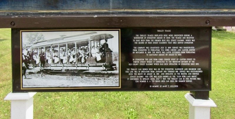
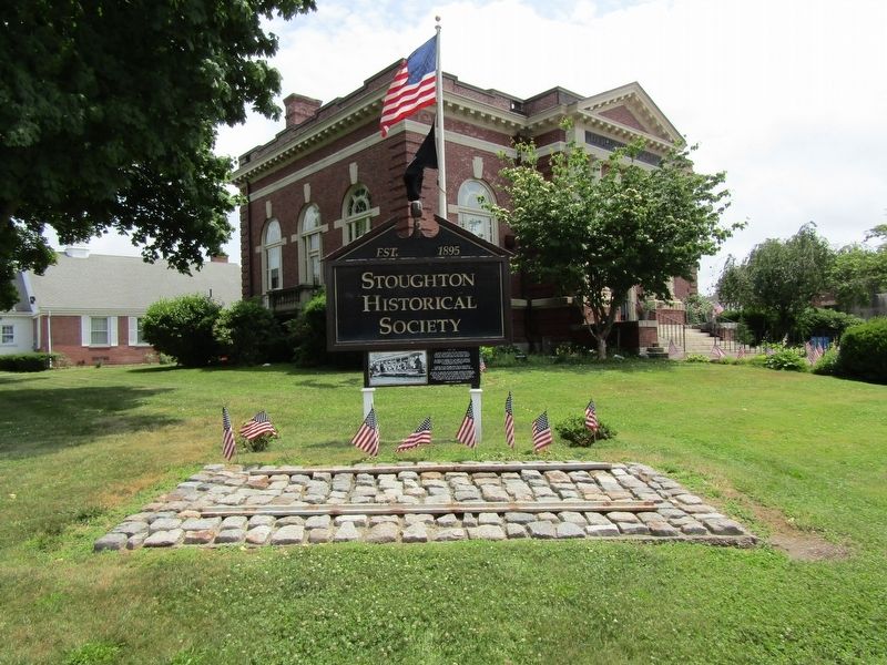
The trolley tracks displayed here were uncovered during a renovation of Stoughton Square in 2008. The tracks are believed to have been from the former Blue Hill Street Railway, which was the second of four street railways that once served Stoughton.
The company was chartered July 21, 1899. Service was inaugurated from Stoughton to Ponkapoag via Cobbs Corner and Canton Center on November 18, 1889. The route was later extended from Ponkapoag to Mattapan Square on August 15, 1903.
In Stoughton the line from Cobbs Corner went up Canton Street to Porter Street where it connected to the Brockton division of the Old Colony Street Railway which had been operating in Stoughton since 1895.
The trolley car shown here was on the Stoughton, Randolph and Holbrook Line. This line was in operation from January 1901 through 1918. Service was reestablished over the route on August 24, 1919 and operated as the Bristol and Norfolk Street Railway. This line was also known as the "Glen Echo Lake Route". It continued to operate until July 7, 1923. The trolley car in this picture was car number 8. A ten bench open car used for summer
this page online
Erected by Stoughton Historical Society.
Topics. This historical marker is listed in this topic list: Railroads & Streetcars. A significant historical date for this entry is July 21, 1899.
Location. 42° 7.452′ N, 71° 6.075′ W. Marker is in Stoughton, Massachusetts, in Norfolk County. It is at the intersection of Park St (Massachusetts Route 27) and Pleasant Street (Route 139), on the left when traveling east on Park St. Touch for map. Marker is at or near this postal address: 6 Park Street, Stoughton MA 02072, United States of America. Touch for directions.

Regionally, this marker is in Greater Boston. It is also in the American Northeast, in New England, and on the Eastern Seaboard. Globally, it is in the North Atlantic Region, North America, the Western Hemisphere, the Western World, and the Anglosphere. Historically, it finds itself in what was once one of the original Thirteen Colonies.
Other nearby markers. At least 8 other markers are within walking distance of this marker: First Public Schoolhouse (a few steps from this marker); Old Stoughton Musical Society (a few steps from this
Photographed by Conrad Ward, June 23, 2024
2. Trolley Tracks
More about this marker. The inauguration year presented on the marker is likely a typo and should probably be “1899”.
Also see . . . Blue Hill Street Railway (CantonMaHistorical Wiki). Excerpt:
The trolley system that ran between Boston and Norfolk County was known as the Blue Hill Street Railway Co. that was chartered in 1899 by Charles A. Stone and Edwin S. Webster with $150,000 in starting capital and Charles H. French as president. In November 1899 service began running between Stoughton and Canton. Between 1900 and 1903 the railway system expanded its service which involved a merger with the Milton Street Railway in 1903, so that service could reach the city of Boston, to reach(Submitted on November 21, 2024.)Mattapan and Readville. The trolleys ran every half-hour in the fall, winter, and spring with fifteen (15) minute service available in the summer at fares that ran between five cents 15 cents through the years, the Readville line which was used infrequently closed in 1915.Photographed by Stone and Webster (courtesy WardMaps LLC), circa 19123. Blue Hill Street Railway Route Map

Credits. This page was last revised on November 21, 2024. It was originally submitted on November 16, 2024, by Conrad Ward of Guilford, Connecticut. This page has been viewed 286 times since then and 65 times this year. Photos: 1, 2. submitted on November 16, 2024, by Conrad Ward of Guilford, Connecticut. 3. submitted on November 21, 2024. • Andrew Ruppenstein was the editor who published this page.
