
Flossenbürg in Neustadt an der Waldnaab, Bavaria, Germany — Central Europe
Burg
⎯⎯⎯
Castle
Photographed by James Hulse, September 27, 2024
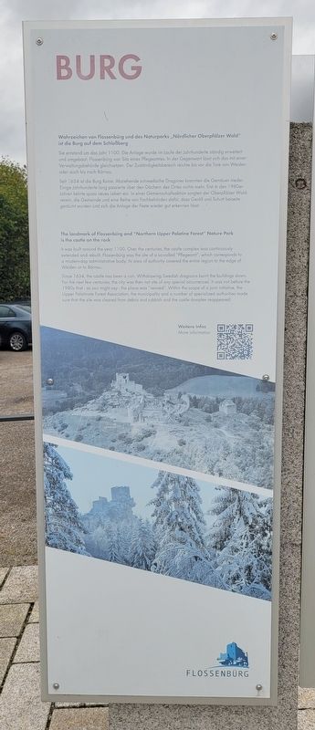
1. Burg / Castle Marker

Wahrzeichen von Flossenbürg und des Naturparks „Nördlicher Oberpfälzer Wald" ist die Burg auf dem Schloßberg
Sie entstand um das Jahr 1100. Die Anlage wurde im Laufe der Jahrhunderte ständig erweitert und umgebaut. Flossenbürg war Sitz eines Pflegeamtes. In der Gegenwart lässt sich das mit einer Verwaltungsbehörde gleichsetzen. Der Zuständigkeitsbereich reichte bis vor die Tore von Weiden ader auch bis nach Bärnau.
Seit 1634 ist die Burg Ruine. Abziehende schwedische Dragoner brannten die Gemäver nieder. Einige Jahrhunderte lang passierte über den Dächern des Ortes nichts mehr, Erst in den 1980er-Jahren kehrte quasi neues Leben ein. In einer Gemeinschaftsaktion sorgten der Oberpfälzer Waldverein, die Gemeinde und eine Reihe von Fachbehörden dafür, dass Geröll und Schutt beiseite geräumt wurden und sich die Anlage der Feste wieder gut erkennen lässt.
The landmark of Flossenbürg and "Northern Upper Palatine Forest" Nature Park is the castle on the rock
It was built around the year 1100. Over the centuries, the castle complex was continuously extended and rebuilt. Flossenbürg was the site of a so-called "Pflegeamt", which corresponds to a modern-day administrative body. Its area of authority covered the entire region to the edge of Weiden or to Bämau.
Since 1634, the castle has been a ruin. Withdrawing Swedish dragoons burnt the buildings down. For the next few centuries, the city was then not site of any special occurrences. It was not before the 1980s that as you might say the place was "revived". Within the scope of a joint initiative, the Upper Palatinate Forest Association, the municipality and a number of specialized authorities made sure that the site was cleared from debris and rubbish and the castle complex reappeared.
Erected by Flossenbürg.
Topics.
this page online
Location. 49° 44.226′ N, 12° 21.272′ E. Marker is in Flossenbürg, Bayern (Bavaria), in Neustadt an der Waldnaab. It is on Silberhüttenstraße just north of Gedächtnisallee, on the left when traveling north. The marker is located at the bus stop and public parking area. Touch for map. Marker is at or near this postal address: Silberhüttenstraße 42, Flossenbürg BY 92696, Germany. Touch for directions.

Regionally, it is in Europe, the European Union, Atlantic Europe, Central Europe, the Schengen Area, Western Europe, and the Western World. Historically, it finds itself in what was once the Holy Roman Empire and also the former West Germany.
Other nearby markers. At least 8 other markers are within walking distance of this marker: Gemeinde Kz-Gedenkstätte / Concentration Camp Memorial Community (here, next to this marker); Geschichte / Story (here, next to this marker); SS-Wirtschaftsgebäude / SS Utility Building (within shouting distance of this marker); Kommandantur / Commandant's Headquarters (about 90 meters
Photographed by James Hulse, September 27, 2024
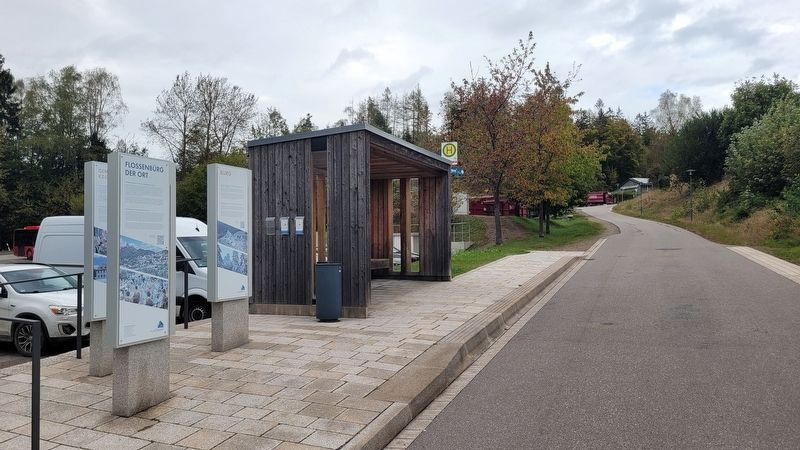
2. The view of the Marker from the street
The marker is located on the far right side of the markers.
Also see . . . Welcome to the Municipality of Flossenbürg. Flossenbürg Municipality (Submitted on November 19, 2024, by James Hulse of Medina, Texas.)
Credits. This page was last revised on September 30, 2026. It was originally submitted on November 16, 2024, by James Hulse of Medina, Texas. This page has been viewed 106 times since then and 11 times this year. Photos: 1, 2. submitted on November 18, 2024, by James Hulse of Medina, Texas.
