
Port Perry in Durham Region, Ontario — Central Canada (North America)
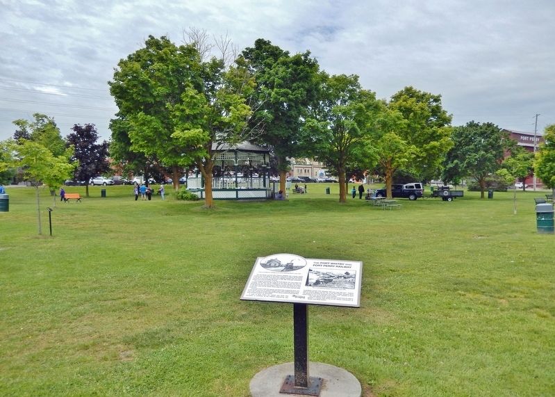
The Port Whitby and Port Perry Railway

Photographed by Cosmos Mariner, June 2, 2024
1. The Port Whitby and Port Perry Railway Marker
The Port Whitby and Port Perry Railway (PW&PP) was a former railway running north from Whitby to Port Perry, a distance of about 30 kilometres. It was built to connect local grain and logging interests with the railway mainlines on the shores of Lake Ontario. It was later extended northeast to Lindsay, becoming the WPP&L Railway.
The inaugural locomotive of the PW & PP Railway line was called the "Scugog" which rolled into the lakefront at Port Perry, for the first time on November 23, 1871. The railway continued to run from Whitby to Port Perry for 68 years with the last train being in 1939.The railway era came to an end in July 1941 when all the railway tracks were torn up to feed wartime steel production.
Passenger trains made two regular runs each day costing 70 cents, and it took about one hour. In addition, freight trains were making three or four trips a day, picking up lumber shipped to Port Perry's lakefront from Fenelon Falls and Bobcaygeon by steamboat.
In spite of early hopes, the railway was never very successful or profitable, as the original engineering was considered sub-par and reliability was poor from
this page online
The main station is still visible having moved from its original position in Palmer Park across to the nearby intersection at Queen and Water Streets.
Erected by Township of Scugog.
Topics. This historical marker is listed in these topic lists: Industry & Commerce • Railroads & Streetcars • War, World II. A significant historical date for this entry is November 23, 1871.
Location. 44° 6.295′ N, 78° 56.453′ W. Marker is in Port Perry, Ontario, in Durham Region. It can be reached from the intersection of Water Street and Mary Street, on the right when traveling north. The marker is located along the walkway, near the southeast corner of Palmer Park. Touch for map. Marker is at or near this postal address: 175 Water Street, Port Perry ON L9L 1C4, Canada. Touch for directions.

Regionally, this marker is in Greater Toronto, specifically on the Golden Horseshoe, in the York, Durham and Headwaters Area, and in the Toronto Metropolitan

2. Marker detail: Port Perry Station, circa 1912
Train arriving from Lindsay to Port Perry Railway Station.
Other nearby markers. At least 8 other markers are within walking distance of this marker: The Rotary Club of Port Perry (within shouting distance of this marker); Lake Scugog (within shouting distance of this marker); Steamboats on Lake Scugog (about 90 meters away, measured in a direct line); Harvey Lillard (about 90 meters away); Daniel David Palmer (about 90 meters away); a different marker also named Daniel David Palmer (about 120 meters away); The Port Perry Grain Elevator (about 120 meters away); St. Charles Hotel (about 150 meters away). Touch for a list and map of all markers in Port Perry.
Also see . . . Port Whitby and Port Perry Railway (Wikipedia).
Excerpt: The Port Whitby and Port Perry Railway was built to connect local grain and logging interests with the railway mainlines on(Submitted on November 20, 2024, by Cosmos Mariner of Cape Canaveral, Florida.)the shores of Lake Ontario. Port Perry was ideally located to gather materials from a considerable area due to its lakeside location on Lake Scugog, which had connections to the Trent-Severn Waterway that offered easy access to large areas of northern Ontario. If a railway was built to the lakeshore, barges could carry produce to Port Perry and then be quickly trans-shipped southward. An official sod-turning ceremony was eventually made on 6 October 1869 by Prince Arthur. Southern portions were completed on 31 August 1870 and opened for traffic in July 1871. 3. Marker detail: G.T.R. Railway Station, Port Perry
circa 1880
In spite of many problems, the railway turned Port Perry into the center of Reach Township. Business quickly moved out of Manchester and Prince Albert, and in a few years, Prince Albert nearly turned into a ghost town, leaving only a general store, a post office and a blacksmith. As Port Perry grew the original alignment of Simcoe Street was changed to run through Port Perry instead of Prince Albert, and today Prince Albert is effectively the southern portion of Port Perry.
Photographed by Cosmos Mariner, June 2, 2024
4. The Port Whitby and Port Perry Railway Marker
Looking northwest across Palmer Park.
Credits. This page was last revised on November 20, 2024. It was originally submitted on November 20, 2024, by Cosmos Mariner of Cape Canaveral, Florida. This page has been viewed 198 times since then and 19 times this year. Photos: 1, 2, 3, 4. submitted on November 20, 2024, by Cosmos Mariner of Cape Canaveral, Florida.
