Cape Girardeau in Cape Girardeau County, Missouri — The American Midwest (Upper Plains)
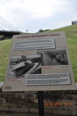
Manitowoc Shipbuilding Company
Photographed by Sandra Hughes, August 12, 2012
1. Manitowoc Shipbuilding Company Marker
In December 1940, the U.S. Navy contracted with the company to construct 10 Gato class submarines. Subsequently, the Navy increased the order to 41 boats of which 28 were ultimately produced prior to the end of the war.
The typical Gato submarine was 312 feet long, with 27-foot beams and a 15-foot draft, and weighted 1825 tons surfaced. Its crew consisted of 65-74 officers and men.
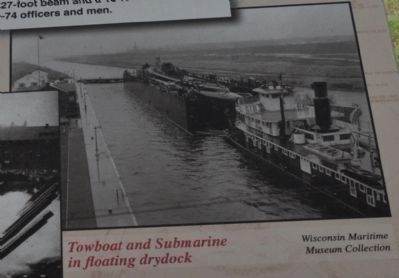
After trial testing in Lake Michigan, the submarines sailed to Chicago, where they were towed to Lockport, Illinois, and then placed in floating dry docks to travel down the Illinois and Mississippi Rivers to New Orleans.
Crowds gathered along the rivers and at bridge crossings to cheer the boats and their crews. From New Orleans, the submarines passed through the Panama Canal before joining the Pacific Fleet at Pearl Harbor.
Erected by Southeast Missouri State University.
Topics. This historical marker is listed in these topic lists: Industry & Commerce • War, World I. A significant historical month for this entry is December 1940.
Location. Marker has been permanently removed. It was located near 37° 17.757′ N, 89° 31.223′ W. Marker was in Cape Girardeau, Missouri, in Cape Girardeau County. It could be reached from Aquasmi Street, on the right when traveling south. Marker is in a park on Southeast University Missouri - River Campus. Touch for map. Marker was in this post office area: Cape Girardeau MO 63701, United States of America.
We have been informed that this marker is no longer there and will not be replaced. This page is an archival view of what was.
Regionally, this marker was in Southeast Missouri. It was also in
this page online

Other nearby markers. At least 8 other markers are within walking distance of this location: St Vincent's Seminary and Southeast Missouri State University (here, next to this marker); Cape La Croix Creek (approx. 0.3 miles away); Don Louis Lorimier / El Camino Real (approx. 0.3 miles away); Old St. Vincent's Church (approx. 0.3 miles away); The Red House (approx. 0.3 miles away); George Drouillard (approx. 0.4 miles away); The Red House Interpretive Center (approx. 0.4 miles away); The Lewis and Clark Expedition Across Missouri (approx. 0.4 miles away). Touch for a list and map of all markers in Cape Girardeau.
Other markers no longer nearby. Cape Girardeau River Crossings (was a few steps from this marker but has been permanently removed); Cape Girardeau and the Railroad (was
Photographed by Sandra Hughes, August 12, 2012
2. Manitowoc Shipbuilding Company Marker
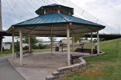
Marker located in the middle under the pavilion.
Additional commentary.
1. Marker confirmed missing.
Just visited 10/25/2025. This park area has been renovated without updates to the markers.
— Submitted October 28, 2025, by Garrett Koch of Saint Louis, Missouri.
Photographed by Sandra Hughes, August 12, 2012
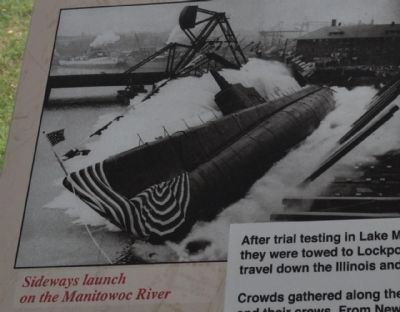
3. Sideways launch on the Manitowoc River
Southeast Missouri State University
Photographed by Sandra Hughes, August 12, 2012
4. Towboat and Submarine in floating drydock
Wisconsin Maritime Museum Collection
Credits. This page was last revised on November 4, 2025. It was originally submitted on August 23, 2012, by Sandra Hughes Tidwell of Killen, Alabama, USA. This page has been viewed 849 times since then and 24 times this year. Last updated on November 22, 2024, by Edward Troxel of Creal Springs, Illinois. Photos: 1, 2, 3, 4. submitted on August 23, 2012, by Sandra Hughes Tidwell of Killen, Alabama, USA. • J. Makali Bruton was the editor who published this page.
