Near Zillebeke in West-Vlaanderen, Flanders, Belgium — Northwestern Europe
Hill 62
Canada
| — | 1916 | — |
Photographed by Steve Stoessel, November 14, 2024
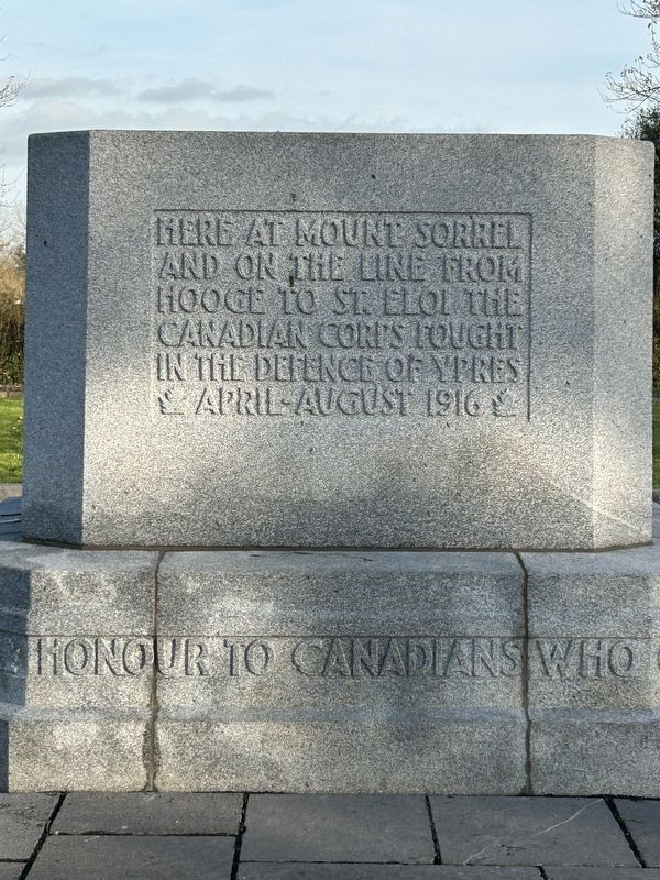
1. Hill 62 Marker

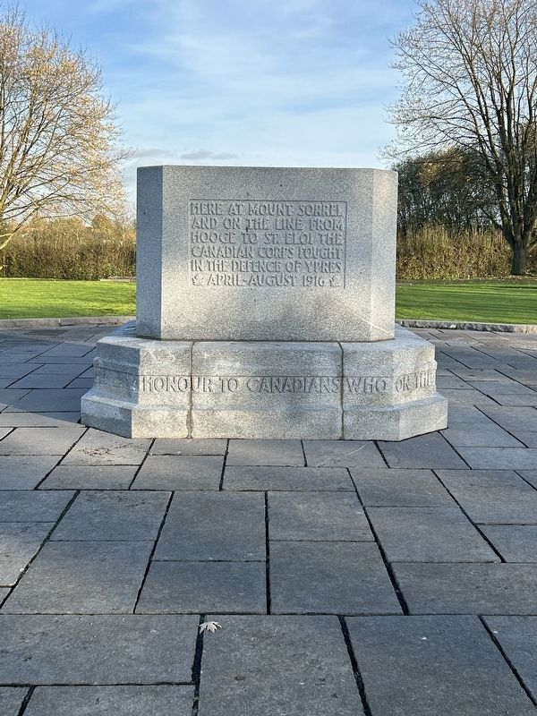
Here at Mount Sorrel and on the line from Hooge to St. Eloi the Canadian Corps fought in the defence of Ypres April - August 1916
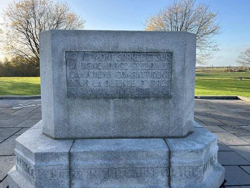
Ici, au Mont Sorrel et sur la ligne de Hooge à Saint-Eloi le Le Corps canadien a combattu pour la défense d'Ypres Avril - Août 1916
Honour to Canadians who on the fields of Flanders and of France fought in the cause of the Allies with sacrifice and devotion
Topics. This memorial is listed in this topic list: War, World I. A significant historical year for this entry is 1916.
Location. 50° 50.064′ N, 2° 56.83′ E. Memorial is near Zillebeke, Vlaanderen (Flanders), in West-Vlaanderen. It can be reached from Canadalaan. Marker is at the end of Canada Lane. Touch for map. Memorial is at or near this postal address: Canadalaan 26, Zillebeke, Vlaanderen 8902, Belgium. Touch for directions.

Regionally, it is in Europe, the European Union, Atlantic Europe, the Benelux Low Countries, the Schengen Area, Western Europe, and the Western World. Historically, it finds itself in what was once the Roman Empire and specifically also the Holy Roman Empire.
this page online
Other nearby markers. At least 8 other markers are within walking distance of this marker: A different marker also named Hill 62 (about 150 meters away, measured in a direct line); Sanctuary Wood Cemetery (approx. half a kilometer away); Hooge Crater Cemetery (approx. 1.4 kilometers away); Thomas Keith Hedley Rae (approx. 1.4 kilometers away); Kastelenin de Ieperboog (approx. 1.4 kilometers away); Kasteeldomeinen Worden Front (approx. 1.4 kilometers away); Kasieeldumeinen na de Oorlog (approx. 1.4 kilometers away); Kasteeldomeinen In De Klein Ieperboog (approx. 1.4 kilometers away).
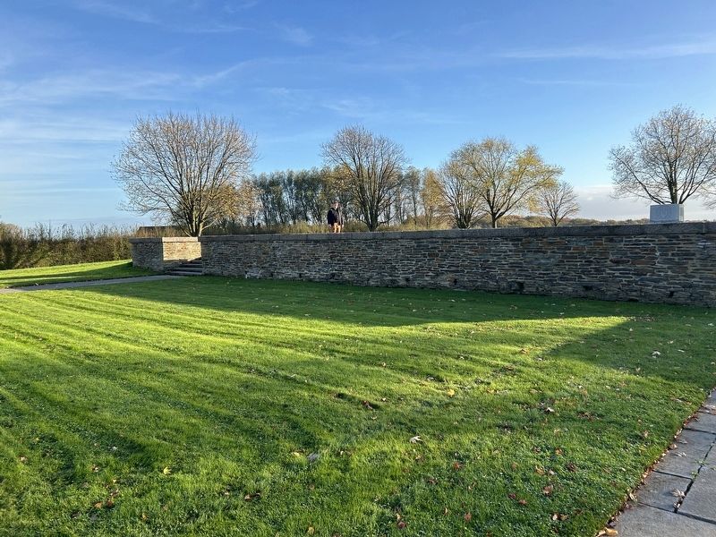
More about this memorial. This area is known as Hill 62 or Sanctuary Wood during the war.
Also see . . .
1. Hill 62 Memorial (Wikipedia). (Submitted on November 23, 2024, by Steve Stoessel of Niskayuna, New York.)
2. Battle of Mount Sorrel (Wikipedia). (Submitted on November 23, 2024, by Steve Stoessel of Niskayuna, New York.)
Photographed by Steve Stoessel, November 14, 2024
2. Hill 62 Marker
Photographed by Steve Stoessel, November 14, 2024
3. Hill 62 Marker
Photographed by Steve Stoessel, November 14, 2024
4. Hill 62 Monument
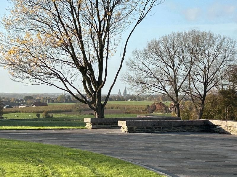
Photographed by Steve Stoessel, November 14, 2024
5. View from the Monument
This view is looking west towards Ypres, which are the towers in the background. They are almost three miles away. The flatness of the landscape, and the importance of small elevations mark a central feature of the fighting in Flanders in WW1.
Credits. This page was last revised on February 26, 2025. It was originally submitted on November 23, 2024, by Steve Stoessel of Niskayuna, New York. This page has been viewed 159 times since then and 12 times this year. Photos: 1, 2, 3, 4, 5. submitted on November 23, 2024, by Steve Stoessel of Niskayuna, New York.
