Near Parowan in Iron County, Utah — The American Mountains (Southwest)
Nathan Benson, Sr. Monument
Photographed by Tom Bosse, July 29, 2024
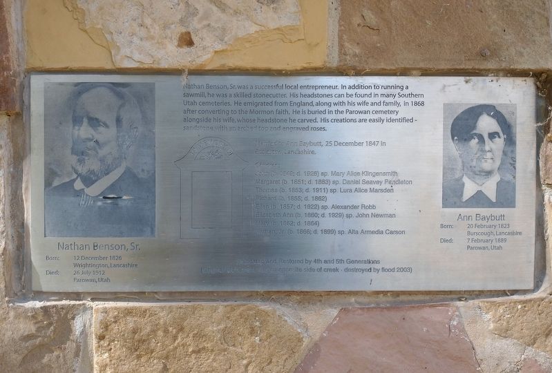
1. Nathan Benson, Sr. Monument Marker
Nathan Benson, Sr. was a successful local entrepreneur. In addition to running a sawmill, he was a skilled stonecutter. His headstones can be found in many Southern Utah cemeteries. He emigrated from England, along with his wife and family, in 1868 after converting to the Mormon faith. He is buried in the Parowan cemetery alongside his wife, whose headstone he carved. His creations are easily identified sandstone with an arched top and engraved roses.
Married to Ann Baybutt, 25 December 1847 in Eccleston, Lancashire.
Nathan Benson, Sr. Born: 12 December 1826, Wrightington, Lancashire. Died: 26 July 1912 Parowan, Utah.
Ann Baybutt. Born: 20 February 1823 Burscough, Lancashire. Died 7 February 1889 Parowan, Utah.
Children:
John (b, 1849; d. 1926) sp. Mary Alice Klingensmith
Margaret (b. 1851; d. 1883) sp. Daniel Seavey Pendleton
Thomas (b.1853; d. 1911) sp. Lura Alice Marsden
Richard (b.1855; d. 1862)
Ellen (b. 1857; d.1922) sp. John Newman
Mary (b. 1862; d. 1864)
Nathan, Jr. (b.1866; d. 1899) sp. Alta Armedia Carson.
Relocated and restored by 4th and 5th Generations. (Original Monument was on opposite
this page online
Erected by Cedar City Chapter of Sons of the Utah Pioneers.
Topics and series. This historical marker and monument is listed in this topic list: Settlements & Settlers. In addition, it is included in the Sons of Utah Pioneers series list. A significant historical date for this entry is February 20, 1823.
Location. 37° 48.039′ N, 112° 48.84′ W. Marker is near Parowan, Utah, in Iron County. It is on South Cyn Road, on the left when traveling south. Marker is located 2.7 miles South from Cemetery on Hwy 143 Parowan, Utah. Longitude: -112.814167; Latitude: 37.800556; Elevation 6580'. Touch for map. Marker is in this post office area: Parowan UT 84761, United States of America. Touch for directions.

Regionally, this marker and monument is in Utah’s Color Country. It is also in the American Mountain West and on the Colorado Plateau. Globally, it is in North America, the Rocky Mountains, the Western Hemisphere, the Western World, and the Anglosphere. Historically, it finds itself in what was once New Spain and also Mexico’s Alta California.
Other nearby markers. At least 8 other markers are
Photographed by Tom Bosse, July 29, 2024
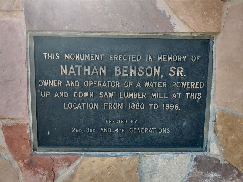
2. Nathan Benson, Sr. Monument

Photographed by Tom Bosse, July 29, 2024
3. Nathan Benson, Sr. Monument

Photographed by Tom Bosse, July 29, 2024
4. Nathan Benson, Sr. Monument
Credits. This page was last revised on November 26, 2024. It was originally submitted on November 23, 2024, by Tom Bosse of Jefferson City, Tennessee. This page has been viewed 210 times since then and 21 times this year. Photos: 1, 2, 3, 4. submitted on November 23, 2024, by Tom Bosse of Jefferson City, Tennessee. • Andrew Ruppenstein was the editor who published this page.
