Port Perry in Durham Region, Ontario — Central Canada (North America)
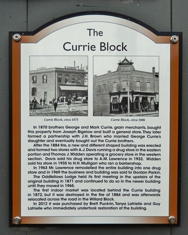
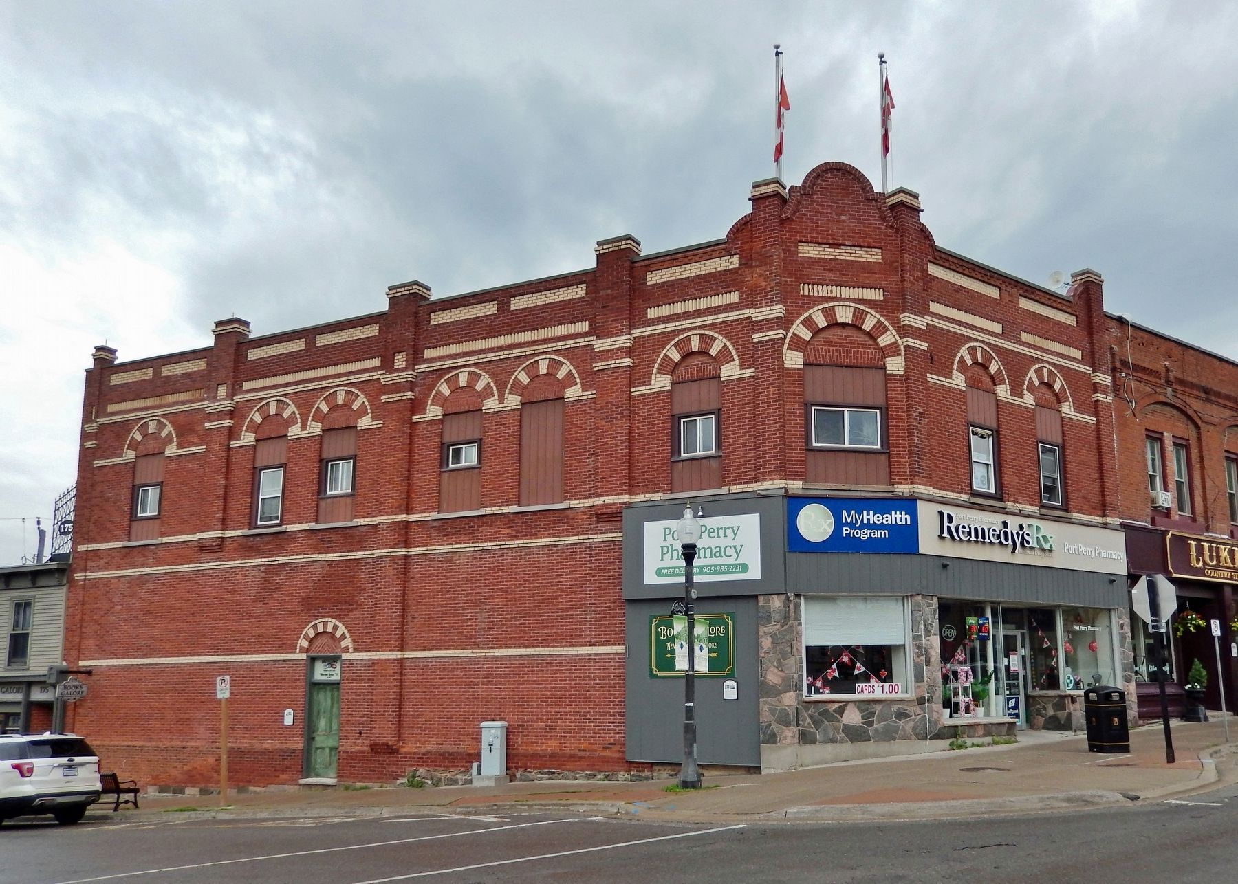
The Currie Block
Photographed by Cosmos Mariner, June 2, 2024
1. The Currie Block Marker
In 1870 brothers George and Mark Currie, grain merchants, bought this property from Joseph Bigelow and built a general store. They later formed a partnership with J.H. Brown who married George Currie's daughter and eventually bought out the Currie brothers.
After the 1884 fire, a new and different shaped building was erected and formed two stores with A.J. Davis running a drug store in the eastern portion and Thomas J. Widden operating a grocery store in the western section. Davis sold his drug store to A.M. Lawrence in 1932. Widden sold his store in 1935 to H.H. Mulligan who ran a barbershop.
In 1963 Mr. Lawrence remodelled the entire building into one drug store and in 1969 the business and building was sold to Gordon Parkin.
The Oddfellows Lodge held its first meeting in the upstairs of the original building in 1871 and continued to do so in the newer building until they moved in 1965.
The first indoor market was located behind the Currie building in 1872, but it was destroyed in the fire of 1884 and was afterwards relocated across the road in the Willard Block.
In 2012 it was purchased by Brett Puckrin, Tanya Latrielle
this page online
Topics. This historical marker is listed in these topic lists: Architecture • Disasters • Fraternal or Sororal Organizations • Industry & Commerce. A significant historical year for this entry is 1870.
Location. 44° 6.292′ N, 78° 56.656′ W. Marker is in Port Perry, Ontario, in Durham Region. It is at the intersection of Perry Street and Queen Street, on the left when traveling south on Perry Street. The marker is mounted at eye-level on the southwest corner of the subject building, facing Perry Street. Touch for map. Marker is at or near this postal address: 209 Queen Street, Port Perry ON L9L 1B8, Canada. Touch for directions.

Regionally, this marker is in Greater Toronto, specifically on the Golden Horseshoe, in the York, Durham and Headwaters Area, and in the Toronto Metropolitan Area. It is also in Central Canada. Globally, it is in North America, on the Great Lakes, in the Western Hemisphere, in the Western World, and in the Anglosphere. Historically, it finds itself in what was once a British colony, the Viceroyalty of New
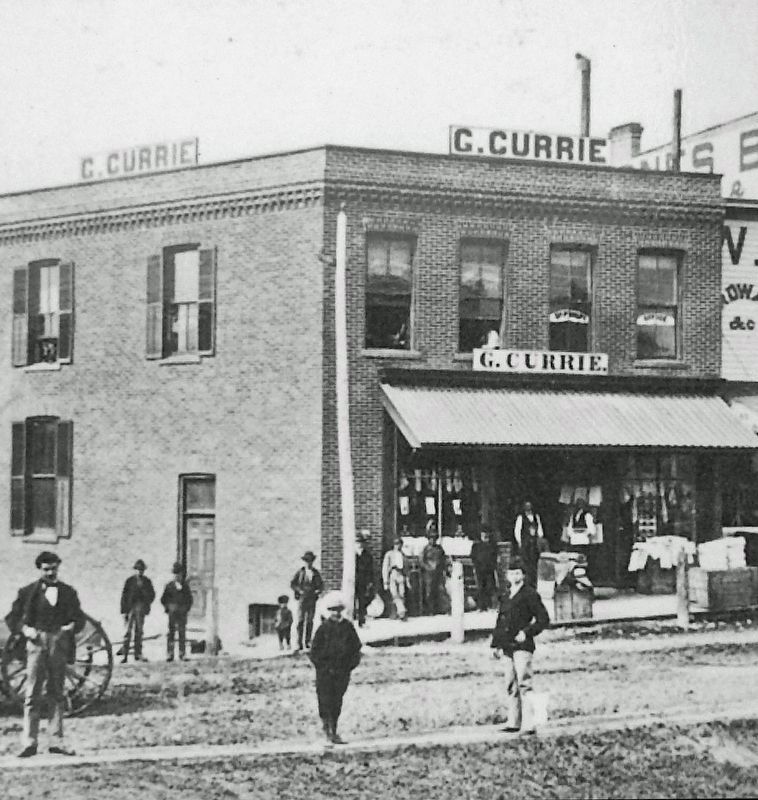
2. Marker detail: Currie Block, circa 1875
Other nearby markers. At least 8 other markers are within walking distance of this marker: Independent Order of Odd Fellows (a few steps from this marker); Wm. L. Parrish Block (a few steps from this marker); The Willard Block (a few steps from this marker); Jones Brothers Block (within shouting distance of this marker); The Harrington Block (within shouting distance of this marker); William Hiscocks Block (within shouting distance of this marker); John W. Davis Block (within shouting distance of this marker); The McCaw Block (within shouting distance of this marker). Touch for a list and map of all markers in Port Perry.
Related markers. Click here for a list of markers that are related to this marker.
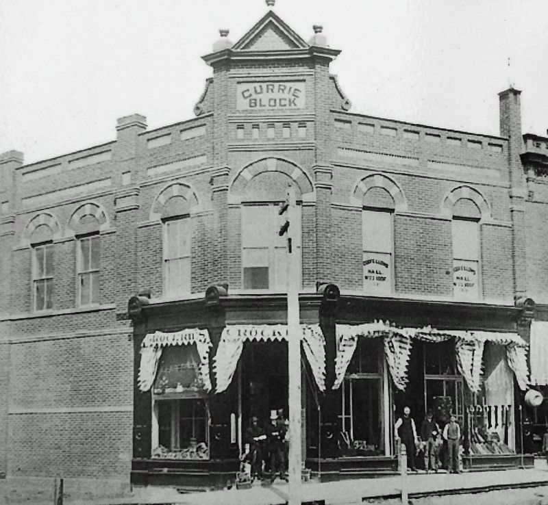
3. Marker detail: Currie Block, circa 1886
Photographed by Cosmos Mariner, June 2, 2024
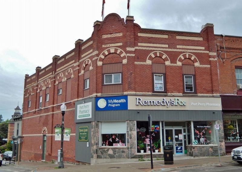
4. The Currie Block (south elevation)
Looking north across Queen Street; Perry Street continues north on the left.
Photographed by Cosmos Mariner, June 2, 2024
5. The Currie Block (southwest elevation)
The marker is visible near the center, beneath the Port Perry Pharmacy sign.
Credits. This page was last revised on November 25, 2024. It was originally submitted on November 24, 2024, by Cosmos Mariner of Cape Canaveral, Florida. This page has been viewed 133 times since then and 18 times this year. Photos: 1, 2, 3, 4, 5. submitted on November 25, 2024, by Cosmos Mariner of Cape Canaveral, Florida.
