Gable in Clarendon County, South Carolina — The American South (South Atlantic)
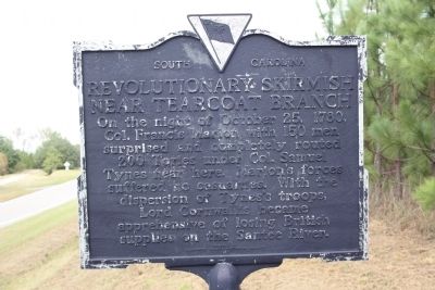
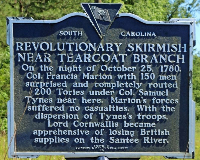
Revolutionary Skirmish Near Tearcoat Branch

Photographed by C Summers, October 22, 2025
1. Revolutionary Skirmish Near Tearcoat Branch Marker
Erected 1980 by Clarendon County Historical Society. (Marker Number 14-5.)
Topics. This historical marker is listed in these topic lists: Patriots & Patriotism • War, US Revolutionary. A significant historical date for this entry is October 25, 1780.
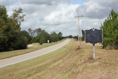
Location. 33° 48.854′ N, 80° 8.556′ W. Marker is in Gable, South Carolina, in Clarendon County. It is on North Brewington Road (State Highway 14-50) 1.7 miles north of U.S. 301, on the right when traveling north. Touch for map. Marker is in this post office area: Gable SC 29051, United States of America. Touch for directions.

Regionally, this marker is in the Pee Dee and in Santee Cooper Country. It is also in the American South and specifically in the Deep South. Globally, it is in North America, the Western Hemisphere, the Western World, and the Anglosphere. Historically,
this page online
Other nearby markers. At least 8 other markers are within 8 miles of this marker, measured as the crow flies: Pleasent Grove School (approx. 3.7 miles away); George Stinney, Jr. (approx. 6.2 miles away); Goodwill School (approx. 6.8 miles away); " Ebenezer " (approx. 6.8 miles away); Goodwill Presbyterian Church, U.S.A. (approx. 6.9 miles away); Midway Church (approx. 6.9 miles away); Midway Presbyterian Church (approx. 6.9 miles away); Ox Swamp (approx. 7½ miles away).
Regarding Revolutionary Skirmish Near Tearcoat Branch. While billeted near Waccamaw, General Marion learned Colonel Tynes with a party of over ninety Tories passed through Camden where they drew supplies and new muskets. They were now camped at the edge of Tearcoat Swamp, between the two forks of the Black River.
Related marker. Click here for another marker that is related to this marker. To better understand the relationship, study each marker in the order shown.
Also see . . . Touring South Carolina's Revolutionary War Sites By Daniel W. Barefoot. Page 8.
Photographed by Mike Stroud, 2009
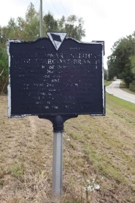
2. Revolutionary Skirmish Near Tearcoat Branch Marker
Photographed by Mike Stroud, October 23, 2009
3. Revolutionary Skirmish Near Tearcoat Branch Marker
Photographed by Mike Stroud, October 23, 2009
4. Revolutionary Skirmish Marker looking west along Brewington Road near the I-95 overpass
Photographed by C Summers, April 26, 2020
5. Revolutionary Skirmish Near Tearcoat Branch Marker
Photographed by Mike Stroud, October 23, 2009
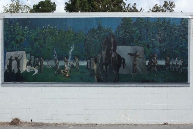
6. Revolutionary Skirmish Near Tearcoat Branch Mural
Battle of Tearcoat Mural at corner of Main St. (US 301) and Calvert St., Turbeville, SC as part of the Francis Marion Trails : Marion called a muster and with 150 men moved to Kingstree. He then turned west and moved swiftly toward Tearcoat. After scouting the encampment Marion split his force into three companies and attacked at midnight. The attackers killed six, wounded fourteen and captured twenty-three men. They also captured the food, baggage, ammunition, over eighty new muskets and horses with saddles. However, Tynes escaped, but was captured a few days later in the High Hills (near Stateburg). Tearcoat Mural ©2002

Photographed by C Summers
7. Revolutionary Skirmish Near Tearcoat Branch Mural in Turbeville, SC
Credits. This page was last revised on October 28, 2025. It was originally submitted on October 25, 2009, by Mike Stroud of Bluffton, South Carolina. This page has been viewed 2,429 times since then and 106 times this year. Last updated on November 25, 2024, by C Summers of Manning, South Carolina. Photos: 1. submitted on October 22, 2025, by C Summers of Manning, South Carolina. 2, 3, 4. submitted on October 25, 2009, by Mike Stroud of Bluffton, South Carolina. 5. submitted on November 25, 2024, by C Summers of Manning, South Carolina. 6. submitted on October 25, 2009, by Mike Stroud of Bluffton, South Carolina. 7. submitted on November 25, 2024, by C Summers of Manning, South Carolina. • Bernard Fisher was the editor who published this page.
