
Picpus in Paris in Département de Paris, Île-de-France, France — Western Europe
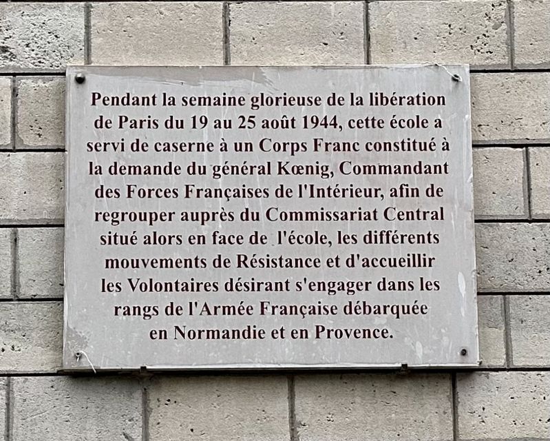
Caserne, août 1944
⎯⎯⎯
Barracks, August 1944
Photographed by Andrew Ruppenstein, September 10, 2024
1. Caserne, août 1944 / Barracks, August 1944 Marker

During the glorious week of the liberation of Paris from August 19 to 25, 1944, this school served as barracks for a Corps Franc formed at the request of General Koenig, Commander of the French Forces of the Interior, in order to bring together the various Resistance movements at the Central Commissariat located opposite the school and to welcome volunteers wishing to join the ranks of the French Army that had landed in Normandy and Provence.
Topics and series. This historical marker is listed in this topic list: War, World II. In addition, it is included in the Liberation of Paris series list. A significant historical date for this entry is August 21, 1944.
Location. 48° 50.436′ N, 2° 23.323′ E. Marker is in Paris, Île-de-France, in Département de Paris.
this page online

Regionally, it is in the North Atlantic Region, Europe, the European Union, Atlantic Europe, the Schengen Area, Western Europe, a coastal Mediterranean country, and the Western World. Historically, it finds itself in what was once a French colony and also the Roman Empire.
Other nearby markers. At least 8 other markers are within walking distance of this marker: École Élémentaire Publique Bignon Deported Jewish Students Memorial (here, next to this marker); Juifs du 12ème arrondissement raflés / Jews of the 12th Arrondissement rounded up Memorial (within shouting distance of this marker); École maternelle Elisa Lemmonier Deported Jewish Students Memorial (within shouting distance of this marker); Enfants du 12ème arrondissement déportés / 12th Arrondissement Deported Jewish Children Memorial (about 90 meters away, measured in a direct line); Square Eugène-Thomas (1877) (about 120 meters away); Jardin de Reuilly - Paul Pernin (1992) (about 120 meters away); Rothschild Hospital Holocaust Memorial (approx. 0.7 kilometers away); École Rue de Picpus Jewish Student Deportation Memorial
Photographed by Andrew Ruppenstein, September 10, 2024
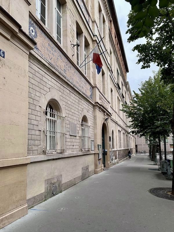
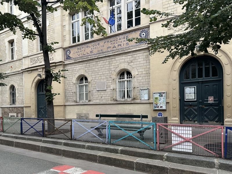
2. Caserne, août 1944 / Barracks, August 1944 Marker - wide view
The marker is visible here just a bit to the left of the entrance to the École Élémentaire publique Bignon.
Also see . . .
1. Liberation of Paris (Wikipedia). Overview:
The liberation of Paris (French: libération de Paris) was a battle that took place during World War II from 19 August 1944 until the German garrison surrendered the French capital on 25 August 1944. Paris had been occupied by Nazi Germany since the signing of the Armistice of 22 June 1940, after which the Wehrmacht occupied northern and western France.(Submitted on November 28, 2024.)
The liberation began when the French Forces of the Interior—the military structure of the French Resistance—staged an uprising against the German garrison upon the approach of the US Third Army, led by General George S. Patton. On the night of 24 August, elements of General Philippe Leclerc de Hauteclocque's 2nd French Armored Division made their way into Paris and arrived at the Hôtel de Ville shortly before midnight. The next morning, 25 August, the bulk of the 2nd Armored Division and US 4th Infantry Division and other allied units entered the city. Dietrich von Choltitz, commander of the German garrison and the military governor of Paris, surrendered to the French at the Hôtel Le Meurice, the newly established French headquarters. General Charlesde Gaulle of the French Army arrived to assume control of the city as head of the Provisional Government of the French Republic.Photographed by Andrew Ruppenstein, September 10, 20243. Caserne, août 1944 / Barracks, August 1944 Marker - wide view
2. Marie-Pierre Kœnig (Wikipedia). Excerpt: Marie Joseph Pierre François Kœnig or Koenig (10 October 1898 – 2 September 1970) was a French general during World War II during which he commanded a Free French Brigade at the Battle of Bir Hakeim in North Africa in 1942. He started a political career after the war and was posthumously elevated to the dignity of Marshal of France in 1984. …In 1944, he was given command of the Free French who participated in the Invasion of Normandy. Kœnig also served as a military advisor to de Gaulle. In June 1944, he was given command of the French Forces of the Interior (FFI) to unify the various French Resistance groups under de Gaulle's control. Under his command, the FFI abandoned ranged battle in the maquis and preferred sabotage that was waged in support of the invading army. Important during D-Day, the FFI had a role that became decisive in the battle for Normandy and in the landing in Provence of the US Seventh Army and French Army B. On 21 August 1944, de Gaulle appointed Kœnig military governor of Paris to restore law and order… (Submitted on November 28, 2024.)
Credits. This page was last revised on November 28, 2024. It was originally submitted on November 28, 2024, by Andrew Ruppenstein of Lamorinda, California. This page has been viewed 88 times since then and 9 times this year. Photos: 1, 2, 3. submitted on November 28, 2024, by Andrew Ruppenstein of Lamorinda, California.
