Tellico Plains in Monroe County, Tennessee — The American South (East South Central)
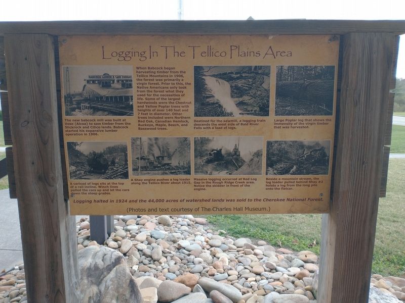
Logging in the Tellico Plains Area
Photographed by Tom Bosse, November 22, 2024
1. Logging in the Tellico Plains Area Marker
Captions
(Photo #1) The new babcock mill was built at Vose (Alcoa) to saw timber from the Slickrock and Citico lands. Babcock started his expansive lumber operation in 1906.
(Photo #2) Destined for the sawmill, a logging train descends the west side of Bald River Falls with a load of logs.
(Photo #3) Large poplar log that shows the immensity of the virgin timber that was harvested.
(Photo #4) A carload of logs sits at the top of a rail incline. Winch lines pulled the cars up and let the cars down the steep grades.
(Photo #5) A Shay engine pushes a log loader along the Tellico River about 1915.
(Photo #6) Massive logging occurred at Red Log Gap in the Rough Ridge Creek area. Notice the skidder in front of the engine.
(Photo #7) Beside a mountain stream, the log loader pulled behind Shay #3 hoists a log from the long pile onto the flatcar.
Logging halted in 1924 and the 44,000 acres of watershed lands was sold to the Cherokee National Forest.
Erected by Charles
this page online
Topics. This historical marker is listed in these topic lists: Horticulture & Forestry • Industry & Commerce. A significant historical year for this entry is 1906.
Location. 35° 22.01′ N, 84° 17.836′ W. Marker is in Tellico Plains, Tennessee, in Monroe County. It is at the intersection of Cherohala Skyway (Tennessee Route 165) and Veterans Memorial Drive, on the left when traveling east on Cherohala Skyway. Marker is located outside the Cherohala Skyway Visitors Center. Touch for map. Marker is at or near this postal address: 225 Cherohala Skyway, Tellico Plains TN 37385, United States of America. Touch for directions.

Regionally, this marker is in East Tennessee. It is also in the American South, specifically in the Upper South, in Appalachia, and specifically in Southern Appalachia. Globally, it is in North America, the Western Hemisphere, the Western World, and the Anglosphere. Historically, it finds itself in what was once the original Cherokee Nation, the territory of the Mississippian Culture, one of the Confederate States of America, and the Antebellum South.
Other nearby markers. At least 8 other
Photographed by Tom Bosse, November 22, 2024
2. Logging in the Tellico Plains Area Marker
Credits. This page was last revised on December 1, 2024. It was originally submitted on November 28, 2024, by Tom Bosse of Jefferson City, Tennessee. This page has been viewed 460 times since then and 104 times this year. Photos: 1, 2. submitted on November 28, 2024, by Tom Bosse of Jefferson City, Tennessee. • James Hulse was the editor who published this page.
