Folsom in Sacramento County, California — The American West (Pacific Coastal)
Rhoads Diggings
Photographed by Jeremy Snow, November 20, 2024
1. Rhoads Diggings Marker
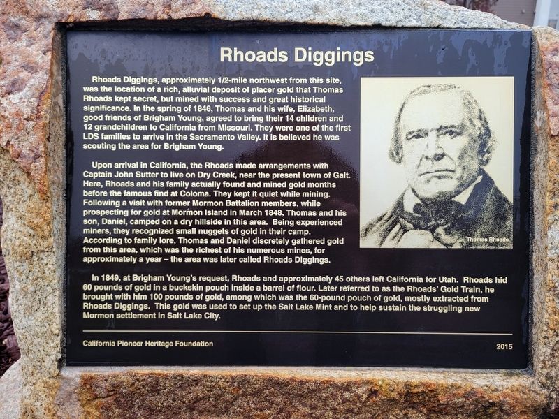
Rhoads Diggings, approximately 1/2-mile northwest from this site, was the location of a rich, alluvial deposit of placer gold that Thomas Rhoads kept secret, but mined with success and great historical significance. In the spring of 1846, Thomas and his wife, Elizabeth, good friends of Brigham Young, agreed to bring their 14 children and 12 grandchildren to California from Missouri. They were one of the first LDS families to arrive in the Sacramento Valley. It is believed he was scouting the area for Brigham Young.
Upon arrival in California, the Rhoads made arrangements with Captain John Sutter to live on Dry Creek, near the present town of Galt. Here, Rhoads and his family actually found and mined gold months before the famous find at Coloma. They kept it quiet while mining. Following a visit with former Mormon Battalion members, while prospecting for gold at Mormon Island in March 1848, Thomas and his son, Daniel, camped on a dry hillside in this area. Being experienced miners, they recognized small nuggets of gold in their camp. According to family lore, Thomas and Daniel discretely gathered gold from this area,
this page online
In 1849, at Brigham Young's request, Rhoads and approximately 45 others left California for Utah. Rhoads hid 60 pounds of gold in a buckskin pouch inside a barrel of flour. Later referred to as the Rhoads' Gold Train, he brought with him 100 pounds of gold, among which was the 60-pound pouch of gold, mostly extracted from Rhoads Diggings. This gold was used to set up the Salt Lake Mint and to help sustain the struggling new Mormon settlement in Salt Lake City.
California Pioneer Heritage Foundation ü2015
Erected 2015 by California Pioneer Heritage Foundation.
Topics. This historical marker is listed in this topic list: Industry & Commerce. A significant historical month for this entry is March 1848.
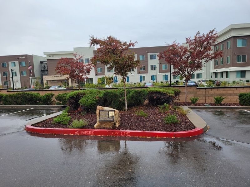
Location. 38° 39.514′ N, 121° 7.594′ W. Marker is in Folsom, California, in Sacramento County. It can be reached from Scholar Way. Marker located on the south side of the LDS Church parking lot just across from the main entrance stairs. Touch for map. Marker is at or near this postal address: 75 Scholar Way, Folsom CA 95630,
Photographed by Jeremy Snow, November 20, 2024
2. Rhoads Diggings Marker

Regionally, this marker is in Sacramento Metro, in the Sacramento Valley, and specifically in the Central Valley. It is also on the American Pacific Coast. Globally, it is in North America, on the Ring of Fire, on the Pacific Rim, in the Western Hemisphere, in the Western World, and in the Anglosphere. Historically, it finds itself in what was once New Spain and also Mexico’s Alta California.
Other nearby markers. At least 8 other markers are within 3 miles of this marker, measured as the crow flies: A different marker also named Rhoads Diggings (approx. half a mile away); Prairie City (approx. 1.9 miles away); Folsom Dam Improvements (approx. 2.6 miles away); Folsom Veterans Memorial (approx. 2.6 miles away); Kuntz Memorial Field (approx. 2.7 miles away); Who is Fisher? (approx. 2.7 miles away); Johnny Cash Trail (approx. 2.7 miles away); Folsom Institute (approx. 2.7 miles away). Touch for a list and map of all markers in Folsom.
Another marker is no longer nearby. Prairie City Cemetery (was approx. 1.9 miles away but has been confirmed missing).
Credits. This page was last revised on November 30, 2024. It was originally submitted on November 28, 2024, by Jeremy Snow of Cedar City, Utah. This page has been viewed 455 times since then and 116 times this year. Photos: 1, 2. submitted on November 28, 2024, by Jeremy Snow of Cedar City, Utah. • Andrew Ruppenstein was the editor who published this page.
