Stanstead in Memphrémagog, Québec — Central Canada (French-Canadian)
In Memory of Stanstead Plain's First Settlers
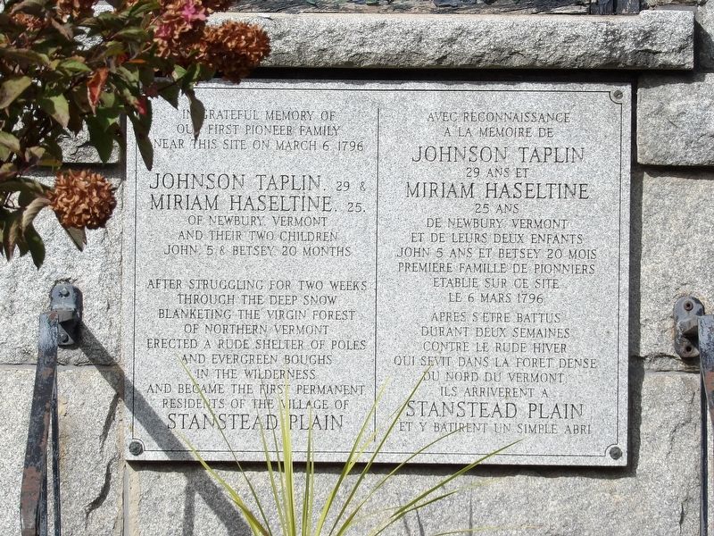
Photographed by Duane and Tracy Marsteller, October 4, 2024
1. In Memory of Stanstead Plain's First Settlers Marker
In grateful memory of our first pioneer family near this site on March 6, 1796 Johnson Taplin, 29 & Miriam Haseltine, 25, of Newbury, Vermont and their two children John, 5 & Betsey, 20 months, after struggling for two weeks through the deep snow blanketing the virgin forest of northern Vermont erected a rude shelter of poles and evergreen boughs in the wilderness and became the first permanent residents of the Village of Stanstead Plain.
[Francais]
Avec reconnaissance a la memoire de Johnson Taplin 29 ans et Miriam Haseltine 25 ans de Newbury Vermont et de leurs deux enfants John 5 ans et Betsey 20 mois premiere famille de pionniers etablie sur ce site le 6 Mars 1796 apres s'etre battus durant deux semaines contre le rude hiver qui sevit dans la foret dense du nord du Vermont ils arriverent a Stanstead Plain. et y batirent un simple abri
Topics. This historical marker is listed in this topic list: Settlements & Settlers. A significant historical date for this entry is March 6, 1796.
Location. 45° 1.11′ N, 72° 5.527′ W. Marker is in Stanstead, Québec, in Memphrémagog. It is at the intersection of Rue Dufferin (Québec
this page online

Regionally, this marker is in the Outaouais & Eastern Townships. It is also in Central Canada. Globally, it is in North America, the Western Hemisphere, and the Western World. Historically, it finds itself in what was once a British colony, the Viceroyalty of New France, the Haudenosaunee (Iroquois) Confederacy, and Rupert’s Land.
Other nearby markers. At least 8 other markers are within walking distance of this marker: Église du Sacré-Coeur / Church of the Sacred Heart (within shouting distance of this marker); Église du Sacré-Coeur (Church of the Sacred Heart) (within shouting distance of this marker); Église Christ Church Anglicane / Christ Church Anglican (about 180 meters away, measured in a direct line); Pensionnnat et monastère des Ursulines / Ursulines Monastery and Boarding School (approx. 0.4 kilometers away); Église unie Centenary / Centenary United Church (approx. half a kilometer away); L'ancien Bureau de Poste et de Douane / The Old Post Office & Customs Office
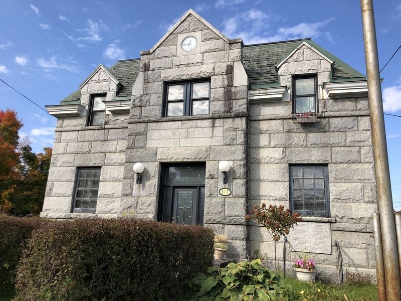
Photographed by Duane and Tracy Marsteller, October 4, 2024
2. In Memory of Stanstead Plain's First Settlers Marker
Credits. This page was last revised on November 29, 2024. It was originally submitted on November 28, 2024, by Duane and Tracy Marsteller of Murfreesboro, Tennessee. This page has been viewed 199 times since then and 40 times this year. Photos: 1, 2. submitted on November 28, 2024, by Duane and Tracy Marsteller of Murfreesboro, Tennessee.
