
Montgomery in Franklin County, Vermont — The American Northeast (New England)
Hectorville Covered Bridge
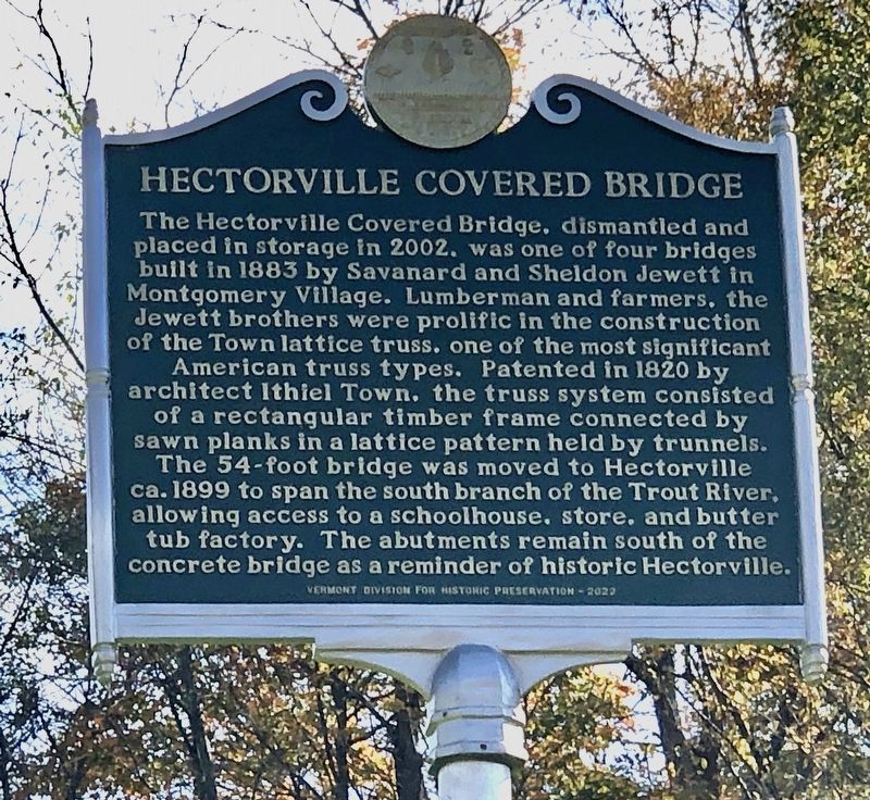
Photographed by Duane and Tracy Marsteller, October 4, 2024
1. Hectorville Covered Bridge Marker
Erected 2022 by Vermont Division for Historic Preservation.
Topics and series. This historical marker is listed in these topic lists: Architecture • Bridges & Viaducts. In addition, it is included in the Covered Bridges, the National Register of Historic Places (NRHP), and the Vermont Division for Historic Preservation Markers series lists. A significant historical year for this entry is 1883.
Location. 44° 51.237′ N,
this page online

Regionally, this marker is in Vermont’s Champlain Valley. It is also in the American Northeast and in New England. Globally, it is in North America, the Great North Woods, the Western Hemisphere, the Western World, and the Anglosphere.
Other nearby markers. At least 8 other markers are within 10 miles of this marker, measured as the crow flies: Comstock Covered Bridge (approx. 3½ miles away); The Black Lantern Inn (approx. 3½ miles away); Union Church (approx. 3.6 miles away); Fuller Covered Bridge (approx. 3.6 miles away); Longley Covered Bridge (approx. 4.2 miles away); George Washington Henderson (approx. 8½ miles away); West Enosburg United Methodist Church (approx. 9.2 miles away); Opera House of Enosburg Falls (approx. 10 miles away). Touch for a list and map of all markers in Montgomery.
Also see . . .
1. Hectorville Covered Bridge (PDF).

Photographed by Duane and Tracy Marsteller, October 4, 2024
2. Hectorville Covered Bridge Marker
2. Montgomery's Hectorville Bridge Project. Archived 2003 blog post about the effort to save the bridge. The bridge's status has not been updated on the site since then. (Scott Perry, Vermont Covered Bridge Society, Aug. 22, 2003) (Submitted on November 28, 2024, by Duane and Tracy Marsteller of Murfreesboro, Tennessee.)

Hugh H. Henry for Vermont Division of Historical Sites; via National Park Service (Public Domain), May 1974
3. Hectorville Covered Bridge
View of the east portal, looking southwest.

Hugh H. Henry for Vermont Division of Historical Sites; via National Park Service (Public Domain), May 1974
4. Hectorville Covered Bridge
View of the bridge looking north from the Trout River.
Credits. This page was last revised on November 29, 2024. It was originally submitted on November 28, 2024, by Duane and Tracy Marsteller of Murfreesboro, Tennessee. This page has been viewed 203 times since then and 37 times this year. Photos: 1, 2, 3, 4. submitted on November 28, 2024, by Duane and Tracy Marsteller of Murfreesboro, Tennessee.
