Silver City in Grant County, New Mexico — The American Mountains (Southwest)
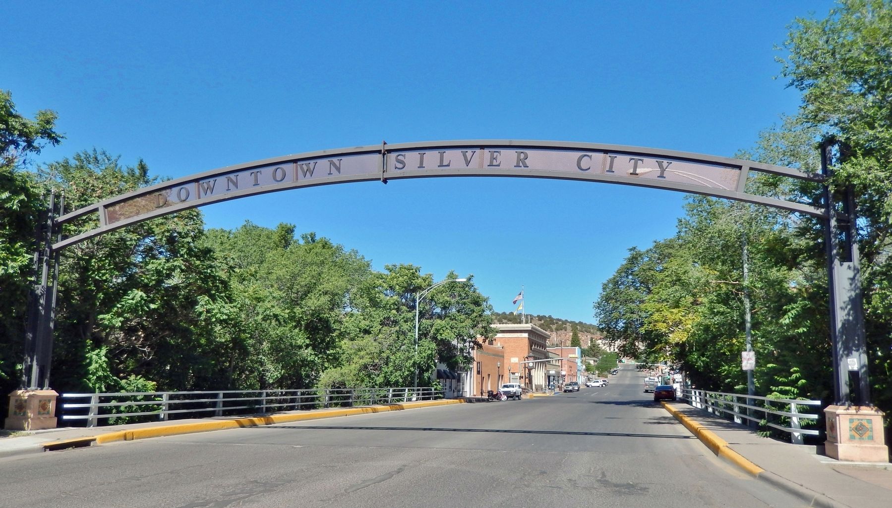
Downtown Gateway Arch

Photographed by Cosmos Mariner, June 7, 2014
1. Downtown Gateway Arch Marker
Constructed in 2010 through the partnership of the Silver City Main Street Project, Rotary Club of Silver City, New Mexico Main Street Program and the Town of Silver City.
The downtown arch and the base for this plaque were constructed using Silver City’s second generation of streetlights that were installed in the 1940s.
Adobe Techniques • Steve and Luanne Brooten • Caspersen Engineering • Custom Steelworks • James Hamilton Construction • Hardy Hole Drilling • KWAL Paint • Mastercraft Metals • Cissy McAndrew • Miller Surveying • Rick Moreno • Morones and Knuttinen, LLC • Rotary Club of Silver City • Carl Ruhne • Syzygy Tileworks • Town and Country Garden Club • Wright and Hammer Architects
And all who helped plan and execute the Gateway Arch Project
Erected by Silver City MainStreet Project.
Topics. This historical marker is listed in these topic lists: Architecture • Charity & Public Work. A significant historical year for this entry is 2010.
Location. 32° 46.187′ N, 108° 16.536′ W. Marker is in Silver City, New Mexico, in Grant County. It is on East Broadway Street just west of North Hudson Street (New
this page online

Regionally, this marker is in Southwest New Mexico. It is also in the American Borderlands and in the Southwest. Globally, it is in North America, the Western Hemisphere, the Western World, and the Anglosphere. Historically, it finds itself in what was once New Spain and also the Gadsden Purchase.
Other nearby markers. At least 8 other markers are within walking distance of this marker: Anita Scott Coleman (a few steps from this marker); 1870's Log Cabin (within shouting distance of this marker); An Oasis in the Desert (within shouting distance of this marker); Destroyed by Floods (within shouting distance of this marker); Protecting our Watershed (within shouting distance of this marker); O.B. McClintock Bank Clock (about 400 feet away, measured in a direct line); Changing Values (about 400 feet away); Municipal Museum (approx. 0.2 miles away).

Photographed by Cosmos Mariner, June 7, 2014
2. Downtown Gateway Arch Marker
Looking west; the arch is located just to the left of this marker.
Also see . . . Silver City MainStreet Project.
Silver City sprang to life during the summer of 1870. The discovery of silver brought thousands of miners, and merchants followed in their footsteps. The town’s founders decided Silver City would be “built to last.” In 1880, an ordinance was passed requiring masonry construction for new buildings in the city limits. This left behind a wealth of solid commercial buildings, brick Victorian homes, and adobe structures.(Submitted on December 1, 2024, by Cosmos Mariner of Cape Canaveral, Florida.)
A series of devastating floods between 1890 and 1910 washed away the original Main Street and all but one of its handsome brick buildings. What used to be Main Street is now known as the Big Ditch Park, and lies some 55 feet below grade. It was named after the Panama Canal, and is the watercourse for San Vicente Creek.Silver City MainStreet is an accredited New Mexico MainStreet program committed to working with our community to revitalize the economy in our historic downtown. Since 1985, Silver City MainStreet has completed numerous projects to improve the economic vitality of downtown Silver City.

Photographed by Cosmos Mariner, June 7, 2014
3. Downtown Gateway Arch at Sunset
Photographed by Cosmos Mariner, June 8, 2014
4. Downtown Gateway Arch
Looking west along Broadway Street; the marker is located just beyond the right edge of this photo.
Credits. This page was last revised on December 1, 2024. It was originally submitted on December 1, 2024, by Cosmos Mariner of Cape Canaveral, Florida. This page has been viewed 396 times since then and 35 times this year. Photos: 1, 2, 3, 4. submitted on December 1, 2024, by Cosmos Mariner of Cape Canaveral, Florida.
