Spindale in Rutherford County, North Carolina — The American South (South Atlantic)
Spindale

Photographed by Cosmos Mariner, April 23, 2022
1. Spindale Marker
In Spindale, North Carolina history is preserved in the small-town charm of the eclectic shops and restaurants that line Main Street and the brick buildings that have stood strong and tall for generations.
A manufacturing hub of mills and factories in the 1900s, Spindale's name was appropriately chosen for its well-known role in the textile industry. Many of the bricks at the base of this stand are from Stonecutter, once the largest mill in Spindale.
Today, Spindale is known to many as home to WNCW 88.7 FM radio, the most-listened to public radio station in Western North Carolina, and for the station's “Spindale Cycle™” radio show. The radio station is part of a growing music scene filling main street, and part of Isothermal Community College, where you will find the Foundation Performing Arts Center, the premier gem of Spindale's music and arts attractions.
To dairy goat aficionados, Spindale is known as home of The American Dairy Goat Association. Begun in 1904 and with over two million animals registered, they are the largest dairy goat registry in the United States.
In front of you is the last operating mill in Spindale. The rail lines built to service the textile industry in its heyday are now transformed into the Thermal Belt Rail Trail and stand as a living legacy of this formative era in our history.
To your left is The Spindale House, seen by generations of Spindale residents as the symbolic heart of the town. The oldest portions of the structure were built between 1849-1851 as a private home for Francis Sidney Coxe, a son of Tench Coxe Sr. who had served as the assistant secretary of the United States Treasury from 1789-1799. It was the boyhood home of Col. Franklin Coxe, a wealthy businessman who built the Battery Park Hotel in Asheville, NC in the late 1800s, and who also owned the famed Green River
this page online
Other town favorites include Charles B. Deviney Park on Greer Street where tennis courts, basketball, picnic shelters, horseshoe pit, playgrounds and leisurely strolls await.
And for those who love the great outdoors, travel the length of our town and beyond on the Thermal Belt Rail Trail. Originally the railroad line that moved textiles in and out of our small southern town, the Rail Trail is now a 13.58 mile walking/running/biking trail that welcomes both casual and serious athletes.
Special thanks from Rutherford County Tourism Development Authority go to Mayor Mickey Bland and the Town of Spindale for financial and moral support for this project.
Learn more at SpindaleNC.net
[photo captions]
• Isothermal Community College & the Foundation
• Outdoor Festivals
Erected 2012.
Topics. This historical marker is listed in these topic lists: Animals • Arts, Letters, Music • Industry & Commerce

2. Spindale Marker Map
Location. 35° 21.431′ N, 81° 55.795′ W. Marker is in Spindale, North Carolina, in Rutherford County. It is at the intersection of Main Street (Alternate U.S. 221) and Spindale Street (State Road 1546), on the left when traveling south on Main Street. Touch for map. Marker is in this post office area: Spindale NC 28160, United States of America. Touch for directions.

Regionally, this marker is in North Carolina’s Mountains. It is also in the American South, specifically in the Upper South, in Appalachia, and specifically in Southern Appalachia. Globally, it is in North America, the Western Hemisphere, the Western World, and the Anglosphere. Historically, it finds itself in what was once the territory of the Mississippian Culture, one of the original Thirteen Colonies, one of the Confederate States of America, and the Antebellum South.
Other nearby markers. At least 8 other markers are within 2 miles of this marker, measured as the crow flies: Rutherfordton (approx. 1.7 miles away); First Baptist Church (approx. 1.7 miles away); Rutherford County
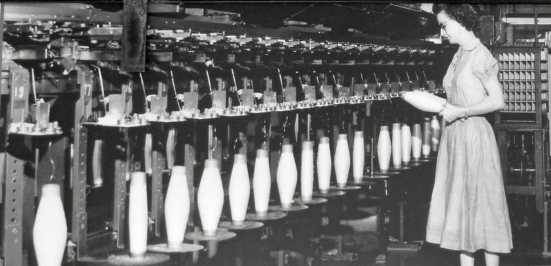
Courtesy Robin Lattimore
3. Marker detail: Industrial Revolution Photo
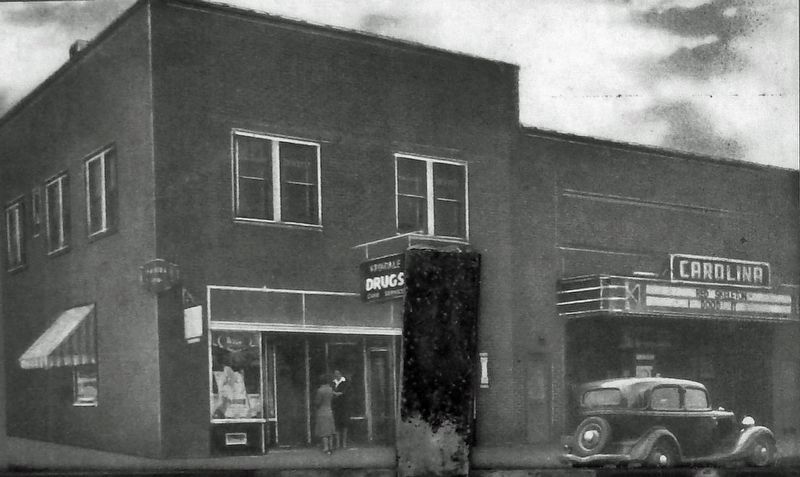
Courtesy Robin Lattimore
4. Marker detail: Spindale Drug Company

Courtesy Zach Byers
5. Marker detail: Aerial View of Spindale

Photographed by Cosmos Mariner, April 23, 2022
6. Spindale Visitor Information Kiosk
The marker is mounted on this kiosk alongside the Thermal Belt Rail Trail.

Photographed by Cosmos Mariner, April 23, 2022
7. Spindale Visitor Information Kiosk
Visitor Information Sign
Installed by
Tyler Moore
Boy Scout Eagle Project ~ Fall 2012
Troop 125 ~ Forest City, NC
Credits. This page was last revised on December 3, 2024. It was originally submitted on December 3, 2024, by Cosmos Mariner of Cape Canaveral, Florida. This page has been viewed 396 times since then and 45 times this year. Photos: 1, 2, 3, 4, 5, 6, 7. submitted on December 3, 2024, by Cosmos Mariner of Cape Canaveral, Florida.
