Bahnhofstrasse in Zürich, Switzerland — Central Europe (the Alps)
Münsterhof 13
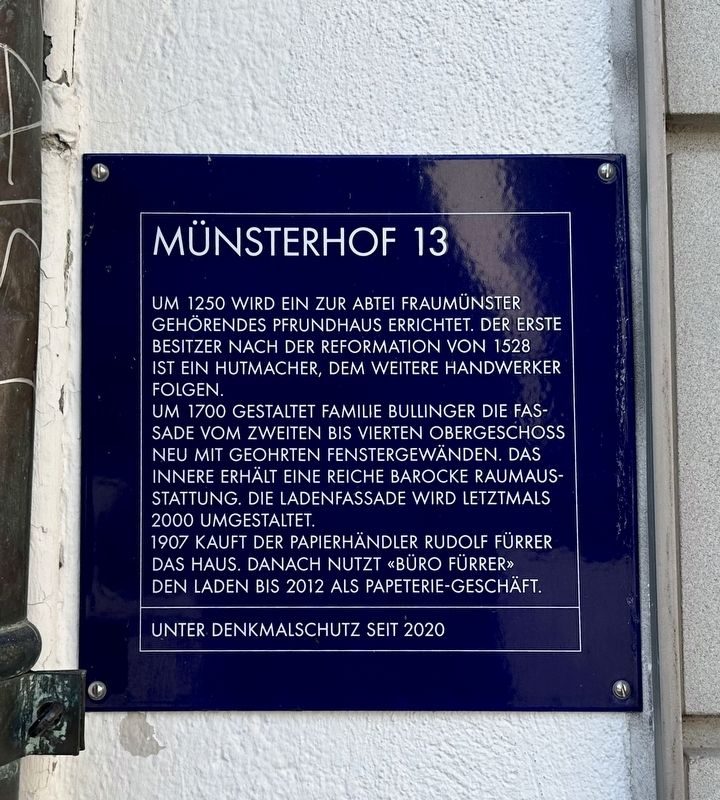
Photographed by Andrew Ruppenstein, August 16, 2024
1. Münsterhof 13 Marker

Um 1700 gestaltet Familie Bullinger die Fassade vom zweiten bis vierten Obergeschoss neu mit geohrten Fenstergewänden. Das Innere erhält eine reiche barocke Raumausstattung. Die Ladenfassade wird letztmals 2000 umgestaltet. 1907 kauft der Papierhändler Rudolf Fürrer das Haus. Danach nutzt «Büro Fürrer» den Laden bis 2012 als Papeterie-Geschäft.
Unter Denkmalschutz seit 2020
(English translation:)
Around 1250, a benefice belonging to the Fraumünster Abbey was built. The first owner after the Reformation in 1528 was a hatter, followed by other craftsmen.
Around 1700, the Bullinger family redesigned the facade from the second to the fourth floor with pierced window surrounds. The interior received a rich baroque interior. The shop facade was redesigned for the last time in 2000. In 1907, the paper merchant Rudolf Fürrer bought the house. Afterwards, "Büro Fürrer" used the shop as a stationery shop until 2012.
Listed as a historical
this page online
Topics and series. This historical marker is listed in these topic lists: Architecture • Industry & Commerce. In addition, it is included in the Zurich Blue Square series list. A significant historical year for this entry is 1250.
Location. 47° 22.215′ N, 8° 32.45′ E. Marker is in Zürich. It is in Bahnhofstrasse. It is on Münsterhof, on the left when traveling east. Touch for map. Marker is at or near this postal address: Münsterhof 13, Zürich 8001, Switzerland. Touch for directions.

Regionally, it is in Europe, Central Europe, the Schengen Area, Western Europe, and the Western World. Historically, it finds itself in what was once the Roman Empire and specifically also the Holy Roman Empire.
Other nearby markers. At least 8 other markers are within walking distance of this marker: Zur Farb (here, next to this marker); Kämbel (within shouting distance of this marker); Zum Sikust (within shouting distance of this marker); Schäniserhaus (within shouting distance of this marker); Zum Tor (within shouting distance of this marker); Zur Grossen Sonne (about 90 meters away, measured in a direct line); Zur Kleinen Bibel

Photographed by Andrew Ruppenstein, August 16, 2024
2. Münsterhof 13 Marker - wide view
The Münsterhof 13 building is the one in the middle.

Photographed by J. Bodmer / Johann Ulrich Burri / Orell Füssli SA, 1824
3. View of Münsterhof
Münsterhof 13 is the building on the very right with the lone horse and rider in front of it.
Credits. This page was last revised on December 4, 2024. It was originally submitted on December 4, 2024, by Andrew Ruppenstein of Lamorinda, California. This page has been viewed 140 times since then and 20 times this year. Photos: 1, 2, 3. submitted on December 4, 2024, by Andrew Ruppenstein of Lamorinda, California.
