Wakeman in Huron County, Ohio — The American Midwest (Great Lakes)
Wakeman Bridge
Photographed by Craig Doda, November 24, 2024
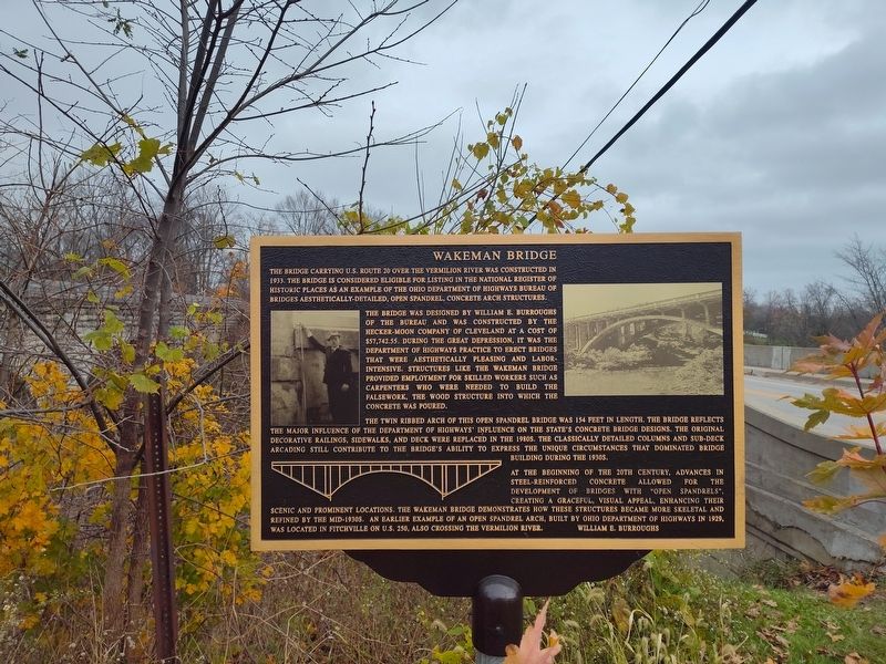
1. Wakeman Bridge Marker
The bridge was designed by William E. Burroughs of the bureau and was constructed by the Hecker-Moon Company of Cleveland at a cost of $57,742.55. During the Great Depression, it was the Department of Highways practice to erect bridges that were aesthetically pleasing and labor-intensive. Structures like the Wakeman Bridge provided employment for skilled workers such as carpenters who were needed to build the falsework, the wood structure into which the concrete was poured.
The twin ribbed arch of this open spandrel bridge was 154 feet in length. The bridge reflects the major influence of the Department of Highways' influence on the state's concrete bridge designs. The original decorative railings, sidewalks, and deck were replaced in the 1980s. The classically detailed columns and sub-deck arcading still contribute to
this page online
At the beginning of the 20th century, advances in steel-reinforced concrete allowed for the development of bridges with "open spandrels", creating a graceful, visual appeal, enhancing their scenic and prominent locations. The Wakeman Bridge demonstrates how these structures became more skeletal and refined by the mid-1930s. an earlier example of an open spandrel arch, built by Ohio Department of Highways in 1929, was located in Fitchville on U.S. 250, also crossing the Vermilion River.
Topics. This historical marker is listed in this topic list: Bridges & Viaducts. A significant historical year for this entry is 1933.
Location. 41° 15.285′ N, 82° 23.979′ W. Marker is in Wakeman, Ohio, in Huron County. It is on South Railroad Street north of East Main Street (U.S. 20), on the right when traveling north. Touch for map. Marker is in this post office area: Wakeman OH 44889, United States of America. Touch for directions.

Regionally, this marker is in the Western Reserve. It is also in the American Midwest and in the Corn Belt.

Photographed by Craig Doda, November 24, 2024
2. Wakeman Bridge Marker
Other nearby markers. At least 8 other markers are within walking distance of this marker: You Are On The Buckeye Trail (within shouting distance of this marker); Civil War Soldiers Memorial (about 300 feet away, measured in a direct line); Wakeman Red Cap Field (about 300 feet away); Garrett Augustus Morgan (1877-1963) / Garrett Morgan's Wakeman Country Club (about 400 feet away); World War I Memorial (about 500 feet away); Mill Stone (about 600 feet away); The former Wakeman School site (approx. 0.2 miles away); Veterans Memorial (approx. 0.2 miles away). Touch for a list and map of all markers in Wakeman.

Photographed by Craig Doda, November 24, 2024
3. Wakeman Bridge
Credits. This page was last revised on December 7, 2024. It was originally submitted on December 5, 2024, by Craig Doda of Napoleon, Ohio. This page has been viewed 465 times since then and 60 times this year. Photos: 1, 2, 3. submitted on December 5, 2024, by Craig Doda of Napoleon, Ohio. • Andrew Ruppenstein was the editor who published this page.
