Colonia in Middlesex County, New Jersey — The American Northeast (Mid-Atlantic)
Westfield Airport
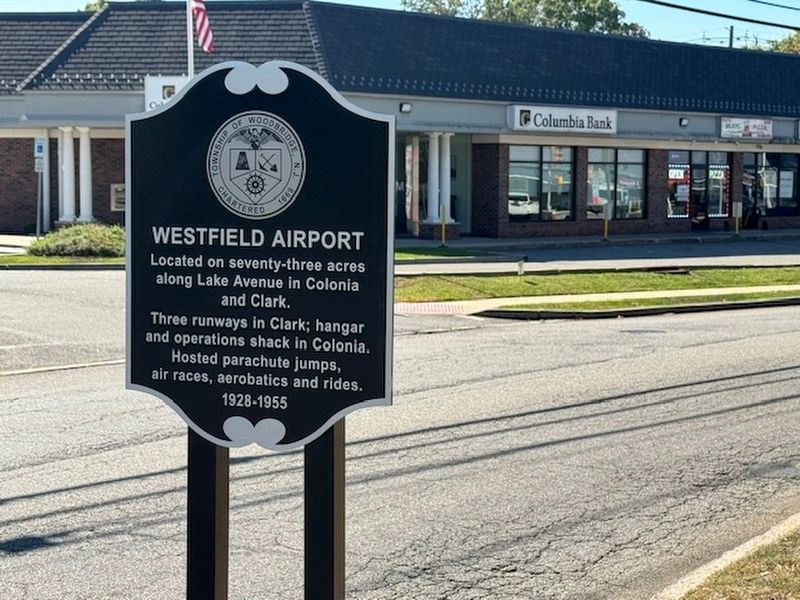
Photographed by John A. Lande
1. Westfield Airport Marker
Located on seventy-three acres
along Lake Avenue in Colonia
and Clark.
Three runways in Clark; hangar
and operations shack in Colonia.
Hosted parachute jumps,
air races, aerobatics and rides.
1928-1955
Topics. This historical marker is listed in these topic lists: Air & Space • Entertainment.
Location. 40° 36.373′ N, 74° 19.326′ W. Marker is in Colonia, New Jersey, in Middlesex County. It is at the intersection of Lake Avenue and Jupitor Street, on the right when traveling west on Lake Avenue. Touch for map. Marker is in this post office area: Colonia NJ 07067, United States of America. Touch for directions.

Regionally, this marker is in Central Jersey, in Greater Princeton, and in the New York City Metropolitan Area. It is also in the American Northeast, in the Mid-Atlantic, and on the Eastern Seaboard. Globally, it is in the North Atlantic Region, North America, the Western Hemisphere, the Western World, and the Anglosphere. Historically, it finds itself in what was once New Netherland and also one of the original Thirteen
this page online
Other nearby markers. At least 8 other markers are within 2 miles of this marker, measured as the crow flies: Homestead Farm at Oak Ridge (approx. 1.3 miles away); Colonia Inn (approx. 1.4 miles away); U.S. General Hospital No. 3 (approx. 1.4 miles away); 365 New Dover Road (approx. 1.4 miles away); The Trees (approx. 1.4 miles away); Kinnekort (approx. 1½ miles away); Devonshire (approx. 1½ miles away); Bridesmaid House (approx. 1½ miles away). Touch for a list and map of all markers in Colonia.
Also see . . . The Lost Westfield Airport In Union County - Mr. Local History Project. (Submitted on December 11, 2024, by Michael Herrick of Southbury, Connecticut.)
Credits. This page was last revised on December 11, 2024. It was originally submitted on December 6, 2024, by John A. Lande of Woodbridge, New Jersey. This page has been viewed 432 times since then and 126 times this year. Photo 1. submitted on December 6, 2024, by John A. Lande of Woodbridge, New Jersey. • Michael Herrick was the editor who published this page.
