Rothenburg ob der Tauber in Ansbach, Bavaria, Germany — Central Europe
Rabbi-Meir-Gärtchen und „Judentanzhaus"
⎯⎯⎯
Rabbi-Meir-Garden and the Former Jewish Community Hall
Photographed by James Hulse, October 4, 2024
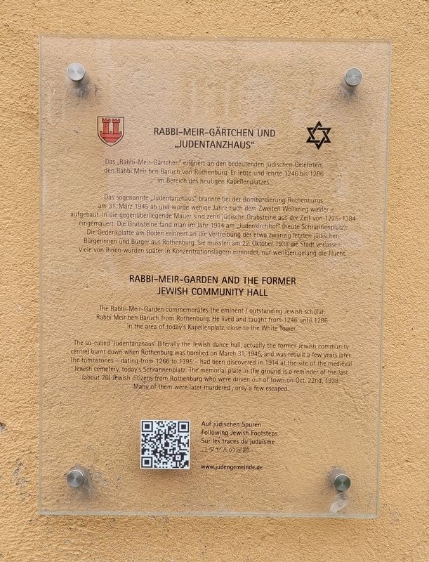
1. Rabbi-Meir-Gärtchen und „Judentanzhaus" / Rabbi-Meir-Garden and the Former Jewish Community Hall Mar

Das „Rabbi-Meir-Gärtchen" erinnert an den bedeutenden jüdischen Gelehrten, den Rabbi Meir ben Baruch von Rothenburg. Er lebte und lehrte 1246 bis 1286 im Bereich des heutigen Kapellenplatzes.
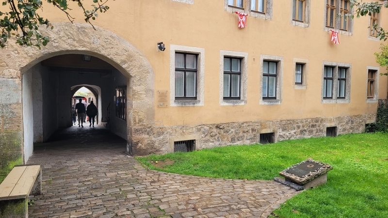
Das sogenannte „Judentanzhaus" brannte bei der Bombardierung Rothenburgs am 31. März 1945 ab und wurde wenige Jahre nach dem Zweiten Weltkrieg wieder aufgebaut. In die gegenüberliegende Mauer sind zehn jüdische Grabsteine aus der Zeit von 1275-1384 eingemauert. Die Grabsteine fand man im Jahr 1914 am Judenkirchhof" (heute Schrannenplatz). Die Gedenkplatte am Boden erinnert an die Vertreibung der etwa zwanzig letzten jüdischen Bürgerinnen und Bürger aus Rothenburg. Sie mussten am 22. Oktober 1938 die Stadt verlassen. Viele von ihnen wurden später in Konzentrationslagern ermordet, nur wenigen gelang die Flucht.
The Rabbi-Meir-Garden commemorates the eminent / outstanding Jewish scholar, Rabbi Meir ben Baruch from Rothenburg. He lived and taught from 1246 until 1286 in the area of today's Kapellenplatz, close to the White Tower.
The so-called 'Judentanzhaus' (literally the Jewish dance hall, actually
this page online
Erected by Following Jewish Footprints and City of Rothenburg ob der Tauber.
Topics. This historical marker is listed in this topic list: War, World II. A significant historical date for this entry is March 31, 1945.
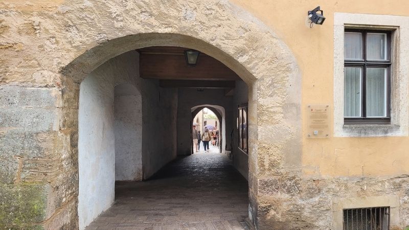
Location. 49° 22.699′ N, 10° 10.82′ E. Marker is in Rothenburg ob der Tauber, Bayern (Bavaria), in Ansbach. It is at the intersection of Georgengasse and Judengasse, on the right when traveling west on Georgengasse. The marker is located at the right side of the hallway entrance. Touch for map. Marker is at or near this postal address: Georgengasse 17, Rothenburg ob der Tauber BY 91541, Germany. Touch for directions.

Regionally, this marker is in German Franconia
Photographed by James Hulse, October 4, 2024
2. Rabbi-Meir-Garden and the Former Jewish Community Hall Marker
Other nearby markers. At least 8 other markers are within walking distance of this marker: Zum Gedenken an Unsere / In Memory of our Jewish Fellow Citizens (a few steps from this marker); Rabbi Meir ben Baruch von Rothenburg (within shouting distance of this marker); Jews's Alley and Jewish Quarter (about 120 meters away, measured in a direct line); St.-Michaels-Kapelle Rothenburg ob der Tauber / St Michaels Chapel (about 120 meters away); Ratstrinkstube / Council Pub (about 120 meters away); Schrannenscheune / Grain Storage Barn (about 120 meters away); Büttelhaus / Bailiff's House (about 150 meters away); Granary / Jewish Cemetery (about 150 meters away). Touch for a list and map of all markers in Rothenburg ob der Tauber.
Also see . . . Judentanzhaus. Following Jewish footsteps through medieval Rothenburg
In medieval times the so called Judenherberge,(Submitted on December 8, 2024, by James Hulse of Medina, Texas.)a kind of Jewish community centre, was located on the site of today's Judentanzhaus, which was rebuilt in the 1950s. In the small garden in front of this building a commemorative plaque acts as a reminder of the displacement and killing of Rothenburg's Jewish community by the National Socialists in the years around 1940.Photographed by James Hulse, October 4, 20243. Rabbi-Meir-Garden and the Former Jewish Community Hall MarkerThe view of the marker along the pathway
Credits. This page was last revised on December 8, 2024. It was originally submitted on December 6, 2024, by James Hulse of Medina, Texas. This page has been viewed 134 times since then and 17 times this year. Photos: 1, 2, 3. submitted on December 7, 2024, by James Hulse of Medina, Texas.
