Rothenburg ob der Tauber in Ansbach, Bavaria, Germany — Central Europe
Reichsburg Rothenburg ob der Tauber
⎯⎯⎯
Imperial Castle of Rothenburg ob der Tauber
Photographed by James Hulse, October 4, 2024
1. Reichsburg Rothenburg ob der Tauber / Imperial Castle of Rothenburg ob der Tauber Marker

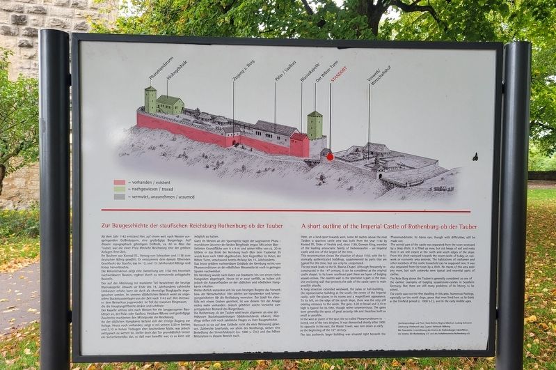
Zur Baugeschichte der staufischen Reichsburg Rothenburg ob der Tauber
Ab dem Jahr 1142 entstand hier, auf einem weit nach Westen vorspringenden Geländesporn, eine großzügige Burganlage. Auf diesem topographisch günstigem Gelände, ca. 60 m über der Tauber, war die einer Pfalz ähnliche Reichsburg eine der größten Anlagen ihrer Zeit.
Ihr Bauherr war Konrad 111., Herzog von Schwaben und 1138 zum deutschen König gewählt. Er entstammte dem damals führenden Geschlecht der Staufer, das im 12. und 13. Jahrhundert Könige und Kaiser hervorbrachte.
Die Rekonstruktion zeigt eine Darstellung um 1150 mit historisch nachweisbaren Bauten, ergänzt durch zu vermutende zeittypische Bauteile.
Der auf der Abbildung rot markierte Teil bezeichnet die heutige Blasiuskapelle. Obwohl sie Ende des 14. Jahrhunderts zahlreiche Umbauten erfuhr, kann sie doch als ehemalige Burgkapelle angesprochen werden. Im unteren südöstlichen Bereich weist sie ungestörte Buckelquaderlagen aus der Zeit nach 1142 auf. Ihre Ostmauer dem Betrachter zugewendet ist Teil der massiven Ringmauer, die die Hauptangriffsseite deckte und schützte.
Der
this page online
An der südlichen Hangkante befand sich der einzige Zugang zur Anlage. Heute noch vorhanden, zeigt er mit seinem 2,20 m breiten und 3,10 m hohen Torbogen eher bescheidene Maße, was jedoch zeittypisch zu werten ist. Stellte doch das Tor grundsätzlich immer ein Sicherheitsrisiko dar, so daß man bemüht war, es so klein wie möglich zu halten.
Ganz im Westen an der Spornspitze ragte der sogenannte Phara - mundsturm als einer der beiden Bergfriede empor. Mit seiner über - lieferten Grundfläche von 9 x 9 m und seiner Höhe von ca. 20 m bildete er das Ende der Kernburg hoch über dem Taubertal. Er wurde kurz nach 1800 abgebrochen. Sein Gegenüber im Osten, der Wüste Turm, verschwand bereits Anfang des 15. Jahrhunderts.
Das letzte größere nachweisbare Gebäude der Kernburg rechts vom Pharamundsturm an der nördlichen Mauerseite ist noch in geringen Spuren nachweisbar.
Die Kernburg wurde nach Osten zur Stadtseite hin von einem tiefen Halsgraben abgeriegelt. Heute
Photographed by James Hulse, October 4, 2024
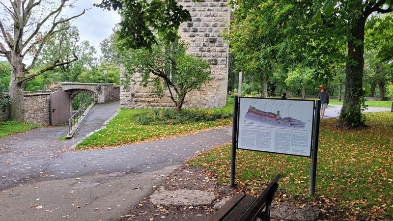
2. The marker located in front of the chapel
Weiter Östlich erstreckte sich bis zum heutigen Burgtor das Vorwerk bzw. der Wirtschaftshof. Hier dürfen wir Handwerker und Versorgungseinheiten für die Reichsburg vermuten. Zur Stadt hin ebenfalls mit einem Graben gesichert, ist von diesem Teil der Anlage nichts mehr vorhanden. Jedoch gehörten solche Vorwerke zum zeittypischen Bestand des Burgenbaus.
Die Rothenburg ob der Tauber wird heute allgemein als eine der frühesten Buckelquaderburgen Süddeutschlands erkannt. Allerdings stellen sich noch zahlreiche Fragen zu ihrer Baugeschichte.
Dennoch ist sie auf dem Gelände nicht die erste Bebauung gewesen. Zahlreiche Lesefunde, vor allem des Nordhangs, weisen eine Besiedlung der Urnenfelderzeit (ca. 1000 v. Chr.) und des frühen Mittelalters in diesem Bereich nach.
Quellengrundlage und Text: Horst Brehm, Regina Däschner, Ludwig Schnurrer Zeichnung: Ferdinand Leya, Layout: Hellmuth Möhring Mit finanzieller Unterstatzung des Vereins der Rothenburger Gästeführer, des Vereins Alt-Rothenburg e.V. und des Verkehrsvereins Rothenburg e.V.
A short outline of the Imperial Castle of Rothenburg ob der Tauber
Here,

Photographed by James Hulse, October 4, 2024
3. The view of the east side of the chapel
This reconstruction shows the situation of about 1150, with the historically authenticated buildings, supplemented by parts that are typical for this time, but can only be conjectured.
The red mark leads to the St. Blasius Chapel. Although frequently reconstructed in the 14th century, it can be considered as the original castle chapel. In its lower southeast part there are layers of bulging square-stones. The eastern wall to the spectator is part of the massive enclosing wall that protects the side of the castle open to main possible attacks.
A long structure extended westward, the palas or hall-building, the representative building at the south, the centre of the Imperial castle, with fire-places in its rooms and a magnificent appearance. To its left, on the edge of the south slope, there was the only still existing entrance to the castle. The gate, 2,20 m broad and 3,10 m high is typical for its time, though rather unpretentious. The gates were generally the spots of great security risk and therefore built as small as possible.
In the west at point of the spur, the so-called Pharamundsturm towered, one of the two donjons. It was dismantled shortly after 1800. Its opposite in the east, the Waste Tower, was torn down as early as the beginning of the 15th century.
The last authentic larger building was situated right beneath the Pharamundsturm; its traces can, though with difficulties, still be made out.
The central part of the castle was separated from the town westward by a deep ditch; it is filled up now, but
Photographed by James Hulse, October 4, 2024
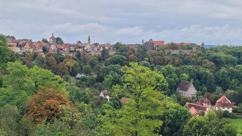
4. The view of the southern section of Rothenburg ob der Tauber from the marker
The Rote Burg above the Tauber is generally considered as one of the earliest examples of bulging squarestone-castles in Southern Germany. But there are still many problems of its history to be solved.
The castle was not the first dwelling in this area. Numerous findings, especially on the north slope, prove that men lived here as far back as the Urnfield period (c. 1000 b.C.), and in the early middle ages.
Source basis and text: Horst Brehm, Regina Däschner, Ludwig Schnurrer Illustration: Ferdinand Leya, Layout: Hellmuth Möhring With financial support from the Association of Rothenburg Tour Guides, the Alt-Rothenburg Association e.V., and the Rothenburg Tourist Association e.V.
Topics. This historical marker is listed in this topic list: Forts and Castles.
Location. 49° 22.577′ N, 10° 10.472′ E. Marker is in Rothenburg ob der Tauber, Bayern (Bavaria), in Ansbach. It is on Alte Burg. The marker is located in the old castle garden area. Touch for map. Marker is in this post office area: Rothenburg ob der Tauber BY 91541, Germany. Touch for directions.

Regionally, this marker is in German Franconia and on the Romantic Road. Globally, it is in Europe, the European Union, Atlantic Europe, Central Europe, the Schengen Area, Western Europe, and the Western World. Historically, it finds itself in what was once the Holy Roman Empire and also the former West Germany.
Other nearby markers. At least 8 other markers are within walking distance of this marker: Blasiuskapelle und Pogromstein / Blasius Chapel and Memorial Stone (within shouting distance of this marker); Burgtorturm / Castle Gate Tower (within shouting distance of this marker); Turm an der Fürbringerscheune / Tower at the Fürbringer Barn (about 90 meters away, measured in a direct line); Ehemaliger Jüdischer Betsaal / The Former Jewish Prayer Hall (about 120 meters away); König Ferdinand und Kaiser Karl V / King Ferdinand and Emperor Charles V (about 180 meters away); Pope Francis in Rothenburg ob der Tauber (about 180 meters away); Herrngasse 16 (about 180 meters away); Kaiser Friedrich III / Emperor Friedrich III (about 180 meters away). Touch for a list and map of all markers in Rothenburg ob der Tauber.
Credits. This page was last revised on December 8, 2024. It was originally submitted on December 7, 2024, by James Hulse of Medina, Texas. This page has been viewed 97 times since then and 14 times this year. Photos: 1, 2, 3, 4. submitted on December 8, 2024, by James Hulse of Medina, Texas.
