Burlington in Halton Region, Ontario — Central Canada (North America)
The Pumphouse
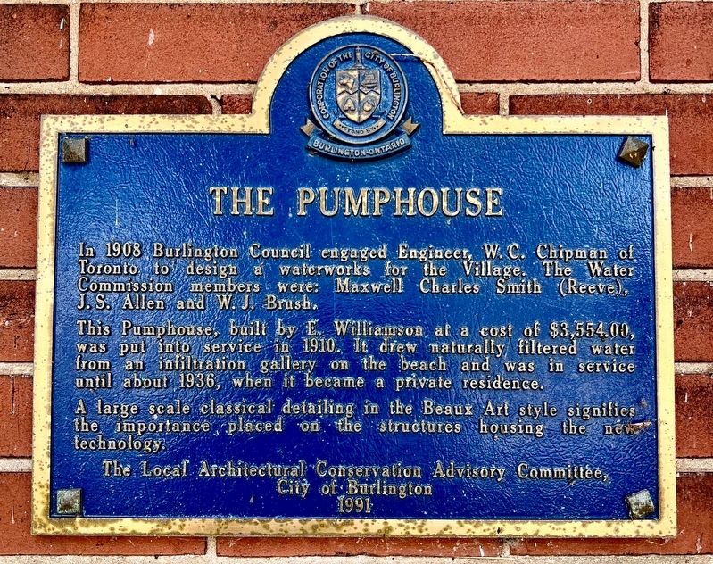
Photographed by Tim Boyd, December 9, 2024
1. The Pumphouse Marker
This Pumpbouse, built by E. Williamson at a cost of $3,554.00, was put into service in 1910. It drew naturally filtered water from an infiltration gallery on the beach and was in service until about 1936, when it became a private residence.
A large scale classical detailing in the Beaux Art style signifies the importance, placed on the structures housing the new technology.
Erected 1991 by The Local Architectural Conservation Advisory Committee, City of Burlington.
Topics. This historical marker is listed in these topic lists: Architecture • Notable Buildings. A significant historical year for this entry is 1908.
Location. 43° 18.553′ N, 79° 48.01′ W. Marker is in Burlington, Ontario, in Halton Region. It is on Waterfront Trail 1.1 kilometers south of North Shore Boulevard East, on the right when traveling north. Touch for map. Marker is at or near this postal address: 1094 Lakeshore Road, Burlington ON
this page online

Regionally, this marker is in Greater Toronto, specifically on the Golden Horseshoe, in the Hamilton-Halton-Brant Area, and specifically in the Toronto Metropolitan Area. It is also in Central Canada. Globally, it is in North America, on the Great Lakes, in the Western Hemisphere, in the Western World, and in the Anglosphere. Historically, it finds itself in what was once a British colony, the Viceroyalty of New France, the Haudenosaunee (Iroquois) Confederacy, and Rupert’s Land.
Other nearby markers. At least 8 other markers are within walking distance of this marker: Joseph Brant Hospital (approx. one kilometer away); Beach Strip (approx. one kilometer away); Brant Street Pier (approx. one kilometer away); The Brant House (approx. 1.1 kilometers away); Victory at Burlington Bay (approx. 1.1 kilometers away); The Brant Inn (approx. 1.1 kilometers away); Terry Fox Marathon of Hope (approx. 1.2 kilometers away); a different marker also named The Brant Inn (approx. 1.2 kilometers away). Touch for a list and map of all markers in Burlington.
Also see . . . The Burlington Pumphouse.
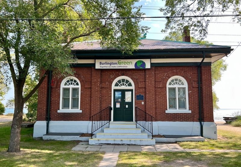
Photographed by Tim Boyd, September 23, 2023
2. The Pumphouse Marker
On June 14, 1909, Reeve Maxwell Smith turned the first sod and the Burlington Pump House began its illustrious history. E. Williamson was chosen to build the structure at a cost of $3,554.00. Smart Turner Co. supplied and installed the electrically operated pumping machinery at a cost of $5000.00. The pump well was the final addition to the building at a cost of $1,943.00. The Burlington Pump House was put into commission in March of 1910 and served the citizens of Burlington dutifully until 1936, a year after Burlington's first water filtration plant was built.(Submitted on December 9, 2024, by Tim Boyd of Hamilton, Ontario.)
Credits. This page was last revised on December 21, 2024. It was originally submitted on December 9, 2024, by Tim Boyd of Hamilton, Ontario. This page has been viewed 173 times since then and 22 times this year. Photos: 1, 2. submitted on December 9, 2024, by Tim Boyd of Hamilton, Ontario. • Andrew Ruppenstein was the editor who published this page.
