Brighton in Northumberland County, Ontario — Central Canada (North America)
Brighton Public School
Photographed by William Fischer, Jr., December 5, 2024
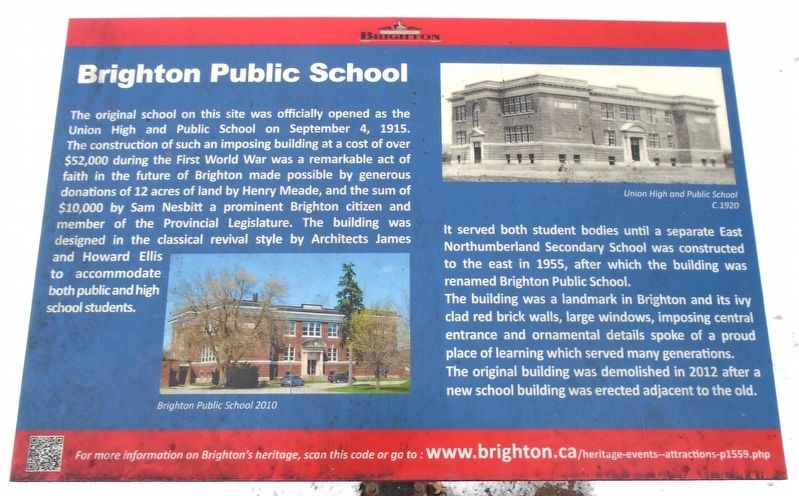
1. Brighton Public School Marker
The original school on this site was officially opened as the Union High and Public School on September 4, 1915. The construction of such an imposing building at a cost of over $52,000 during the First World War was a remarkable act of faith in the future of Brighton made possible by generous donations of 12 acres of land by Henry Meade, and the sum of $10,000 by Sam Nesbitt a prominent Brighton citizen and member of the Provincial Legislature. The building was designed in the classical revival style by Architects James and Howard Ellis to accommodate both public and high school students.
It served both student bodies until a separate East Northumberland Secondary School was constructed to the east in 1955, after which the building was renamed Brighton Public School.
The building was a landmark in Brighton and its ivy clad red brick walls, large windows, imposing central entrance and ornamental details spoke of a proud place of learning which served many generations. The original building was demolished in 2012 after a new school building was erected adjacent to the old.
[Photo captions, top to bottom, read]
• Union High and Public School C.1920
• Brighton Public School 2010
Erected by the
this page online
Topics. This historical marker is listed in these topic lists: Charity & Public Work • Education. A significant historical date for this entry is September 4, 1915.
Location. 44° 2.551′ N, 77° 44.013′ W. Marker is in Brighton, Ontario, in Northumberland County. It is on Elizabeth Street (Provincial Highway 2) just west of Terry Fox Drive/Pinnacle Street South, on the right when traveling west. Touch for map. Marker is at or near this postal address: 24 Elizabeth Street, Brighton ON K0K 1H0, Canada. Touch for directions.

Regionally, this marker is in the Kawarthas Northumberland Area and in Eastern Ontario. It is also in Central Canada. Globally, it is in North America, on the Great Lakes, in the Western Hemisphere, in the Western World, and in the Anglosphere. Historically, it finds itself in what was once a British colony, the Viceroyalty of New France, the Haudenosaunee (Iroquois) Confederacy, and Rupert’s Land.
Other nearby markers. At least 8 other markers are within 3 kilometers of this marker, measured as the crow flies: Brighton District Pioneers and Farmers (about 150 meters away, measured

Photographed by William Fischer, Jr., December 5, 2024
2. Brighton Public School Marker and Date Stone
Also see . . . Brighton Digital Archives. (Submitted on December 9, 2024, by William Fischer, Jr. of Reynoldsburg, Ohio.)

Photographed by William Fischer, Jr., December 5, 2024
3. Brighton Public School Date Stone
Credits. This page was last revised on December 9, 2024. It was originally submitted on December 9, 2024, by William Fischer, Jr. of Reynoldsburg, Ohio. This page has been viewed 132 times since then and 16 times this year. Photos: 1, 2, 3. submitted on December 9, 2024, by William Fischer, Jr. of Reynoldsburg, Ohio.
