Rothenburg ob der Tauber in Ansbach, Bavaria, Germany — Central Europe
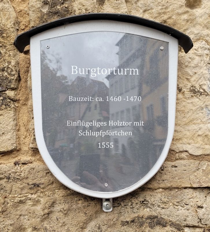
Burgtorturm
⎯⎯⎯
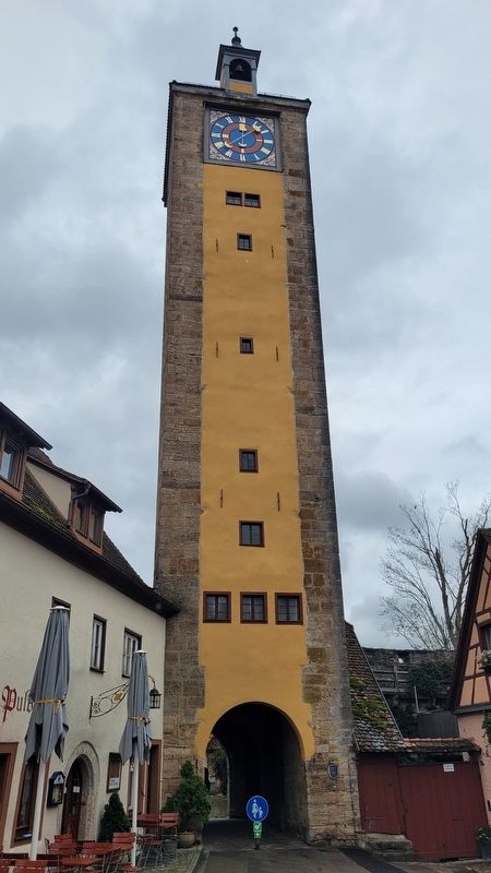
Castle Gate Tower
Photographed by James Hulse, October 4, 2024
1. Burgtorturm / Castle Gate Tower Marker

Bauzeit: ca. 1460-1470
Einflügeliges Holztor mit Schlupfpförtchen 1555
Construction period: approx. 1460-1470
Single-leaf wooden door with a small wicket gate 1555
Topics. This historical marker is listed in this topic list: Forts and Castles. A significant historical year for this entry is 1555.
Location. 49° 22.605′ N, 10° 10.501′ E. Marker is in Rothenburg ob der Tauber, Bayern (Bavaria), in Ansbach. It is at the intersection of Herrngasse and Burggasse on Herrngasse. The marker is located at the base of the tower. Touch for map. Marker is at or near this postal address: Herrngasse 38A, Rothenburg ob der Tauber BY 91541, Germany. Touch for directions.

Regionally, this marker is in German Franconia and on the Romantic Road. Globally, it is in Europe, the European Union, Atlantic Europe, Central Europe, the Schengen Area, Western Europe, and the Western World. Historically, it finds itself in what was once the Holy Roman Empire and also the former West Germany.
Other nearby markers. At least 8 other markers are within walking distance of this marker: Reichsburg Rothenburg ob der Tauber / Imperial Castle of Rothenburg ob der Tauber
this page online
Also see . . . castle gate - Following Jewish footsteps through medieval Rothenburg.
One of the fateful places for the early Jewish community is the former castle gate, the entrance to the imperial castle, the origin of the city. The Jewish community sought safety under this gate in 1298 when they had to flee from incited Rothenburg residents because they had allegedly committed desecration of the host. The Jews could no(Submitted on December 9, 2024, by James Hulse of Medina, Texas.)longer find safety. So the entire Jewish community, around 400 to 500 people of all ages, were killed in the castle. It was the first pogrom in the history of Rothenburg, which also went down in history in other places in southern Germany as the "Rintfleischpogrom", named after the knight of the same name from the town of Röttingen in the Tauber valley.Photographed by James Hulse, October 4, 20242. Burgtorturm / Castle Gate Tower Marker

Photographed by James Hulse, October 4, 2024
3. The view of the Castle Gate Tower from the street
Credits. This page was last revised on December 10, 2024. It was originally submitted on December 9, 2024, by James Hulse of Medina, Texas. This page has been viewed 106 times since then and 13 times this year. Photos: 1, 2, 3. submitted on December 10, 2024, by James Hulse of Medina, Texas.
