Watertown in Codington County, South Dakota — The American Midwest (Upper Plains)
North End Neighborhood
November 10, 2024
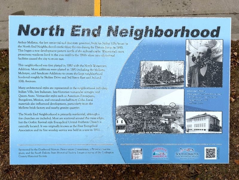
1. North End Neighborhood Marker
This neighborhood was first platted in 1880 with the North Watertown Addition. More additions were platted in 1883 including the Mellette, McIntyre, and Syndicate Additions to create the large neighborhood bordered roughly by Skyline Drive and 3rd Street East and 3rd and 10th Avenues.
Many architectural styles are represented in the neighborhood including Italian Villa, late Italianate, late-Victorian vernacular cottages, and Queen Anne. Vernacular styles such as American Foursquare, Bungalows, Mission, and one-and-one-half-story Cube. Local materials also influenced development, particularly from the Mellette brick factory and nearby granite quarries.
The North End Neighborhood is primarily residential, although a few churches are included.
this page online
1. Governor Mellette.
2. Evangelical United Brethren Church.
3. Birdseye view of the North End Neighborhood, 1915.
4. Mellette School.
Erected by the Deadwood Historic Preservation Commission, a Preserve America grant, and the South Dakota State Historical Society. Images courtesy of the Codington County Historical Society.
Topics. This historical marker is listed in these topic lists: Architecture • Religion & Religious Structures. A significant historical year for this entry is 1880.
Location. 44° 54.568′ N, 97° 7.095′ W. Marker is in Watertown, South Dakota, in Codington County. It is on 7th Avenue Northwest east of 3rd Street Northwest, on the right when traveling west. Touch for map. Marker is in this post office area: Watertown SD 57201, United States of America. Touch for directions.

Regionally, this marker is in East River. It is also in the American Midwest, in

November 10, 2024
2. North End Neighborhood Marker, from the east
Other nearby markers. At least 8 other markers are within walking distance of this marker: Mellette Hill (approx. 0.2 miles away); Mellette House (approx. ¼ mile away); Arthur Calvin Mellette (approx. ¼ mile away); Fire and Rescue (approx. half a mile away); Old M. & St. L. Depot Museum (approx. half a mile away); Minneapolis and St. Louis Depot (approx. half a mile away); Rail & Industrial Center (approx. half a mile away); John M. Mahowald Harness Store (approx. 0.6 miles away). Touch for a list and map of all markers in Watertown.

November 10, 2024
3. North End Neighborhood Marker, north of Mellette School
Credits. This page was last revised on December 10, 2024. It was originally submitted on December 10, 2024. This page has been viewed 122 times since then and 14 times this year. Photos: 1, 2, 3. submitted on December 10, 2024.
