Red Rock in Thunder Bay District, Ontario — Central Canada (North America)
CPR Station
Photographed by Cosmos Mariner, June 14, 2024
1. CPR Station Marker
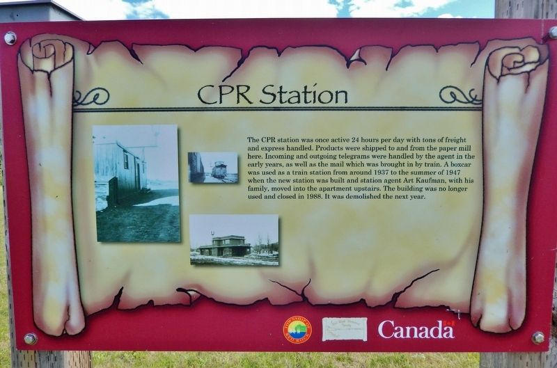
The CPR station was once active 24 hours per day with tons of freight and express handled. Products were shipped to and from the paper mill here. Incoming and outgoing telegrams were handled by the agent in the early years, as well as the mail which was brought in by train. A boxcar was used as a train station from around 1937 to the summer of 1947 when the new station was built and station agent Art Kaufman, with his family, moved into the apartment upstairs. The building was no longer used and closed in 1988. It was demolished the next year.
Erected by Red Rock Historical Society.
Topics. This historical marker is listed in these topic lists: Architecture • Industry & Commerce • Railroads & Streetcars. A significant historical year for this entry is 1937.
Location. 48° 56.809′ N, 88° 15.784′ W. Marker is in Red Rock, Ontario, in Thunder Bay District. It is on Provincial Highway 628 7.3 kilometers east of Trans-Canada Highway (Provincial Highway 11/17), on the right when traveling east. Touch for map. Marker is in this post office area: Red Rock ON P0T 2P0, Canada. Touch for directions.

Regionally,
this page online
Other nearby markers. At least 8 other markers are within 8 kilometers of this marker, measured as the crow flies: CNR Station (a few steps from this marker); Fish and Game Club (approx. 0.3 kilometers away); Marina & Pul-A-Log Park (approx. 0.4 kilometers away); The World Famous Nipigon River (approx. 0.4 kilometers away); The Town of Red Rock (approx. 0.4 kilometers away); Clearwater Creek (approx. 6.9 kilometers away); Turbine Runner (approx. 6.9 kilometers away); a different marker also named The World Famous Nipigon River (approx. 7 kilometers away). Touch for a list and map of all markers in Red Rock.
Related markers. Click here for a list of markers that are related
Photographed by Cosmos Mariner, June 14, 2024
2. CPR Station Marker
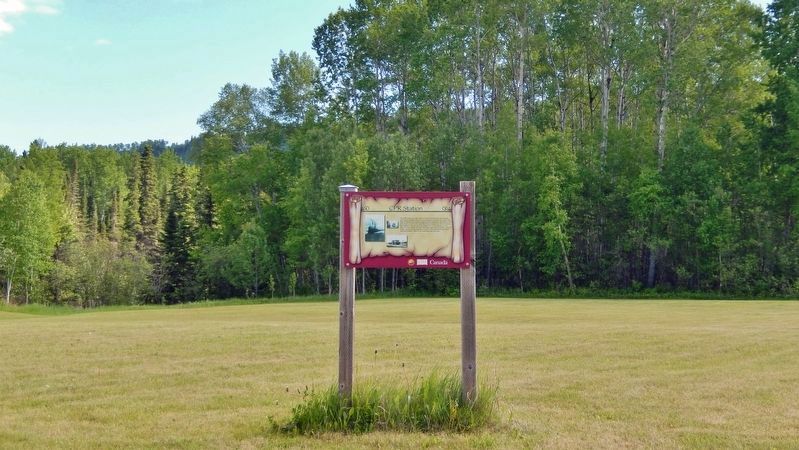
Looking south from Ontario Highway 628.
Also see . . .
1. Canadian Pacific Railway (Wikipedia).
Excerpt: The Canadian Pacific Railway, also known simply as CPR or Canadian Pacific and formerly as CP Rail, is a Canadian Class I railway incorporated in 1881. The CPR was Canada's first transcontinental railway. Primarily a freight railway, the CPR was for decades the only practical means of long-distance passenger transport in most regions of Canada and was instrumental in the colonization and development of Western Canada.(Submitted on December 10, 2024, by Cosmos Mariner of Cape Canaveral, Florida.)
2. Red Rock, Ontario (Wikipedia).
Excerpt: The Canadian Pacific Railway was built through the area in the 1880s. In 1937, construction began on a paper mill, along with a new town site for employee homes and bunkhouses. But the mill company went bankrupt in 1938, and the project was abandoned. In 1940, the mill site was bought by the Canadian Government, who converted the bunkhouses into a prisoner-of-war camp, known as Camp "R". In October 1941, all prisoners were transferred to other internment camps and the site was closed. In 1942, a new pulp and paper company bought the site and construction of a mill began again in 1944. On July 20, 1945, the community was incorporated as the Improvement District of Red Rock. That same year, the mill became operational. The town grew with new stores, a theatre, a public school, two railroad stations, and a church.(Submitted on December 10, 2024, by Cosmos Mariner of Cape Canaveral, Florida.)
Credits. This page was last revised on December 10, 2024. It was originally submitted on December 10, 2024, by Cosmos Mariner of Cape Canaveral, Florida. This page has been viewed 186 times since then and 43 times this year. Photos: 1, 2. submitted on December 10, 2024, by Cosmos Mariner of Cape Canaveral, Florida.
