Danville, Virginia — The American South (Mid-Atlantic)
Schoolfield Welfare Building
Photographed by C. Ryan Dodson, October 26, 2024
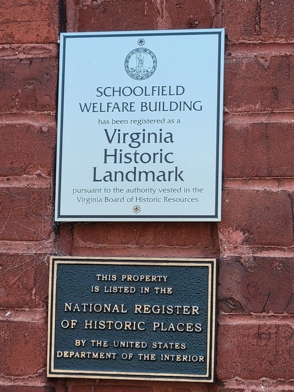
1. Schoolfield Welfare Building Marker
Welfare Building
has been registered as a
Virginia
Historic
Landmark
pursuant to the authority vested in the
Virginia Board of Historic Resources
This property
is listed in the
National Register
of Historic Places
by the United States
Department of the Interior
Erected 2010 by Virginia Board of Historic Resources, United States Department of the Interior.
Topics and series. This historical marker is listed in this topic list: Landmarks. In addition, it is included in the National Register of Historic Places (NRHP) series list. A significant historical year for this entry is 1917.
Location. 36° 34.157′ N, 79° 25.45′ W. Marker is in Danville, Virginia. It is at the intersection of West Main Street (Virginia Route 293) and Wood Avenue, on the right when traveling east on West Main Street. Touch for map. Marker is at or near this postal address: 917 West Main Street, Danville VA 24541, United States of America. Touch for directions.

Regionally, this marker is in Southside Virginia and specifically in Central Virginia. It is also in the American South and specifically in the Upper South.
this page online
Other nearby markers. At least 8 other markers are within walking distance of this marker: Schoolfield (within shouting distance of this marker); Schoolfield School (about 600 feet away, measured in a direct line); Site of the Schoolfield Recreation Center (about 600 feet away); Ballou Park History (approx. half a mile away); The Cousins-Tulloch House (approx. half a mile away); Flowering Dogwood (approx. 0.6 miles away); Basswood (approx. 0.7 miles away); Memorial Drive (approx. ¾ mile away). Touch for a list and map of all markers in Danville.

Photographed by C. Ryan Dodson, October 26, 2024
2. Schoolfield Welfare Building Marker
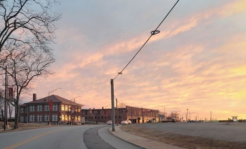
Photographed by C. Ryan Dodson, March 10, 2025
3. Schoolfield Welfare Building

Photographed by C. Ryan Dodson, October 26, 2024
4. Schoolfield Welfare Building
As seen from the nearby Schoolfield Historic Marker
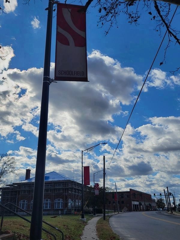
Photographed by C. Ryan Dodson, November 15, 2024
5. Schoolfield Welfare Building
Flanked by Schoolfield Historic District banners

Photographed by C. Ryan Dodson, October 26, 2024
6. Schoolfield Village Sign and log cabin

Photographed by C. Ryan Dodson, October 26, 2024
7. Log Cabin
The Schoolfield Welfare Building features a log cabin formerly used as a village kindergarten.

Photographed by C. Ryan Dodson, October 26, 2024
8. Schoolfield Welcome Sign
In front of the Schoolfield Welfare Building.
Credits. This page was last revised on September 10, 2025. It was originally submitted on December 10, 2024, by C. Ryan Dodson of Danville, Virginia. This page has been viewed 236 times since then and 26 times this year. Photos: 1, 2. submitted on December 10, 2024, by C. Ryan Dodson of Danville, Virginia. 3. submitted on September 4, 2025, by C. Ryan Dodson of Danville, Virginia. 4. submitted on December 10, 2024, by C. Ryan Dodson of Danville, Virginia. 5. submitted on December 18, 2024, by C. Ryan Dodson of Danville, Virginia. 6, 7, 8. submitted on December 10, 2024, by C. Ryan Dodson of Danville, Virginia. • Bernard Fisher was the editor who published this page.
