Red Rock in Thunder Bay District, Ontario — Central Canada (North America)
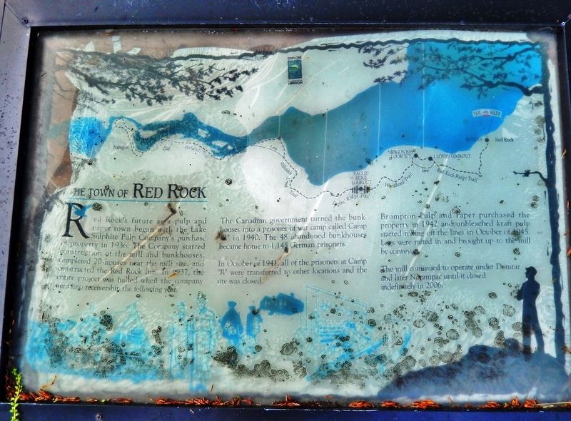
The Town of Red Rock
Photographed by Cosmos Mariner, June 14, 2024
1. The Town of Red Rock Marker
Red Rock’s future as a pulp and paper town began with the Lake Sulphite Pulp Company’s purchase of property in 1936. The Company started construction of the mill and bunkhouses, completed 20 houses near the mill site, and constructed the Red Rock Inn. In 1937, the entire project was halted when the company when into receivership the following year.
The Canadian government turned the bunkhouses into a prisoner of war camp called Camp “R” in 1940. The 48 abandoned bunkhouses became home to 1,145 German prisoners.
In October of 1941, all of the prisoners at Camp “R” were transferred to other locations and the site was closed.
Brompton Pulp and Paper purchased the property in 1942 and unbleached kraft pulp started rolling off the lines in October of 1945. Logs were rafted in and brought up to the mill by conveyor.
The mill continued to operate under Domtar and later Norampac until it closed indefinitely in 2006.
Topics. This historical marker is listed in these topic lists: Industry & Commerce • War, World II. A significant historical year for this entry is 1936.
Location. 48° 56.847′ N, 88° 15.464′ W. Marker is in Red Rock,
this page online

Regionally, this marker is in Northern Ontario and specifically in Northwest Ontario. It is also in Central Canada. Globally, it is in North America, in the Great North Woods, on the Great Lakes, on Lake Superior’s North Shore, in the Western Hemisphere, in the Western World, and in the Anglosphere. Historically, it finds itself in what was once a British colony, the Viceroyalty of New France, the Haudenosaunee (Iroquois) Confederacy, and Rupert’s Land.
Other nearby markers. At least 8 other markers are within 8 kilometers of this marker, measured as the crow flies: The World Famous Nipigon River (a few steps from this marker); Marina & Pul-A-Log Park (within shouting distance of this marker); Fish and Game Club (about 150 meters away, measured in a direct line); CNR Station (approx. 0.4 kilometers away); CPR Station (approx. 0.4 kilometers away);

Photographed by Cosmos Mariner, June 14, 2024
2. The Town of Red Rock Marker
Looking east; the north end of Nipigon Bay is in the background.
Also see . . .
1. Pulp Pioneers of Red Rock, 1936-1974.
(by L.M. (Buzz) Lein February 25, 1974) Excerpt: In 1936 a bleached kraft mill took shape and substance on the northwest shore of Nipigon Bay on Lake Superior. Closed down by financial problems before it could get rolling in 1938, it just sat there until the Brompton Pulp and Paper Company acquired the property in 1942 and started to turn out kraft paper on a converted newsprint machine some two years later. From its start-up early in 1944 and through 1951, the mill was producing about 250 tons of brown paper per day, six days a week. All the wood required was delivered in log form, nearly all by water during spring and summer. Some 130,000 cords of softwood were consumed yearly. The softwood was about 70% spruce and 30% jackpine.(Submitted on December 10, 2024, by Cosmos Mariner of Cape Canaveral, Florida.)
2. 'Notorious' PoW camp near Thunder Bay subject of book. CBC website entry (Submitted on December 25, 2025, by Larry Gertner of New York, New York.)
Credits. This page was last revised on December 25, 2025. It was originally submitted on December 10, 2024, by Cosmos Mariner of Cape Canaveral, Florida. This page has been viewed 207 times since then and 29 times this year. Photos: 1, 2. submitted on December 10, 2024, by Cosmos Mariner of Cape Canaveral, Florida.
