Marion Township near Findlay in Hancock County, Ohio — The American Midwest (Great Lakes)
Township Road 241 Bridge

Photographed by Joel Seewald, August 25, 2024
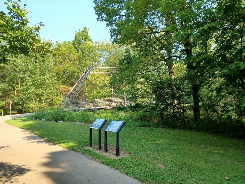
1. Township Road 241 Bridge Marker
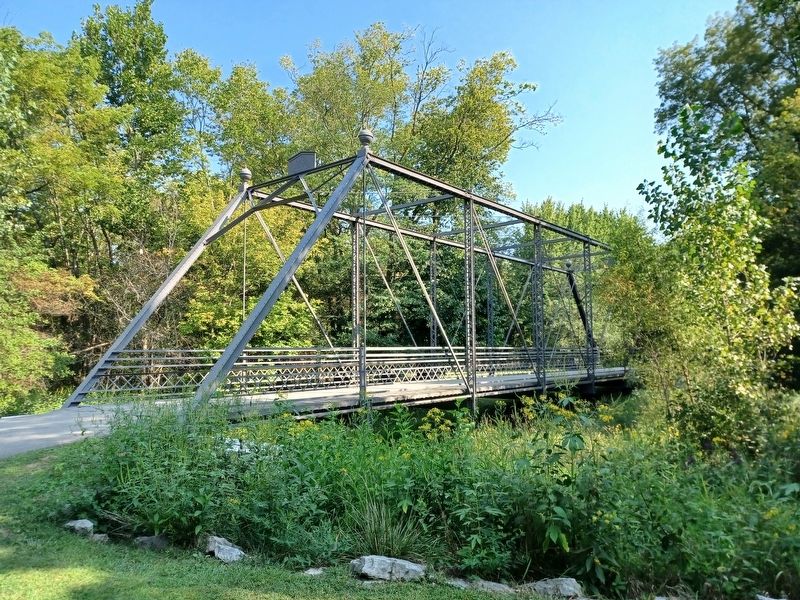
The Township Road 241 Bridge (TR 241 Bridge) is a wrought iron Pratt through-truss that spanned the Blanchard River for 114 years. It was originally located on Township Road 241, which now forms the western boundary of Riverbend Recreation Area. Cast iron plaques bolted to the top of two portals have the names of Hancock County Commissioners who purchased the bridge and the name of the company that built it in 1895.
The history of the TR 241 Bridge is not written in books and newspapers or seen in photographs. Its story is in the metal members that make up the bridge, wrought iron making process, and fabrication methods used in its construction.
In less than ten years after the bridge was erected, ninety percent of the highway bridges would be made of steel. A high degree of skill from many iron craftsmen was needed to produce wrought iron. It could not compete with steel that was mass produced at low cost.
Following the fabrication of the TR 241 Bridge, it was likely painted with a mixture of lead and oil and then shipped from Canton, Ohio by rail. At a rail siding in Findlay, the bridge would have been unloaded,
this page online
Those who watched the bridge being erected in 1895 recorded nothing of their impressions on that day. By 1895 the erection of an iron truss bridge was a common site across the country and the new iron truss bridge spanning the Blanchard River was seen as nothing more than an improvement to Township Road 241. To know the value of this wrought iron bridge is to carefully read the unwritten words the craftsmen left in building the TR 241 Bridge.
Source: Vern Mesler, Township Road 241 Bridge, 2008
Topics. This historical marker is listed in this topic list: Bridges & Viaducts. A significant historical year for this entry is 1895.
Location. 41° 2.018′ N, 83° 33.63′ W. Marker is near Findlay, Ohio, in Hancock County. It is in Marion Township. It can be reached from Township Road 208. Marker is in Riverbend Recreation Area along the north section of the Loop Trail, near the north parking lot. Touch for map. Marker is at or near this postal address: 16618 Township Road 208, Findlay OH 45840, United States of America. Touch for directions.

Regionally, this marker is in the Till Plains.
Photographed by Joel Seewald, August 25, 2024
2. Township Road 241 Bridge Marker
The Township Road 241 Bridge marker is the one on the right.
Other nearby markers. At least 8 other markers are within 2 miles of this marker, measured as the crow flies: Covered Bridge (here, next to this marker); Marion Township School District #3 (approx. 1.7 miles away); Liberty Tree (approx. 1.7 miles away); "Boom Town" (approx. 1.7 miles away); How Oil Saved Findlay (approx. 1.7 miles away); Hancock County & The Civil War (approx. 1.7 miles away); Riverside Park (approx. 1.7 miles away); Hancock County Underground Railroad (approx. 1.7 miles away). Touch for a list and map of all markers in Findlay.
Photographed by Joel Seewald, August 25, 2024
3. Township Road 241 Bridge
Credits. This page was last revised on December 11, 2024. It was originally submitted on December 11, 2024, by Joel Seewald of Madison Heights, Michigan. This page has been viewed 144 times since then and 24 times this year. Photos: 1, 2, 3. submitted on December 11, 2024, by Joel Seewald of Madison Heights, Michigan.
