Altstadt in Zürich, Switzerland — Central Europe (the Alps)
Münsterbrücke
⎯⎯⎯
Münster Bridge
Photographed by Andrew Ruppenstein, August 16, 2024
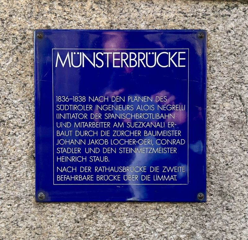
1. Münsterbrücke / Münster Bridge Marker

1836-1838 nach den Plänen des südtiroler Ingenieurs Alois Negrelli (Initiator der Spanischbrotlibahn und Mitarbeiter am Suezkanal) erbaut durch die zürcher Baumeister Johann Jakob Locher-Oeri, Conrad Stadler und den Steinmetzmeister Heinrich Staub.
Nach der Rathausbrücke die zweite befahrbare Brücke über die Limmat.
(English translation:)
Münster Bridge
Built between 1836 and 1838 according to the plans of the South Tyrolean engineer Alois Negrelli (initiator of the Spanischbrotlibahn and collaborator on the Suez Canal) by the Zurich master builders Johann Jakob Locher-Oeri, Conrad Stadler and the master stonemason Heinrich Staub.
After the Rathausbrücke (“City Hall Bridge”), the second drivable bridge over the Limmat River.
Topics and series. This historical marker is listed in this topic list: Bridges & Viaducts. In addition, it is included in the Zurich Blue Square series list. A significant historical year for this entry is 1836.
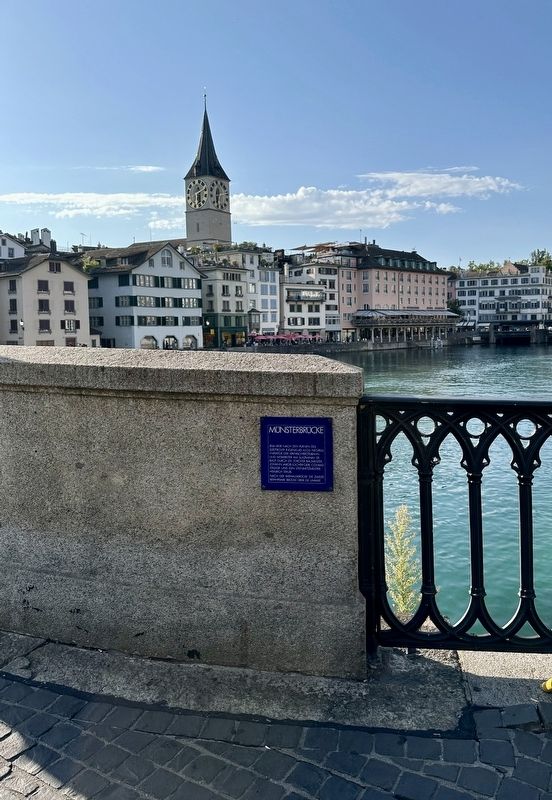
Location. 47° 22.202′ N, 8° 32.579′ E. Marker is in Zürich. It is in Altstadt. It is at the intersection of Münsterbrücke and Limmatquai, on the right when traveling west on Münsterbrücke.
this page online

Regionally, it is in Europe, Central Europe, the Schengen Area, Western Europe, and the Western World. Historically, it finds itself in what was once the Roman Empire and specifically also the Holy Roman Empire.
Other nearby markers. At least 8 other markers are within walking distance of this marker: Wettinghäuser / Wettinger Buildings (within shouting distance of this marker); Grössmunster (within shouting distance of this marker); Das Haus zum Loch (about 90 meters away, measured in a direct line); Zum Pflug - Anna Pestalozzi-Schulthess (about 90 meters away); Rosa Gutknecht (about 120 meters away); Zum Loch (about 120 meters away); Zur Kerze (about 120 meters away); Anna Bullinger-Adlischwyler (about 120 meters away). Touch for a list and map of all markers in Zürich.
Also see . . . Münsterbrücke, Zürich (Wikipedia). History:
The earliest bridge at the location was built in the Roman era, and in medieval Zürich a wooden bridge, called the Obere Brücke (upper bridge), connected the two banks of the Limmat. Between 1836 and 1838, the former(Submitted on December 12, 2024.)wooden bridge was replaced by a stone bridge. Alois Negrelli engineered and supervised the construction of the bridge as it is still present today; it was inaugurated in August 1838. The bridge congested the traffic on the Limmat, so a land connection in the then "modern" Zürich was urgently needed by replacing the narrow medieval Reichsstrasse towards the present Rathausbrücke crossing. Thus, sections of the present Limmatquai on the eastern shore of the Limmat were built simultaneously.Photographed by Andrew Ruppenstein, August 16, 20242. Münsterbrücke / Münster Bridge Marker - wide view
Photographed by Andrew Ruppenstein, August 16, 2024
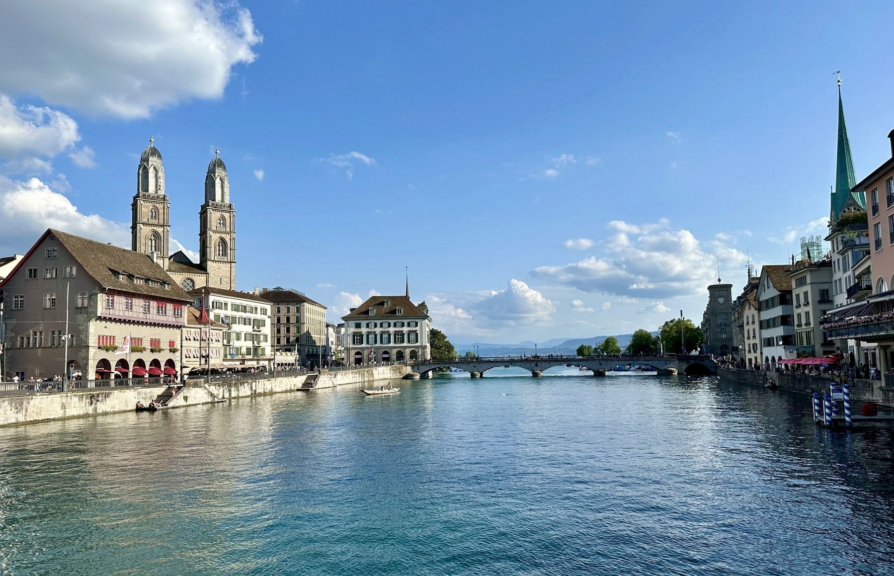
3. Münsterbrücke as seen from the Rathausbrücke
Münsterbrücke is a pedestrian and road bridge over the Limmat in the city of Zürich, Switzerland. It is listed in the Swiss inventory of cultural property of national and regional significance. It is indirectly named after two Münster (minsters), the Fraumünster and Grossmünster. - Wikipedia
The steeples of the Grossmünster are visible on the left side of the river, and the spire of the Fraumünster is visible on the right. The marker (although not visible here) is on the east end of the bridge (picture left).
The steeples of the Grossmünster are visible on the left side of the river, and the spire of the Fraumünster is visible on the right. The marker (although not visible here) is on the east end of the bridge (picture left).
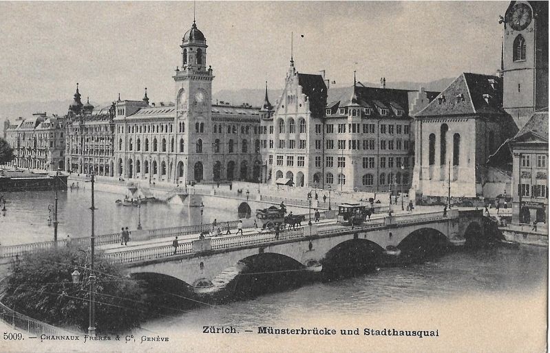
Photographed by Charnaux Frères & Co., Genève, circa 1900
4. Münsterbrücke and Stadhausquai
Credits. This page was last revised on December 12, 2024. It was originally submitted on December 12, 2024, by Andrew Ruppenstein of Lamorinda, California. This page has been viewed 459 times since then and 72 times this year. Photos: 1, 2, 3, 4. submitted on December 12, 2024, by Andrew Ruppenstein of Lamorinda, California.
