West Helena in Phillips County, Arkansas — The American South (West South Central)
A Web of Track

Photographed by Cosmos Mariner, September 16, 2024
1. A Web of Track Marker
After decades of effort, Helena won the bid for a major railroad in 1907. The city of West Helena was platted two years later. The new city's industrial center quickly filled with mills, lumberyards, cooperages and woodenware manufacturers turning out chairs, elm barrel hoops, and wagon parts.
Helena Wins the Missouri & North Arkansas
When the Missouri & North Arkansas announced plans to expand, businessmen in Little Rock promised the railroad a station and right-of-way into the city. The Businessmen's League of Helena upped the ante, guaranteeing a right-of-way from Cotton Plant to Helena and land for a terminal at no cost. Helena won and the M&NA began construction in 1907. The first train steamed into Helena in fall 1908.
Modern Industrial City
There had been talk of expanding Helena's industrial area for years. Finally, the time was right to act. In 1910, E.C. Hornor founded a modern city, West Helena. When incorporated in 1917, it was one of the busiest industrial towns in Arkansas. Lumber products flowed out of the mills and factories. Industry attracted the M&NA, Frisco, and Yazoo & Mississippi Valley railroads.
A Web of Track
By 1918, the industrial area of West Helena was a web of track. Spur lines branched off the Missouri & North Arkansas and Missouri Pacific main lines to fifteen industrial sites, all but two of them dealing in lumber products. Helena Southwestern Railroad served the huge Chicago Mill & Lumber Company works on the west side of town. Chicago Mill owned the Helena Southwestern, which delivered logs from the company-owned forests to the mill and carried finished products out.
Tracks leading out of West Helena formed an arc south to Helena Crossing, where railroads from the south and west intersected the tracks extending south from Helena. All freight traveling east from West Helena took
this page online
Background image caption: West Helena, 1918; Based on the 1918 Sanborn Fire Insurance Co. Maps
Topics. This historical marker is listed in these topic lists: Horticulture & Forestry • Industry & Commerce • Railroads & Streetcars. A significant historical year for this entry is 1917.
Location. 34° 32.644′ N, 90° 38.816′ W. Marker is in West Helena, Arkansas, in Phillips County. It is on Plaza Avenue 0.1 miles east of U.S. 49, on the left when traveling east. This marker is one of six interpretive panels in the Plaza Avenue median at this location. Touch for map. Marker is at or near this postal address: 57 Plaza Avenue, West Helena AR 72390, United States of America. Touch for directions.

Regionally, this marker is in the Arkansas Delta, in Crowley’s Ridge, in the Mississippi Alluvial Plain, and in the Quapaw Homeland. It is also in the American South, specifically in the Upper South, in the Mississippi Delta, and in the Great River Road Region. Globally, it is in North America, the Western Hemisphere, the Western World, and the Anglosphere. Historically, it

Courtesy UALR Center Arkansas History & Culture, Arkansas Studies Institute, Little Rock
2. Marker detail: Theo Fathaure sawmill, ca. 1918
Other nearby markers. At least 8 other markers are within 3 miles of this marker, measured as the crow flies: End of an Era (here, next to this marker); Early Railroads (here, next to this marker); Wood Products Capital (here, next to this marker); Made in West Helena (here, next to this marker); Unbroken Forest (here, next to this marker); West Helena's POW Camp (approx. 0.2 miles away); Battery B (approx. 2.9 miles away); Patrick Ronayne Cleburne (approx. 3.1 miles away). Touch for a list and map of all markers in West Helena.
Related markers. Click here for a list of markers that are related to this marker. West Helena, Arkansas
Also see . . . A Brief History of West Helena, Arkansas.
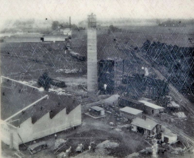
Excerpt: West Helena began as a railroad town, incorporated in 1917. The lands surrounding Helena were well suited for the production of cotton, but the periodic flooding and poor drainage initially limited large-scale operations to the high ground west of(Submitted on December 13, 2024, by Cosmos Mariner of Cape Canaveral, Florida.)the city. Agriculture slowly expanded southward, but only as farmers built small levees and drained the land. Meanwhile, the vast stands of lowland trees such as cypress and tupelo and the hardwoods along Crowley’s Ridge were soon being exploited. In 1826, a sawmill began operations in Helena, and the timber industry continued to grow until well into the twentieth century. Cotton and timber eventually dominated the local economy.Courtesy Butler Center for Arkansas Studies, Arkansas Studies Institute, Little Rock3. Marker detail: Chicago Mill veneer drying yard, ca. 1917

Photographed by Department of Arkansas Heritage Delta Cultural Center
4. Marker detail: Pekin Wood Products (formerly Pekin Cooperage), 1927

Courtesy Butler Center for Arkansas Studies, Arkansas Studies Institute, Little Rock
5. Marker detail: Unloading logs at Chicago Mill, ca. 1917
Library of Congress Prints and Photographs Division
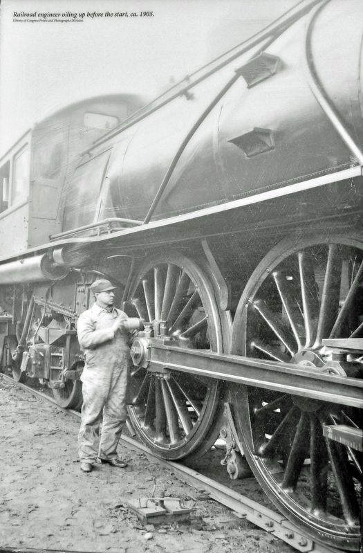
6. Marker detail: Railroad engineer oiling up before the start, ca. 1905

Photographed by Cosmos Mariner, September 16, 2024
7. A Web of Track Marker
Looking west through the Plaza Avenue median; this marker is the second one from the front on the right. A restored and preserved Union Pacific caboose is on exhibit just to the west of this group of six interpretive panels.
Credits. This page was last revised on December 14, 2024. It was originally submitted on December 12, 2024, by Cosmos Mariner of Cape Canaveral, Florida. This page has been viewed 150 times since then and 23 times this year. Photos: 1, 2, 3, 4, 5, 6, 7. submitted on December 13, 2024, by Cosmos Mariner of Cape Canaveral, Florida.
