Valkenburg in Valkenburg aan de Geul, Limburg, Netherlands — Northwestern Europe
Halifax JB 907 Crash Memorial
Photographed by Andrew Ruppenstein, July 13, 2024
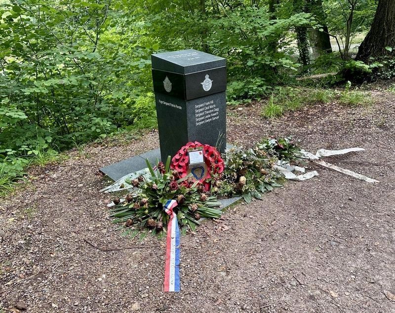
1. Halifax JB 907 Crash Memorial Marker
Top, east, and north sides of the memorial are visible here.

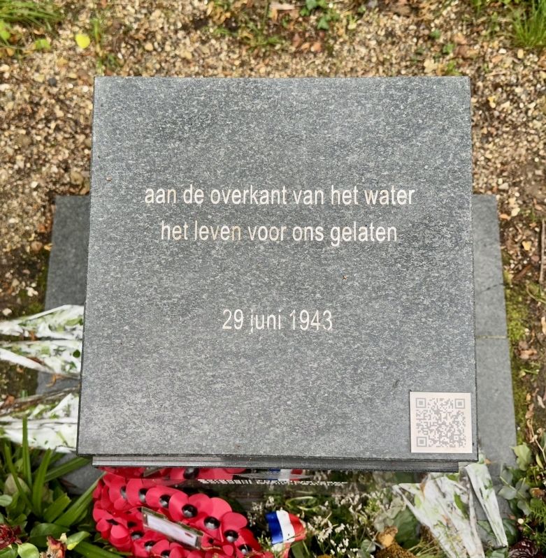
het leven voor ons gelaten
29 juni 1943
Flight Sergeant Patrick Rendle
Sergeant Frank Hill
Sergeant Cecil Morris
Sergeant Theodore Dagg
Sergeant Leslie Howarth
Sergeant Gwilym Samuel
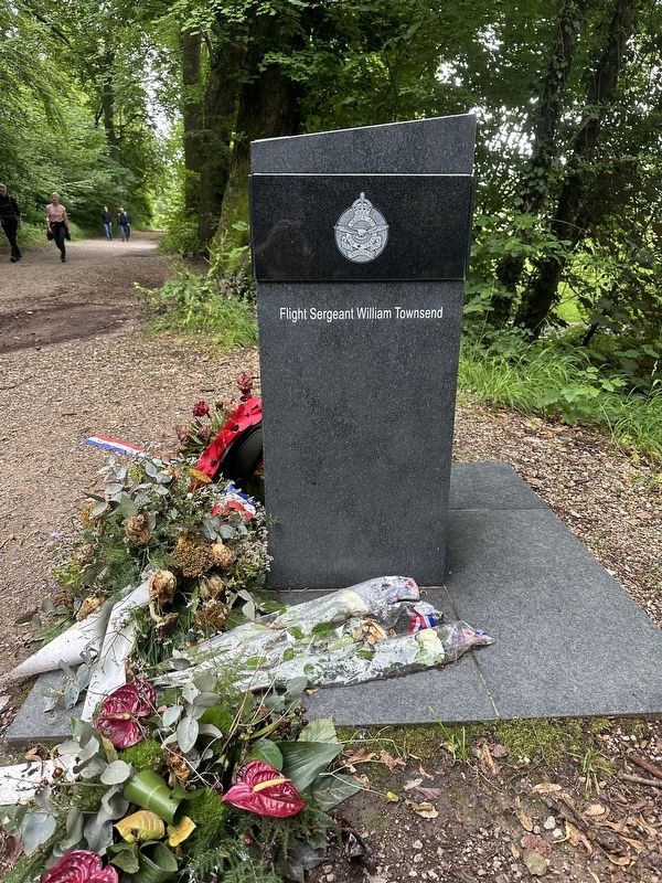
Flight Sergeant William Townsend
Erected 2013 by Kunst- en Cultuurraad, 1Valkenburg.
Topics. This memorial is listed in these topic lists: Air & Space • War, World II. A significant historical date for this entry is June 29, 1943.
Location. 50° 51.549′ N, 5° 50.881′ E. Memorial is in Valkenburg, Limburg, in Valkenburg aan de Geul. It is on Oostervoetpad, on the right when traveling east. The memorial is on the path (“Oostervoetpad”) leading east from Oosterweg in Valkenburg. There is a some parking on Oosterweg, about 250m west of the memorial. It is an easy walk. Touch for map. Memorial is in this post office area: Valkenburg, Limburg 6305, Netherlands. Touch for directions.

Regionally, it is in Europe, the European Union, Atlantic Europe, the Benelux Low Countries, the Schengen Area, Western Europe, and
this page online
Other nearby markers. At least 8 other markers are within walking distance of this marker: Crash Vliegtuig Kasteel Schaloen / Kasteel Schaloen Plane Crash (here, next to this marker); Geologisch Monument Groeve Kasteel Oost / Kasteel Oost Quarry Geological Monument (approx. 0.3 kilometers away); Kasteel Oost (approx. half a kilometer away); Kasteel Oost / Oost Castle (approx. half a kilometer away); Johannes de Doperkerk / John the Baptist Church (approx. 0.6 kilometers away); a different marker also named Johannes de Doperkerk / John the Baptist Church (approx. 0.6 kilometers away); Vaandeluitreiking Landstormkorps / Flag presentation of the Landstorm Corps (approx. 0.7 kilometers away); Duitse invasie - May 10, 1940 - German Invasion (approx. 1.2 kilometers away). Touch for a list and map of all markers in Valkenburg.
Also see . . . Herdenkingsmonument omgekomen vliegers (KCR, in Dutch). Th QR code on the memorial leads to this page, which provides a lengthy description of the memorial and
Photographed by Andrew Ruppenstein, July 13, 2024
2. Halifax JB 907 Crash Memorial - top side
Valkenburg was startled on 29 June 1943 at 01.25 by a crashing plane that was shot down in the Oosterweg by a German night fighter. It was an English bomber type Halifax II Hendley. The plane crashed in “de Gats” (Oosterweg) after it had lost a wing with an engine at the chapel along the St. Jansbosweg.(Submitted on December 12, 2024.)
7 Airmen did not survive this attack.
The war memorial in the “Oostergats”, in memory of 7 airmen who died during an attack by German night fighters on 29 June 1943 at 01.25, was unveiled by the KCR on 29 June 2013.
The monument is located in the immediate vicinity of the place where the plane crashed and reminds passers-by of the sacrifices made by these people. Every year on 29 June a short moment of commemoration and reflection is held at this monument.
Additional keywords. Herdenkingsmonument

Photographed by Andrew Ruppenstein, July 13, 2024
3. Halifax JB 907 Crash Memorial - north side
Photographed by Andrew Ruppenstein, July 13, 2024
4. Halifax JB 907 Crash Memorial - west side
Photographed by Andrew Ruppenstein, July 13, 2024
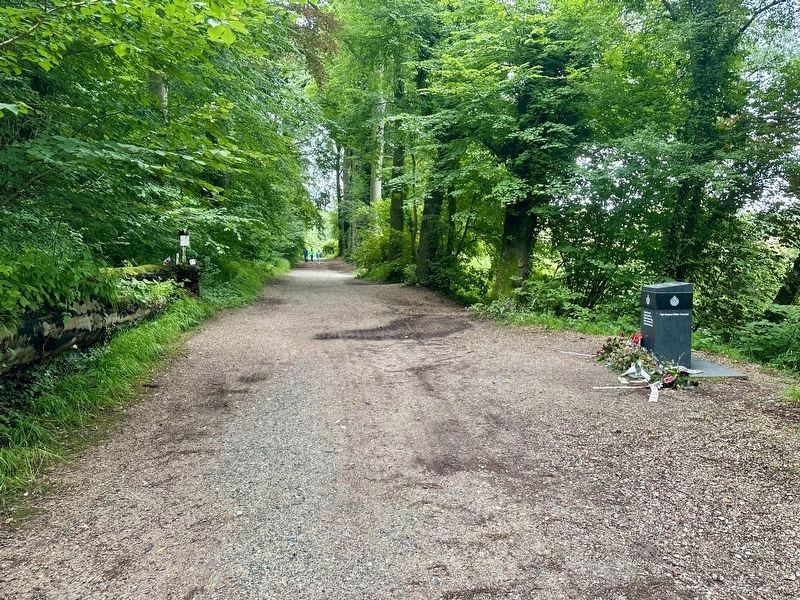
5. Halifax JB 907 Crash Memorial - wide view, looking east
The Geul River (the water mentioned on the memorial) is just a few meters to the south of the memorial (out of the picture, on the right). Visible on the left side of the path, just a few meters further east, is a second memorial for this plane crash.
Credits. This page was last revised on December 13, 2024. It was originally submitted on December 12, 2024, by Andrew Ruppenstein of Lamorinda, California. This page has been viewed 194 times since then and 31 times this year. Photos: 1, 2, 3, 4, 5. submitted on December 12, 2024, by Andrew Ruppenstein of Lamorinda, California.
