Newtown in Norfolk, Virginia — The American South (Mid-Atlantic)
U.S. Flag Mexican War, 1846-1847

Photographed by Brandon D Cross
1. U.S. Flag Mexican War, 1846-1847 Marker
Texas, like Florida, had once been an integral part of the Spanish domain on the North American Continent for nearly 300 years until 1821. Spain controlled Texas in 1836, Texas declared its independence from Mexico and thus became an independent nation. In 1845 over much opposition from Congress, President James K. Polk admitted Texas as the 28th State. This action directly led to war with Mexico and thus fixed the southern boundary of Texas as the Rio Grande River.
Erected by Woodlawn Memorial Gardens.
Topics. This memorial is listed in these topic lists: Military • Patriots & Patriotism • War, Mexican-American. A significant historical year for this entry is 1846.
Location. 36° 51.143′ N, 76° 11.112′ W. Memorial is in Norfolk, Virginia. It is in Newtown. It can be reached from the intersection of East Virginia Beach Boulevard (U.S. 58) and George Street, on the right when traveling east. The marker is located within Woodlawn Memorial Gardens, at the Avenue of Flags. Touch for map. Memorial is at or near this postal address: 6309 E Virginia Beach Blvd, Norfolk VA 23502,
this page online

Regionally, this memorial is in Virginia’s Hampton Roads, specifically in Coastal Virginia, and in the Hampton Roads Metropolitan Area. It is also in the American South, specifically in the Upper South, in the Tidewater, and on the Eastern Seaboard. Globally, it is in the North Atlantic Region, North America, the Western Hemisphere, the Western World, and the Anglosphere. Historically, it finds itself in what was once the territory of the Mississippian Culture, one of the original Thirteen Colonies, one of the Confederate States of America, and the Antebellum South.
Other nearby markers. At least 8 other markers are within walking distance of this marker: U.S. Flag Civil War, 1861-1863 (here, next to this marker); Great Star Flag, 1818-1819 (here, next to this marker); Betsy Ross Flag, 1777-1795 (here, next to this marker); Star Spangled Banner, 1795-1818 (a few steps from this marker); The 49-Star Flag 1959-1960 (a few steps from this marker); The 48-Star Flag 1912-1959 (a few steps from this marker); The 50-Star Flag 1960 (a few steps from this marker); New Town
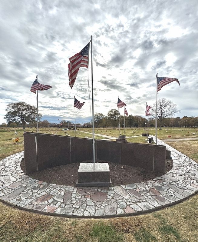
Photographed by Brandon D Cross
2. U.S. Flag Mexican War, 1846-1847 Marker
Also see . . .
1. Mexican American War, 1845 - 1848. (Submitted on December 13, 2024, by Brandon D Cross of Flagler Beach, Florida.)
2. Facts about the United States Flag. (Submitted on December 13, 2024, by Brandon D Cross of Flagler Beach, Florida.)

Photographed by Wikipedia
3. U.S. Flag Mexican War, 1846-1847
Credits. This page was last revised on December 16, 2024. It was originally submitted on December 13, 2024, by Brandon D Cross of Flagler Beach, Florida. This page has been viewed 183 times since then and 25 times this year. Photos: 1, 2, 3. submitted on December 13, 2024, by Brandon D Cross of Flagler Beach, Florida. • J. J. Prats was the editor who published this page.
