Senatobia in Tate County, Mississippi — The American South (East South Central)
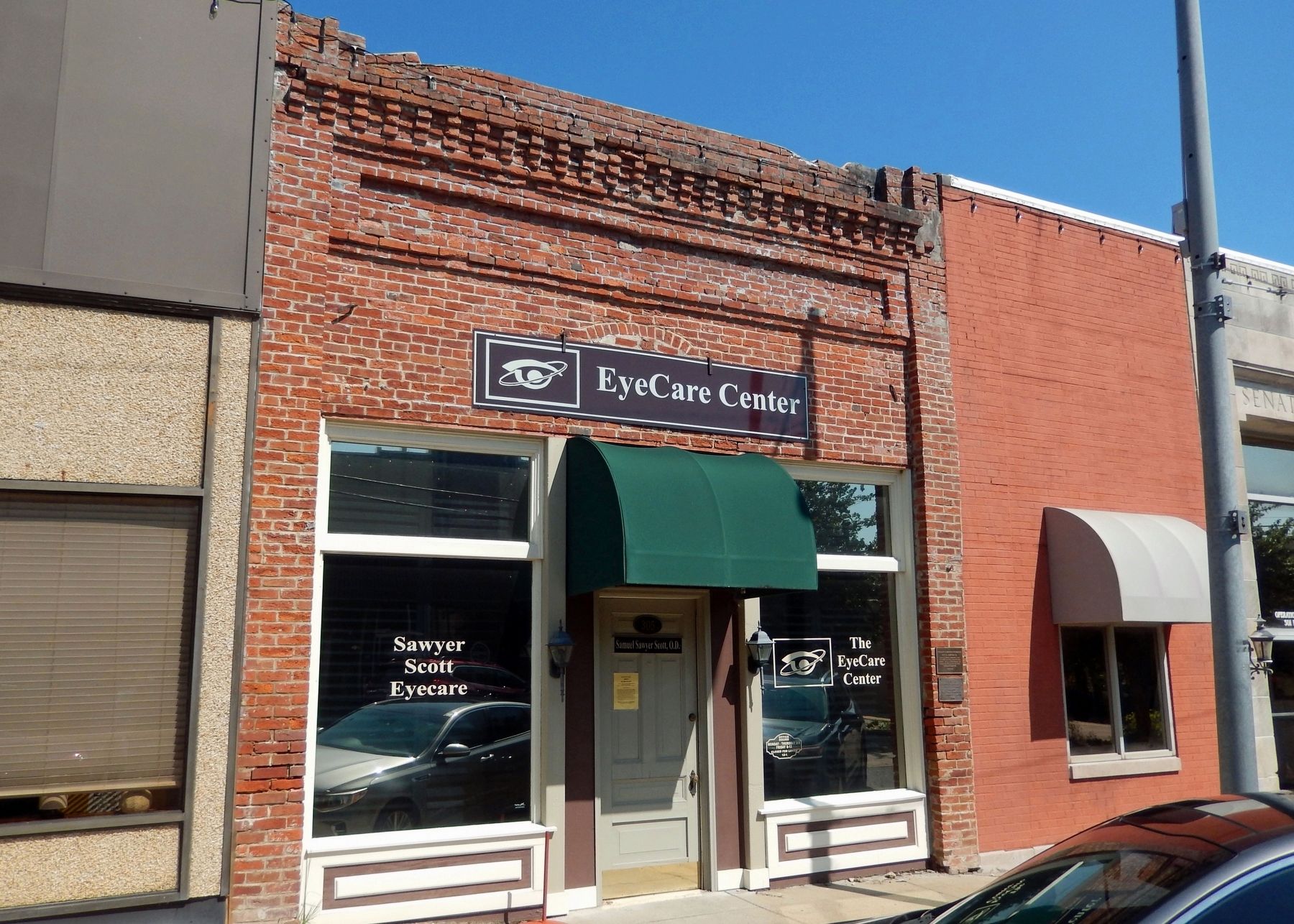
305 West Main Street
Photographed by Cosmos Mariner, September 17, 2024
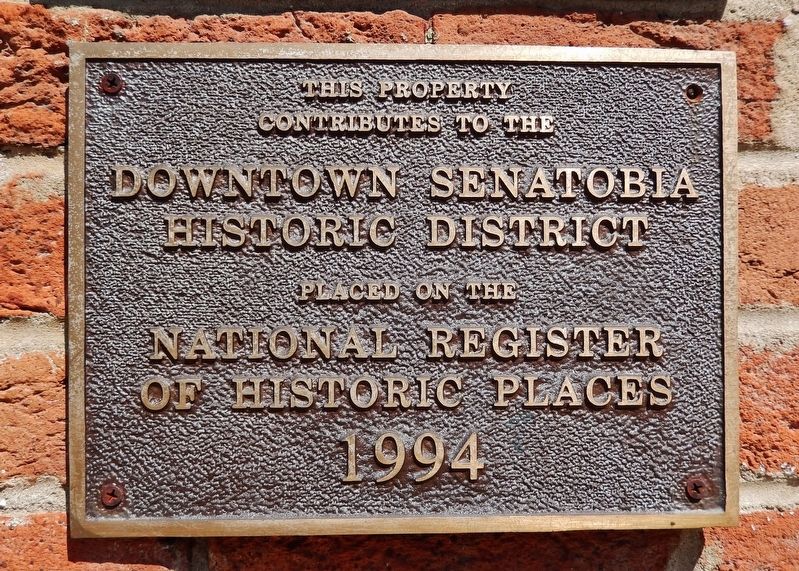
1. 305 West Main Street Marker
contributes to the
Downtown Senatobia
Historic District
placed on the
National Register
of Historic Places
1994
Topics and series. This historical marker is listed in these topic lists: Architecture • Notable Buildings. In addition, it is included in the National Register of Historic Places (NRHP) series list. A significant historical year for this entry is 1885.
Location. 34° 37.119′ N, 89° 57.931′ W. Marker is in Senatobia, Mississippi, in Tate County. It is on West Main Street just west of Center Street, on the right when traveling west. The marker is mounted at eye-level, directly on the subject building, at the right/east edge of the front façade. Touch for map. Marker is at or near this postal address: 305 West Main Street, Senatobia MS 38668, United States of America. Touch for directions.

Regionally, this marker is in Greater Memphis. It is also in the American South, specifically in the Deep South, and in the Mississippi Delta. Globally, it is in North America, a Gulf of Mexico state, the Western Hemisphere, the Western World, and the Anglosphere. Historically, it finds itself in what was
this page online
Other nearby markers. At least 8 other markers are within 5 miles of this marker, measured as the crow flies: Senatobia (about 300 feet away, measured in a direct line); Tate County Courthouse (about 600 feet away); O.B. McClinton (about 700 feet away); Sid Hemphill (about 700 feet away); Tate County World War I Memorial (approx. half a mile away); Bethesda Cemetery (approx. half a mile away); Jessie Mae Hemphill (approx. 1.8 miles away); Tate County Blues: Coldwater (approx. 4.8 miles away). Touch for a list and map of all markers in Senatobia.
Regarding 305 West Main Street. Contributing property, Downtown Senatobia Historic District, National Register of Historic Places № 94000205.
From the National Register Nomination prepared by John Linn Hopkins, 6/1/1993:
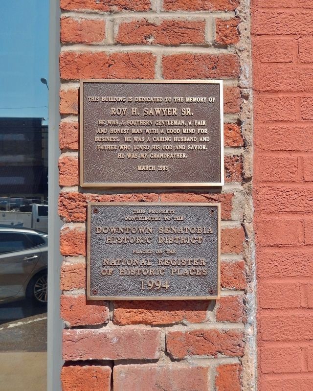
The Downtown Senatobia Historic District is composed of most of the traditional central business district area in the city of Senatobia. The street pattern of Downtown Senatobia is composed of an irregular grid, which largely reflects the informaldevelopment history of the city following the opening of the Tennessee and Mississippi Railroad in 1856. Lot widths in the Downtown vary widely, from as little as ten feet to as many as 85 feet; lot depths vary from forty-five to 160 feet in depth. The most common pattern of lot division is based upon a lot of twenty feet in width and eighty feet in depth. Buildings are set back from the street by only the width of the sidewalk, which ranges from six to twelve feet. Buildings in the district are largely built of brick masonry construction to a height of one story and have traditional three-bay commercial storefront facades with transom, display windows and bulkheads.Photographed by Cosmos Mariner, September 17, 20242. 305 West Main Street MarkerThere are two markers here on the right/east edge of the front façade: the National Register of Historic Places marker and a memorial plaque regarding an early Senatobia merchant at this location.
Also see . . . Downtown Senatobia Historic District (Wikipedia).
Excerpt: The Downtown Senatobia Historic District includes most of the traditional central business district area in the city of Senatobia. It is listed on the National Register of Historic Places since March 31, 1994. The downtown developed in 1856 after the opening of the Tennessee and Mississippi Railroad. Senatobia became the county seat in 1873 for the newly formed Tate County.(Submitted on December 17, 2024, by Cosmos Mariner of Cape Canaveral, Florida.)

Photographed by Cosmos Mariner, September 17, 2024
3. Roy H. Sawyer Sr. Memorial
Photographed by Cosmos Mariner, September 17, 2024
4. 305 West Main Street
Credits. This page was last revised on December 17, 2024. It was originally submitted on December 15, 2024, by Cosmos Mariner of Cape Canaveral, Florida. This page has been viewed 150 times since then and 23 times this year. Photos: 1, 2, 3, 4. submitted on December 17, 2024, by Cosmos Mariner of Cape Canaveral, Florida.
