West Saint Clair Township near Ryot in Bedford County, Pennsylvania — The American Northeast (Mid-Atlantic)
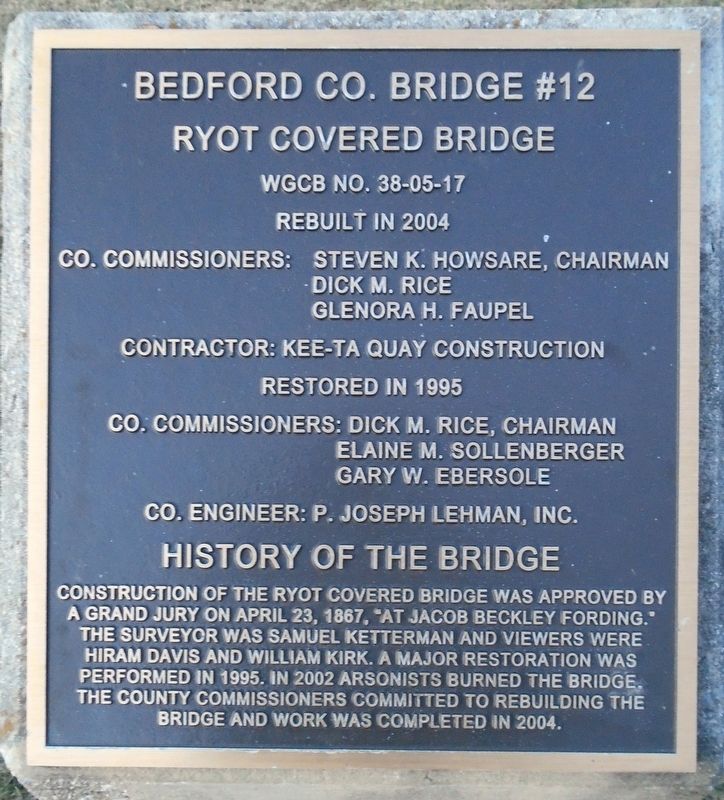
Bedford Co. Bridge #12
Ryot Covered Bridge
| — | WGCB No. 38-05-17 | — |
Photographed by William Fischer, Jr., December 14, 2024
1. Bedford Co. Bridge #12 Marker
Co. Commissioners: Steven K. Howsare, Chairman
Dick M. Rice • Glenora H. Faupel
Contractor: Kee-Ta Quay Construction
Restored in 1995
Co. Commissioners: Dick M. Rice, Chairman
Elaine M. Sollenberger • Gary W. Ebersole
Co. Engineer: P. Joseph Lehman, Inc.
History of the Bridge
Construction of the Ryot Covered Bridge was approved by a Grand Jury on April 23, 1867, "at Jacob Beckley fording." The surveyor was Samuel Ketterman and viewers were Hiram Davis and William Kirk. A major restoration was performed in 1995. In 2002 arsonists burned the bridge. The County Commissioners committed to rebuilding the bridge and work was completed in 2004.
Erected by Bedford County Commissioners.
Topics and series. This historical marker is listed in these topic lists: Bridges & Viaducts • Charity & Public Work. In addition, it is included in the Covered Bridges series list. A significant historical date for this entry is April 23, 1867.
Location. 40° 8.538′ N, 78° 37.447′ W. Marker is near Ryot, Pennsylvania, in Bedford County. It is in West Saint Clair Township. It is at the intersection of Dunnings Creek Road and
this page online

Regionally, this marker is in South-Central Pennsylvania and in the Laurel Highlands. It is also in the American Northeast, in the Mid-Atlantic, in Appalachia, and specifically in Northern Appalachia. Globally, it is in North America, the Western Hemisphere, the Western World, and the Anglosphere. Historically, it finds itself in what was once the Haudenosaunee (Iroquois) Confederacy and also one of the original Thirteen Colonies.
Other nearby markers. At least 8 other markers are within 7 miles of this marker, measured as the crow flies: New Paris (approx. 2.2 miles away); Friends Cemetery / The Underground Railroad (approx. 2.3 miles away); Pleasantville (approx. 2.6 miles away); Pleasantville School (approx. 2.8 miles away); Benjamin Walker Homestead (approx. 3.6 miles away); Osterburg Area Veterans Memorial (approx. 5.9 miles away); St. Clairsville (approx. 6.1 miles away); Veterans Memorial
Photographed by William Fischer, Jr., December 14, 2024
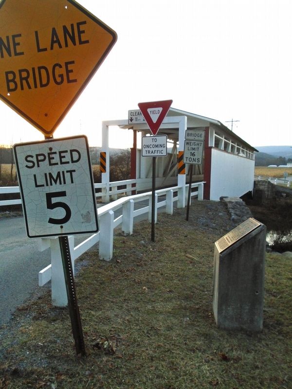
2. Bedford Co. Bridge #12 Marker
Also see . . . Ryot Covered Bridge at Wikipedia. (Submitted on December 16, 2024, by William Fischer, Jr. of Reynoldsburg, Ohio.)
Photographed by William Fischer, Jr., December 14, 2024
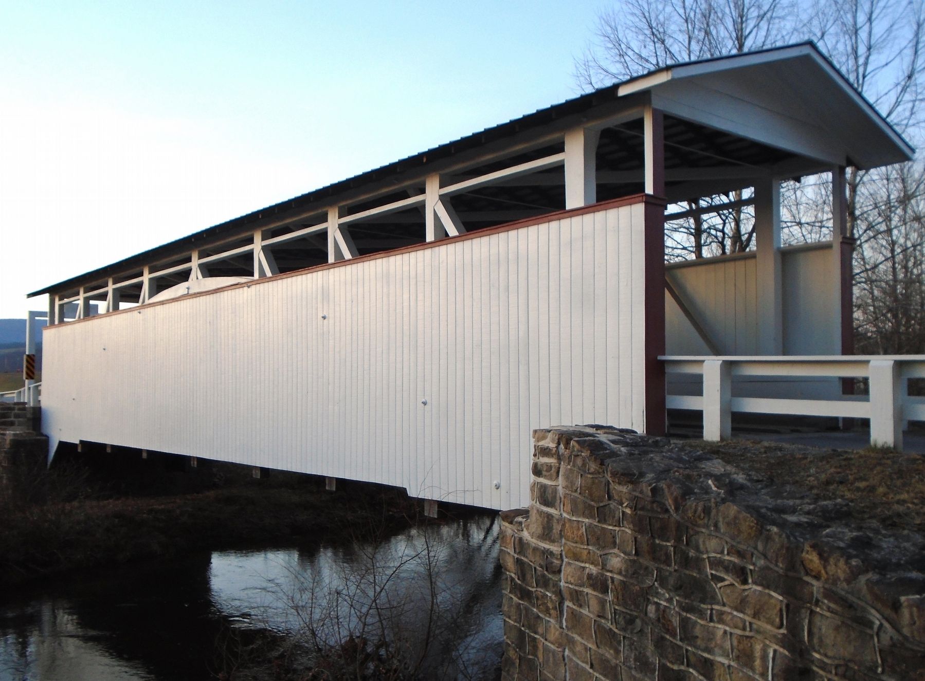
3. Bedford Co. Bridge #12 (Ryot Covered Bridge)
Photographed by William Fischer, Jr., December 14, 2024
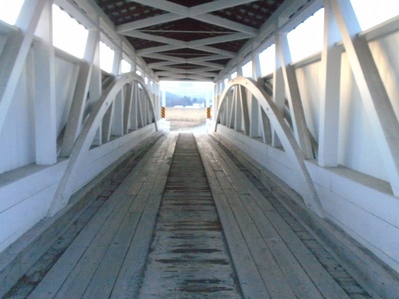
4. Bedford Co. Bridge #12 Interior
Credits. This page was last revised on December 16, 2024. It was originally submitted on December 16, 2024, by William Fischer, Jr. of Reynoldsburg, Ohio. This page has been viewed 183 times since then and 41 times this year. Photos: 1, 2, 3, 4. submitted on December 16, 2024, by William Fischer, Jr. of Reynoldsburg, Ohio.
