Agua Dulce in Los Angeles County, California — The American West (Pacific Coastal)
The Castle of Vasquez Rocks
The Fort

Photographed by Craig Baker, December 16, 2024
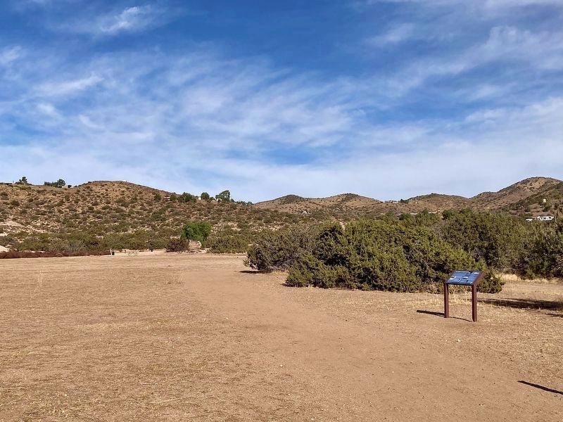
1. Castle of Vasquez Rocks Marker
If you were to spend any amount of time in our Interpretive Center, you may hear a patron ask us a question that makes us smile - "I'm not sure if I imagined this, but when I was a kid, I remember a huge castle that was here. Was that real?" Believe it or not, it was! With thousands of films, TV shows, music videos, and photo shoots permitted here (as early as 1905), this land has served as countless backdrops. Before the use of computer-generated imagery in films, elaborate sets were commonplace on sound stages -- but were they common here?
Construction of The Fort
The field around you is where this impressive set stood. Built in 1956-57 for the NBC's series "Tales of the 77th Bengal Lancers", the exterior cost a staggering $117,843.17 (calculated at $1,248,512.74 in 2023), not including the interior or set decorations.
Throughout the Rocks' extensive filming history, sets, matte painting, forced perspectives of miniatures, and CGI have created whole new worlds. The only known set to surpass this fort's scale was the town of "Bedrock" for Universal's 1994 film, "The Flintstones".
this page online
A Unique Photo-Op
Built when the land was still privately owned, the set continued to be a source of revenue for studios that wanted to use it, and a hit with park visitors who enjoyed exploring it (despite dramatic heights and lack of safety rails).
Taking Down the Castle
The now-crumbling fort was taken down for safety reasons in 1969, but continues to live in memories, photographs, old films, and TV Shows. Want to check out the fort in action? A few productions featuring the set include:
• "Tales of the 77th Bengal Lancers" TV Series (1957)
• "Star Trek" NBC Original TV Series, episode "Arena" (1967)
• "The Wild Wild West" CBS Original TV Series, Season One (1965)
• "Fort Utah" Paramount Pictures Feature Film (1967)
photo captions:
· This image offers an intimate view under the eaves of the set, taken in the late 1950s by Harold G. Deines.
· View of the southeastern-facing side of the fort in 1960.
· A 1957 TV Guide Magazine feature discusses the newly constructed set.
· A still from a 1957 episode of NBC's "Tales of the 77th Bengal Lancers"

Photographed by Craig Baker, December 16, 2024
2. Marker Detail - 1968 Photo
· Actress Kathleen Crowley photographed on the fort set while guest-starring in Episode 3 of "Tales of the 77th Bengal Lancers" in 1956.
· A young park visitor, Cyndi Baker, poses on the fort in this 1965 family photo.
Images courtesy Leon Worden, SCVHistory.com, Myrna Deines Litt, B.J. Atkins, Cyndi Baker, LA County Public Library, and Sarah Brewer.
Erected 2024 by County of Los Angeles Department of Parks and Recreation.
Topics. This historical marker is listed in these topic lists: Architecture • Arts, Letters, Music • Entertainment • Forts and Castles. A significant historical year for this entry is 1957.
Location. 34° 29.008′ N, 118° 18.726′ W. Marker is in Agua Dulce, California, in Los Angeles County. It can be reached from Escondido Canyon Road half a mile east of Agua Dulce Canyon Road, on the right when traveling east. It is on the Homestead Trail/Juniper Meadow Walking Loop, beyond the last dirt parking lot. Touch for map. Marker is at or near this postal address: 10700 Escondido Canyon Rd, Santa Clarita CA 91390, United States of America.

Photographed by Craig Baker, December 16, 2024
3. Marker Detail - 1957 TV Series

Regionally, this marker is in Greater Los Angeles and in the Transverse Ranges. It is also on the American Pacific Coast. Globally, it is in North America, on the Ring of Fire, on the Pacific Rim, in the Western Hemisphere, in the Western World, and in the Anglosphere. Historically, it finds itself in what was once New Spain and also Mexico’s Alta California.
Other nearby markers. At least 11 other markers are within walking distance of this marker: Vasquez Rocks Becomes a Park (about 400 feet away, measured in a direct line); The Krieg-Toney Family (about 600 feet away); The Vasquez Rocks (approx. 0.2 miles away); The Asher Family (approx. 0.2 miles away); Land and Industry (approx. 0.3 miles away); The Mexican & Early American Eras (approx. 0.4 miles away); European Contact & the Spanish Era (approx. 0.4 miles away); How Do We Know What We Know? (approx. half a mile away); Pacific Crest Trail (approx. 0.6 miles away); "Devil’s Punchbowl Wildlife" Mural (approx. 0.6 miles away); Toney Residence (approx. 0.6 miles away). Touch for a list and map of all markers in Agua Dulce.
Also see . . . Wikipedia list of productions at Vasquez Rocks.
Photographed by Craig Baker, December 16, 2024
4. Castle of Vasquez Rocks Marker
Additional commentary.
1. Remembering the Fort
We often explored Vasquez Rocks as children when my family would visit the park in the 1960s. I remember following other kids to the Fort, but there was a chain-link fence surrounding it. People would crawl through holes cut in the fence. At age six, I thought I would go to jail if the authorities caught me, so I stayed out.
Not long ago, I asked a question at the Interpretive Center, which went something like this: "I'm not sure if I imagined this, but when I was a kid, I remember a huge castle that was here. Was that real?"
— Submitted December 16, 2024, by Craig Baker of Sylmar, California.
Photographed by Craig Baker, December 16, 2024
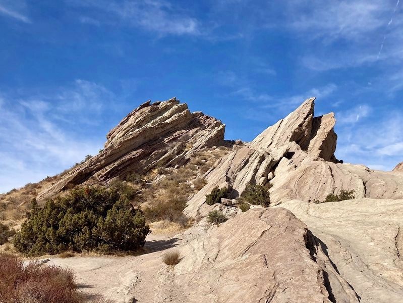
5. Vasquez Rocks

Photographed by Craig Baker, December 9, 2024
6. Aerial Photograph of The Fort - 1963
This photo is from nearby marker The Vasquez Rocks.
Credits. This page was last revised on March 2, 2025. It was originally submitted on December 16, 2024, by Craig Baker of Sylmar, California. This page has been viewed 762 times since then and 93 times this year. Photos: 1, 2, 3, 4, 5. submitted on December 16, 2024, by Craig Baker of Sylmar, California. 6. submitted on December 10, 2024, by Craig Baker of Sylmar, California.
