Dundalk in Baltimore County, Maryland — The American Northeast (Mid-Atlantic)
Francis Scott Key Memorial Bridge
Photographed by William Pfingsten, 08-19-2007
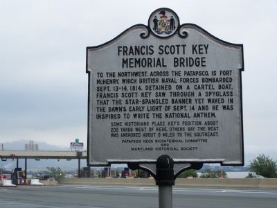
1. Francis Scott Key Memorial Bridge Marker
To the northwest, across the Patapsco, is Fort McHenry, which British Naval Forces bombarded September 13-14, 1814. Detained on a cartel boat, Francis Scott Key saw through a spyglass that the star-spangled banner yet waved in the dawn’s early light on September 14 and he was inspired to write the National Anthem.
Some historians place Key’s position about 200 yards west of here. Others say the boat anchored about 3 miles to the southeast.
Erected by Patapsco Neck Bicentennial Committee & Maryland Historical Society.
Topics and series. This historical marker is listed in these topic lists: Bridges & Viaducts • Forts and Castles • Patriots & Patriotism • War of 1812. In addition, it is included in the Maryland Historical Trust series list. A significant historical date for this entry is September 13, 1814.
Location. 39° 13.778′ N, 76° 30.701′ W. Marker is in Dundalk, Maryland, in Baltimore County. It is on Authority Drive west of Broening Highway, on the left when traveling west. The marker stands near toll booths at the east end of the bridge. Touch for map. Marker is at or near this postal address: 303 Authority
this page online

Regionally, this marker is in the Baltimore Metro Region and in Central Maryland. It is also in the American Mid-Atlantic, in the Chesapeake Bay Region, and on the Eastern Seaboard. Globally, it is in the North Atlantic Region, North America, the Western Hemisphere, the Western World, and the Anglosphere. Historically, it finds itself in what was once one of the original Thirteen Colonies and also the Antebellum South.
Other nearby markers. At least 8 other markers are within 3 miles of this marker, measured as the crow flies: Logan Field (approx. 1.4 miles away); Korean and Viet Nam Veterans Memorial (approx. 1.6 miles away); Two World Wars Veterans Memorial (approx. 1.6 miles away); Dundalk, Maryland (approx. 1.7 miles away); Community Public Library (approx. 2 miles away); Veterans Memorial (approx. 2.1 miles away); World War II Memorial-Point Breeze Works Employees (approx. 2.1 miles away); Presented to Fort Holabird (approx. 2½ miles away). Touch for a list and map of all markers in Dundalk.
Additional commentary.
1. Bridge has since collapsed
It
Photographed by William Pfingsten, 08-19-2007
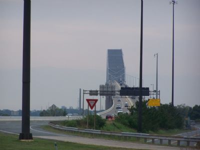
2. Francis Scott Key Bridge over Patapsco River
— Submitted December 30, 2024, by Carl Gordon Moore Jr. of North East, Maryland.
Photographed by JoAnn Degreenia, 2010
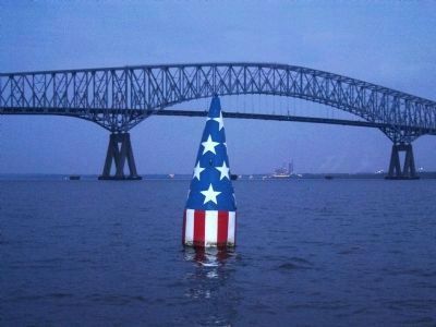
3. Francis Scott Key Buoy
This buoy marks the spot where Key's boat was positioned while he witnessed the bombardment of Fort McHenry, assuming "about 200 yards west" of the Francis Scott Key Memorial Bridge marker is correct. The Key bridge is in the background. If instead the "3 miles to the southwest" anchorage is correct, then Key's postion would be on the opposite side of this bridge, and close to Sparrow's Point.
Credits. This page was last revised on March 9, 2026. It was originally submitted on August 19, 2007, by Bill Pfingsten of Bel Air, Maryland. This page has been viewed 6,010 times since then and 48 times this year. Last updated on March 8, 2026, by Evan Dwyer of Richmond, Virginia. Photos: 1, 2. submitted on August 19, 2007, by Bill Pfingsten of Bel Air, Maryland. 3. submitted on September 18, 2010, by F. Robby of Baltimore, Maryland. • Devry Becker Jones was the editor who published this page.
