Irving in Dallas County, Texas — The American South (West South Central)
South Delaware Church of Christ
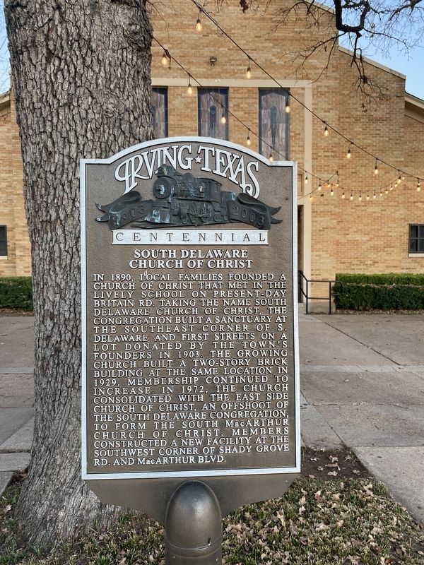
Photographed by Morgan Petermann
1. South Delaware Church of Christ Marker
Erected by City of Irving.
Topics. This historical marker is listed in this topic list: Religion & Religious Structures. A significant historical year for this entry is 1890.
Location. 32° 48.802′ N, 96° 56.616′ W. Marker is in Irving, Texas, in Dallas County. It is at the intersection of South Delaware Street and East Irving Blvd (Texas Highway 356), on the left when traveling south on South Delaware Street. Touch for map. Marker is at or near this postal
this page online

Regionally, this marker is in the Prairies & Lakes Region and in the Dallas-Fort Worth Metropolitan Area. Globally, it is in North America, a Gulf of Mexico state, the Western Hemisphere, the Western World, and the Anglosphere. Historically, it finds itself in what was once New Spain, the Republic of Texas, one of the Confederate States of America, and the Antebellum South.
Other nearby markers. At least 8 other markers are within walking distance of this marker: St. Luke Catholic Church (about 400 feet away, measured in a direct line); School Campus (about 400 feet away); Randle Clock Tower (approx. 0.2 miles away); Bear Creek Community (approx. 0.2 miles away); Elm Community (approx. 0.2 miles away); Union Bower Community (approx. 0.2 miles away); Estelle Community (approx. 0.2 miles away); Sowers Community (approx. 0.2 miles away). Touch for a list and map of all markers in Irving.

Photographed by Morgan Petermann
2. South Delaware Church of Christ Marker
Credits. This page was last revised on December 20, 2024. It was originally submitted on December 19, 2024, by Morgan Petermann of Hurst, Texas. This page has been viewed 209 times since then and 38 times this year. Photos: 1, 2. submitted on December 19, 2024, by Morgan Petermann of Hurst, Texas. • James Hulse was the editor who published this page.
