Marker Logo
THE HISTORICAL
MARKER DATABASE
“Bite-Size Bits of Local, National, and Global History”
Irving in Dallas County, Texas — The American South (West South Central)
 

The Irving Public Library
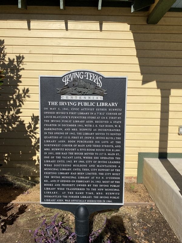
 
 
The Irving Public Library Marker image. Click for full size.
Photographed by Morgan Petermann, December 20, 2024
1. The Irving Public Library Marker
Inscription. On May 5, 1941, civic activist Esther Hurwitz opened Irving's first library in a 7' x 12' corner of Louis Blaylock's furniture store at 126 E. First St. The Irving Public Library Assn. received a state charter in December 1941, with J.E. Van Horn, W.E. Harrington, and Mrs. Hurwitz as incorporators. In the Spring of 1942, the library moved to rented quarters at 113 E. First St. (now E. Irving Blvd.) The Library Assn. soon purchased six lots at the northwest corner of Main and Third Streets, and Mrs. Hurwitz bought a five-room house for $1,000. In 1951, she had the house moved to 217 S. Main St., one of the vacant lots, where she operated the library until 1962. By 1960, City of Irving leaders were discussing building and maintaining a municipal library. Until then, city support of the existing library had been limited. The city built the Irving Municipal Library at 915 O'Connor Rd., and it opened on February 24, 1962. Most of the books and property owned by the Irving Public Library were transferred to the new municipal library. At the same time, Mrs. Hurwitz dismantled the former library. The Irving Public Library Assn.
Paid Advertisement
Click or scan to see
this page online
was officially dissolved in 1964.
 
Erected by City of Irving.
 
Topics. This historical marker is listed in this topic list: Notable Places. A significant historical date for this entry is May 5, 1941.
 
Location. 32° 48.72′ N, 96° 56.791′ W. Marker is in Irving, Texas, in Dallas County. It is at the intersection of West 3rd Street and South Main Street, on the right when traveling west on West 3rd Street. Touch for map. Marker is in this post office area: Irving TX 75060, United States of America. Touch for directions.

Regionally, this marker is in the Prairies & Lakes Region and in the Dallas-Fort Worth Metropolitan Area. Globally, it is in North America, a Gulf of Mexico state, the Western Hemisphere, the Western World, and the Anglosphere. Historically, it finds itself in what was once New Spain, the Republic of Texas, one of the Confederate States of America, and the Antebellum South.

Other nearby markers. At least 8 other markers are within walking distance of this marker: Eagle Ford Crossing (a few steps from this marker); Twin Wells Community (a few steps from this marker); Kit Community (a few steps from this marker);
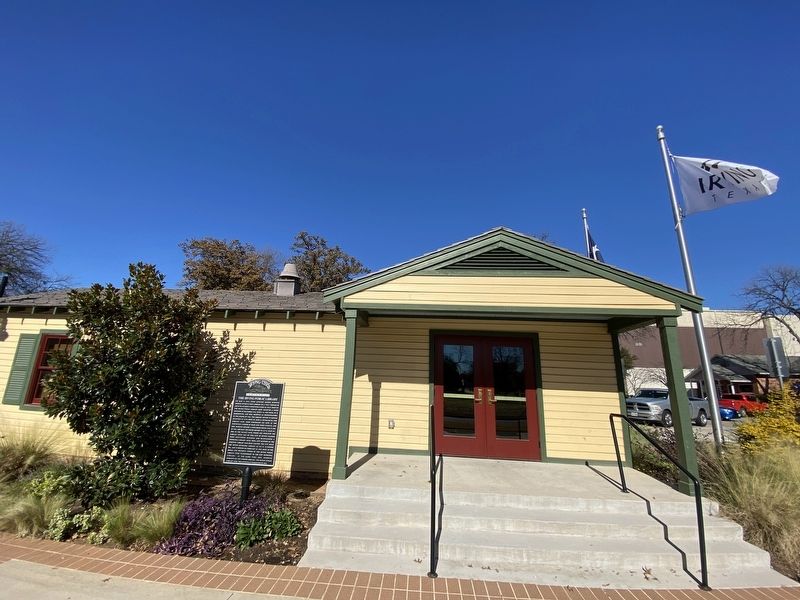
The Irving Public Library Marker image. Click for full size.
Photographed by Morgan Petermann, December 20, 2024
2. The Irving Public Library Marker
Heritage Park Gazebo (within shouting distance of this marker); Irving's First 'Water Tower' (within shouting distance of this marker); Union Bower Community (within shouting distance of this marker); Sowers Community (within shouting distance of this marker); Heritage Park Depot (within shouting distance of this marker). Touch for a list and map of all markers in Irving.
 
 
Credits. This page was last revised on December 22, 2024. It was originally submitted on December 21, 2024, by Morgan Petermann of Hurst, Texas. This page has been viewed 195 times since then and 36 times this year. Photos:   1, 2. submitted on December 21, 2024, by Morgan Petermann of Hurst, Texas. • James Hulse was the editor who published this page.

m=263446

CeraNet Cloud Computing sponsors the Historical Marker Database.
This website earns income from purchases you make after using our links to Amazon.com. We appreciate your support.
Paid Advertisement
Jul. 9, 2026